ルイス・エスコバルのカリフォルニア・ランニング通信#3/グラウンドキャニオンのリム・ランニング
写真/文 ルイス・エスコバル 訳 大島竜也/三田正明
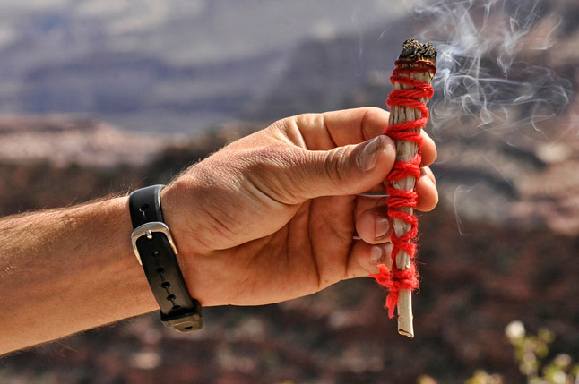
3回目となる写真家ルイス・エスコバルのカリフォルニア・ランニング通信。今回はグランドキャニオンにあるルイスおすすめのトレイルを紹介してくれます。“Rim to Rim to Rim running”とは?観光客に出会わない隠れたランニングコースとは?ダイナミックなグランドキャニオンの写真と一緒にお楽しみください。
■グラウンドキャニオンのリム・ランニング/The Road Little Less Travelled…
1919年に正式認定されてから、グランドキャニオンはアメリカの国立公園の象徴となっている。アリゾナ州北 部に位置し、1,900平方マイル(=4,930km²=東京都の面積の2.3倍!)の面積を持ち、アメリカの中でも11番 目に大きいこの国立公園には広大なフィールドと何百マイルものトレイルがあり、ハイカーやランナーにとって も途方もなく多くの選択肢がある場所だ。
グランドキャニオンでのトレイルランニングはとても人気があるが、その中でもよく整備された三本のトレイル であるSouth Kiabab Trail、North Kiabab Trail、Bright Angel Trailは最良な選択肢だろう。“Rim to Rim to Rim running(キャニオンの縁【へり】から縁へ走ること)をパーク・レンジャーは推奨しないが、それは違法 行為でもない。しかし、一歩間違えば取り返しのつかない事故に繋がることも事実でもある。このランを試みる 人は十分な準備をし、しっかりとした知識を持ち、自己責任を負える人でなければならない。
グランドキャニオンの変わりやすく極端な天気はいつも問題だが、”Rim Run”には最も適した天気である。その 意味で季節は春か秋をお薦めする。私は夏にここを走ったことがあるが、二度と同じ事はしないだろう。その日 のキャニオンの気温はとても高く不快で、危険だった。もしRim Runをするなら、私は暑さを避けるためにも、 午前3時からスタートすることを勧める。
スタートしたら、South Kiabab Trailを約11km程コロラドへ向かって走り、Black Bridge付近で川を渡り、Ph antom Ranchへ進む。Phantom RanchからNorth Kiabab Trailheadに向かってそのまま13マイル(約21km) を行く。 そして、そこで折り返し、来た道を戻ってPhantom Ranchを通り、Silver Bridge付近のコロラド川 を横断し、Bright Angel Trailへ進む。Phantom RanchからBright Angel Trailheadの頂上までは、長くて急勾 配の道が約10マイル(= 16km)待っている。 到着する頃には暗くなっているかもしれないので、その事を考 慮して計画するのが良いだろう。
The South Kiabab Trailは露出した尾根にあり、とてもごつごつしてとても急な勾配を有している。South RimのYaki Pointの南から始まり、コロラド川に向けて6マイル(約10km)下って行く。 キャニオンの縁と コロラド川の標高差は4860フィート(1,480m)あり、そこは水も影もないが、公園内で最も見晴らしが良い場 所だ。一方でこのTrailの上の道は、冬から雪解け前の季節の間ひどく凍結する程標高差がある。
The Bright Angel Trailはとても人気で、最も多くの人が歩くトレイルだ。トレイルそのものは約29km(キ ャニオンの縁から川へ下り、再度キャニオンを登った距離)あり、Grand Canyon South RimのBright Angel Lodgeのすぐ後ろからスタートする。その道は急で、数々のジグザグ道があり、いくつかの道は露出した岩が見 え隠れしている。水場はスタート地点からは4.5マイル(約7km)、Phantom Ranchまでは9マイル(約14km )の位置にあるIndian Gardensにある。
The North Kiabab Trailはこの3つのトレイルの中で最も人が少なく、かつ最も難易度が高いと言われている 。トレイルはSouth Rimより約900mも高い場所に位置し、カナダからメキシコの間にある全ての生態系が存在 していると言われている。コロラド川からNorth Rimにあるトレイルヘッドまでは険しい道が約22km続く。トレイルヘッドまで5マイル(約 8km)の場所にあるPumphouse Ranger Stationには水があるかもしれないが、 直近の状況については公園の係員に確認をした方が良いだろう。
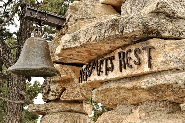
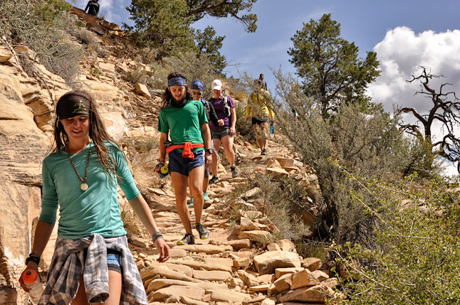
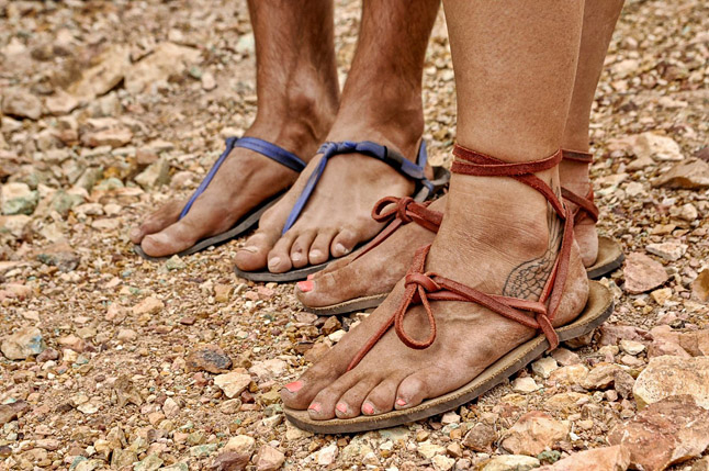
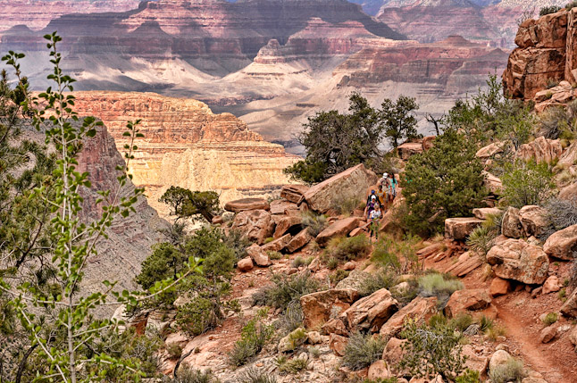
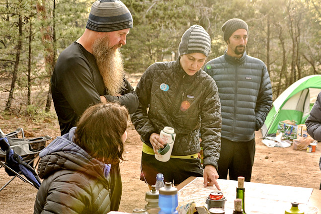
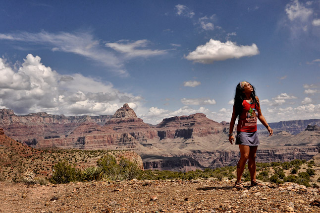
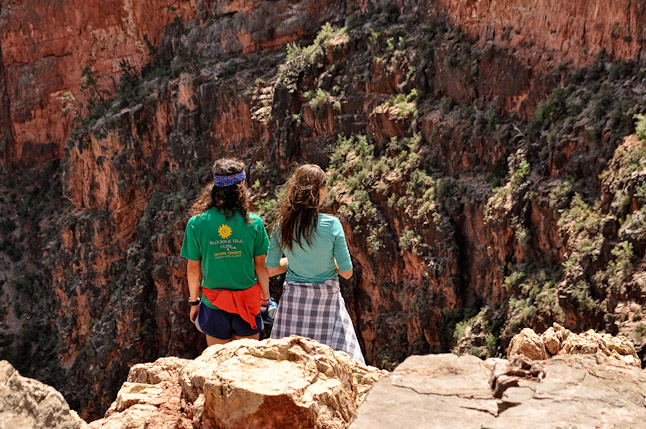
以上が3本のTrailの概要だが、詳しい情報はこちら(http://www.nps.gov/grca/index.htm)でチェックして 欲しい。この3本のトレイルには歩く際の目印となるマーカーもしっかりあり、道を探すのは容易だと思う。 South Rimの多くのトレイルは比較的簡単にアクセスができるのでとても人気で、混雑する場合がある。もしSouth Rimで観光客に煩わされずに走れるランニング環境を探しているなら、The Grandview Trailがオススメだ。メン テナンスがされておらず、厳しく急峻で岩だらけだが、ほとんど人が入っていない。見つけるのも進むのも簡単 なトレイルだが、ある程度の用心と敬意が必要だ。トレイルヘッドはGrand Canyon VillageからDesert View Roadに沿いに東へ12マイル(約19km)にあるGrandview Pointにある。トレイルヘッドの標高は7,400フィ ート約2,220kmあり、トレイルにはなんの補助も水もないが、Horseshoe Mesa/Stone Cabinの折り返し地点 まで3マイル、往復でも5マイル(約 10km)しかないし、人里離れたとても面白いランニング体験になるだろ う。これらの写真は2014年の4月中頃にGrandview Trailをグループ・ハイクした際に撮影したものだ。
The Road Little less travelled. by Luis Escobar
GRAND CANYON ARIZONA.
Dedicated in 1919, Grand Canyon is an iconic American National Park. Located in northern Arizona, with over one thousand-nine hundred square miles, Grand Canyon is the eleventh largest park in the National Park system. Grand Canyon has nearly unlimited miles of open space and hundreds of miles of trail. The hiking and running opportunities are incredible. Trail running in Grand Canyon is very popular and the obvious choices are the three maintained trails, the South Kiabab Trail, the North Kiabab Trail and the Bright Angel Trail.
Rim to Rim to Rim running is not suggested by the Park Rangers and while rim to rim to rim running is not illegal it is strongly discouraged. Those who attempt this run should be well prepared, educated and completely self-reliant. Constantly changing and extreme weather is always an issue and for that reason this run is best suited in the spring or fall. I have made the out and back run in the summer and I would not do it again. Temperatures on the canyon floor can be very high, uncomfortable and dangerous. If you attempt to run rim to rim to rim, I would suggest starting at 3:00am. Run the South Kiabab Trail approximately seven miles to the Colorado River, cross the river on the Black Bridge to Phantom Ranch. Continue thirteen miles from Phantom ranch to the North Kiabab Trailhead. From there turn around, retrace your steps back to Phantom Ranch. Depart Phantom Ranch crossing the Colorado River at the Silver Bridge to the Bright Angel Trail. Phantom Ranch to the summit of Bright Angel Trailhead is about ten, long, steep miles. You may be finishing in the dark, plan accordingly. Below is a short summery of these three trails. Complete information is available at http:// www.nps.gov/grca/index.htm
The South Kiabab Trail is situated on an exposed ridge, it is very rocky and steep. This trail begins south of Yaki Point on Yaki Point Road on the South Rim and descends six miles to the Colorado river. The elevation change between the rim and the river is 4860 feet (1480m). There in no water and little shade but some of the best views in the park. The upper sections of this trail can be extremely icy in the winter and early spring.
The Bright Angel Trail is very popular and heavily used. The Bright Angel Trail is about 18 miles (round trip – Rim to River to Rim) and starts right behind the Bright Angel Lodge on the Grand Canyon South Rim. The trail is steep and features several tight switchback sections. Some of the trail is covered but most is within an exposed rocky drainage. Water is usually available at Indian Gardens which about four and one half miles below the trailhead and at Phantom Ranch about nine miles below.
The North Kiabab Trail is the least visited and most difficult of the three maintained trails in Grand Canyon. The North Kiabab Trailhead is almost a thousand feet higher than the South Rim trails and passes through every ecosystem found between Canada and Mexico. It is about fourteen strenuous miles from the Colorado River to the North Kiabab Trailhead on the North Rim. Water may be available at the Pumphouse Ranger
Station, five miles from the trailhead. Always check with park officials for current water availabilities.
The three maintained trails that I have described are very well marked and simple to navigate. The most of South Rim trails are relatively easy to access, making them very popular and busy. However, if you are looking for a South Rim, tourist free running environment, I would recommend the Grandview Trail. The Grandview Trail is unmaintained. It is strenuous, steep and rocky. It is also a trail less traveled. This trail is well defined, easy to follow but it does require a certain level of caution and respect. You will find the trailhead at Grandview Point, about twelve miles east of Grand Canyon Village along Desert View Road. Trailhead elevation is 7,400 feet, there is no assistance and no water on this trail. It is only three miles to the Horseshoe Mesa / Stone Cabin turnaround point (six miles round trip) but it is a remote and interesting running experience.
The photographs that accompany this article were taken in mid April, 2014. These images are from a group hike along the Grandview Trail.
TAGS:


 ULギアを自作するための生地、プラパーツ、ジッパー…
  Tenkara USA | RHODO (ロード)
  Tenkara USA | YAMA (ヤマ)
  Tenkara USA | Rod Cases (…
  Tenkara USA | tenkara kit…
  Tenkara USA | Forceps & …
  Tenkara USA | The Keeper …
  Tenkara USA | 12 Tenkara …
  Tenkara USA | Tenkara Lev…