Copper Canyon 500mile Hike #3 / コッパーキャニオン500マイルハイク#3

写真/文:ジャスティン・リクター 訳:大島竜也/三田正明
■DAY5 / ウルアチ町長との面会
周囲を囲む山々に朝日が遮られ、ウルアチの朝は遅かった。僕たちはまだほの暗いなか目を覚まし、昨夜バックパックから「爆発」して部屋中に散乱したままの荷物を、装備と食料とハイク中に集めた石のサンプルに区別しながらパッキングを始めた。
この旅で、僕は友人が運営する“Adventurers and Scientists for Conservation”(環境保全のための冒険者と科学者たち)というNPO(非営利団体)から「宿題」を与えられていた。 そのNPOは提携する冒険家たちに、あくまで遠征への影響を最小限に留めることを前提で、僻地に赴く際にその土地に関係する研究をしている科学者たちと連携させる活動を行っているのだ。
前回のヒマラヤへの遠征で僕はナキウサギとインドガン(印度雁)のデータを収集したけれど、今回は岩の表面に住む微生物を研究しているコロラド大学の鉱物科の教授と協力するよう依頼があった。僕の任務は、温泉などの苔や細菌等の増殖しやすい場所で25セントコインほどの大きさ(約2.5cm)の岩の破片を収集し、場所を記録することだった。僕は自分のポリシーであるウルトラライトに逆らって、文字通り自分のパックに岩を運んでいたのだった。
The daylight moved slowly into Uruachi with the surrounding mountains shadowing the rising sun. We woke up naturally in the dark and started to organize our belongings from the pack explosion in the room the night before. I shuffled through my stuff and organized my food and the rock samples that I had been gathering.
I was “on assignment” from my friend’s non-profit called Adventurers and Scientists for Conservation. The non-profit partners adventurers headed to remote destinations with scientists that are studying things that might pertain to those areas, while being minimally invasive into the expedition.
On previous trips I had collected data on pikas and bar-headed geese. This time they had paired me up with a professor at the University of Colorado School of Mines that was researching microbes on rock surfaces. My duty was to collect small shards of rock, about the size of a quarter, and document the location. Areas of interest included hot springs and places where the rocks had some sort of lichen or bacterial growth. I was going against the old ultralight expression and literally carrying rocks in my pack.
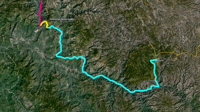
僕たちは前の晩に夕食をとったレストランで手早く朝食をとり、町にある小さな市場に向かった。 旅に出る前に情報収集した際、地元の人からもウルアチについてはほとんど情報がなかった。僕たちは小さな食料品店を見つけ、ここで10日間程の食料を確保できればとの思いでお店に入った。
お店の品揃えは、この辺境にある事を考えると驚くほど素晴らしかった。今後のルートの情報を得るために店主に話を聞くと、彼は僕らが目指すオレトス峡谷にある鉱山で働いているヘクターという男を紹介してくれた。 その店主は信じられないほど親切で、僕たちのやっていることにとても驚いていた。
彼が携帯電話を取り出しどこかへ電話をかけると、数分後に町の町長が僕たちに会うために店にやってきた。カウボーイハット、カウボーイブーツ、大きな銀のベルトバックルで着飾ったその出立ちは、まるでテキサスから来たようだった。どこかで見たことのある顔だと思ったけれど、昨日ウルアチを目指して歩いていた際に一日中目にしていた選挙ポスターで見ていたのだと気づいた。いま僕たちはその人、トニー町長と現実に面会をしているのだ。
僕たちはウルアチに環境保全やアウトドア目的で旅行者が来た際に、どんなものが必要かについてトニーと一時間ほど話をした。トニーはそれが彼の“Pueblo Magico” (魔法のような村)が恩恵を受ける話でもあるためか、とても熱心に聞いてくれた。
We grabbed a quick breakfast at the same restaurant that we had been to for dinner the night before and then headed to the small market. We were unable to get any information on the town of Uruachi, even from locals in the region, before heading out on the trip. Now that were in the town and saw the small grocery store, we wished that we hadn’t been carrying 10 days of food.
The choice of supplies was surprisingly good for being in the middle of nowhere. We chatted with the storeowner and tried to get some information on the upcoming route. He directed us to another guy, Hector, who worked at a mine that we would be passing as we dropped into our next canyon, the Oteros. The storeowner was also unbelievably helpful and genuinely amazed at what we were doing.
He made a quick call from his mobile phone and a few minutes later the president of the town strolled in to the shop to meet us. He was decked out in a cowboy hat, cowboy boots, and a big silver belt buckle and could have come straight from Texas. It turned out that we had been seeing campaign posters with Tony’s face on them the entire day as we road walked in to Uruachi and now we were meeting him in person.
We talked for about an hour about the opportunity that Uruachi had to bring in tourists if conservation and outdoor recreation were prioritized. Tony was very interested since it would also benefit his “Pueblo Magico” (Magical Village).
すこし多目にキャンディバーや食料を購入し、僕たちはウルアチを後にした。計画段階では巨大なクエスチョンマークが浮かんでいたこの町の滞在だったけれど、最終的にこの旅で僕のもっともお気に入りの町になった。 尾根へ登って東へ進み、いくつかの集落を通り過ぎ、舗装されていない道を下り、日が暮れる頃には鉱山キャンプのある村までやって来た。僕たちは小さな店を発見し、ボトル入り飲料水と夕食用のポテトチップスをいくつか買った。
どこかにその晩泊まれる場所がないかを尋ねると、村人の1人が空き部屋を持っているというので、そこでお世話になることにした。 僕たちはギシギシ鳴るベッドの上でくつろいで、ここから先の更なる情報を得るため翌朝ヘクターを訪ねることにした。数時間後、僕らが休息を取りそろそろ眠りに落ちそうになった頃になると、子供達がドアの向こうから僕らの一挙手一投足を興味津々な様子で眺めていた。
After picking up a few extra candy bars and food items we made our way out of the Uruachi. This town stop had been a big question mark during the planning stages, but it turned in to being my favorite town of the entire trip. We climbed over the ridge to the east passing by sporadic settlements. Then we dropped on a dirt road to the mining camp and a small village as the daylight waned. We found a small shop and bought bottled water and some potato chips for dinner and asked if there was a place we could say.
One of the villagers had a spare room that they rented to us. We relaxed on the rickety beds with plans to visit Hector the next morning to get any additional information that we could glean for the days ahead. For the next couple of hours as we rested and got ready to sleep children peered through the door and watched our every move with curiosity.
■DAY6 / 鉱山キャンプのヘクター
翌朝は子供達の1人が、ヘクターのいる鉱山キャンプへと続く蜘蛛の巣のような山道を案内してくれた。鉱山キャンプに着くと、そこは僕たちが滞在した谷向こうの村とは全く異なる様子だった。村はとても貧しく、家には水道設備もなく今にも倒壊しそうだったが、鉱山キャンプはペンキ塗りたてで、内部にはテレビがあり、無線LAN、エアコン、冷蔵庫も揃っていた。
僕たちは食堂で朝食をとっている出勤前のヘクターを見つけた。血色の悪い唇をした彼は体の大きなフレンドリーな男で、鉱山のユニフォームの青い上着を着ていた。キャンプの食堂のキッチンには二人の女性が彼を待ち、テレビからはBandamex(メキシコの音楽専門チャンネル)がけたたましく鳴り響いていた。
彼は20年以上も鉱山で働いており、この地域に精通していた。彼は2週に一度家族の待つ家へと帰り、1週間滞在しては再び仕事に戻る生活をしてるという。彼は僕たちに食事や飲み物、ケーキまで振る舞ってくれただけでなく、案内してくれた子供にもごちそうしてくれた。まったく素晴らしいもてなしと寛大さだった。ヘクターは僕たちがこの旅で出会ってきた人々と同様に印象的な人物で、この先僕らがオテロス峡谷で体験するであろうことを教えてくれた。地元の人々から情報を集めるまでオテロスのことはまったくわからなかったけれど、いまでは急峻な岩壁と澄み切った深い池があるというその峡谷を踏破できそうな気がしていた。
そうして始まったオテロス渓谷の旅は、カンダメナ渓谷よりも何倍も速く進むことができた。単純に峡谷の底に転がる岩が、家ほども大きさのあったカンダメナの時よりも小さかったのだ。僕たちは足早に歩み続け、その日の終点となるキャンプ地までたどり着いた。キャンプにうってつけの砂浜を暗くなる前に見つけ、翌朝の1,800mの高低差の登攀に備えてその前半部の偵察もすることができた。
The next morning one of the children led us on the five-minute walk through the spider web of trails to the mining camp and Hector’s outpost. It was a stark difference from the small village that we had stayed in across a small ravine. The village was poor and ramshackle, with no indoor plumbing. The mining camp was freshly painted, with televisions inside, wifi, air conditioning, and refrigeration.
We found Hector in the cafeteria where he was eating breakfast before heading in to the mine. He was a big, friendly man, with cyanotic lips, and donning the blue cover-ups that were the uniform of the mine. Two women that were the kitchen staff were waiting on him in the cafeteria for the mining camp. He was eating with Bandamex, the Mexican music television channel, blaring on the television.
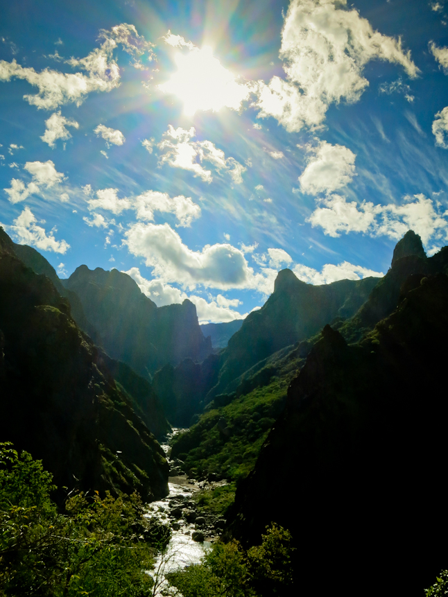
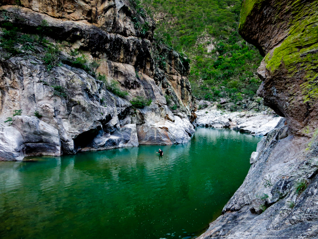
He was very familiar with the area, as he had been working at the mines for more than twenty years. He leaves to visit his family for a week once every two weeks. They offered us food, drinks, and cake. They even fed the kid who brought us over to meet Hector. It was completely impressed with their hospitality and generosity. Hector was equally as impressed by what we were undertaking. He described a little bit about the Oteros Canyon and what we would find and we set out on our way. The Oteros was a complete unknown before we gathered some local information. Now we had a little bit of confidence that we would most likely be able to make it up the canyon. It was beautiful, with clear deep pools and steep walls.
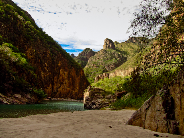
Travel was infinitely faster than the Candamena Canyon. The rocks in the canyon bottom were merely pebbles compared to the house sized boulders that had been choking the canyon the past few days. We progressed fast and made it to our exit point for camp. We found an ideal sandy beach shortly before dark. We scouted lower section of the cross-country exit route so we would be ready for 6,000 foot climb the next morning.
■DAYS 7, 8, 9, and 10 / クリールへの遠い道
翌日はいきなり峡谷の底をヤブ漕ぎすることになり、茨の刺で服やバックパックが引っ張られ、肌を引っ掻かれたりした。ときどきけもの道や数100mも続く家畜用のトレイルを見つけたりもしたけれど、茨の道は通るのが困難で、僕は峡谷を登り始めてからバックパックのサイドポケットにしまっておいたトレッキングポールを失くしてしまった。
峡谷の底から600mほど登ると、やっとまともなトレイルを見つけることができた。そのトレイルは等高線沿いに道をのばし、荒廃した廃村へと続いていた。僕たちは峡谷の尾根へと続くトレイルが地図にマークされていた場所にある廃屋を探していて、地図で示された方向へとくぐり抜けると 、幸運にも良い状態のトレイルを見つける事ができた。
やっとまともな条件のスイッチバック(つづら折り)のトレイルを見つけて安堵した。僕たちは峡谷の尾根へと続く残り約1,200mの登攀を楽しみ、いくつか素晴らしい景色も見ることもできた。そのまま峠を越えて牧草地帯へと降りていき、牧草地とその周りに小さな家々が点在する集落に到着する少し前で暗闇のなかキャンプを設営した。
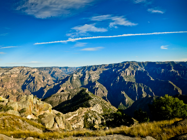
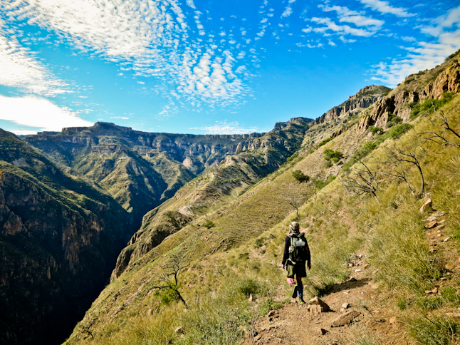
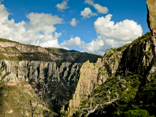
On the rim of the canyon after the 600 vertical foot climb out of the river bottom./川底から約1,800mの高さを登った峡谷の縁から見えた風景
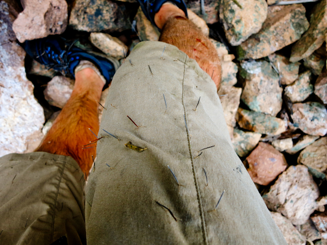
We bushwhacked out of the bottom of the canyon through thorny brush that grabbed and tugged at our clothes and packs, and thrashed our skin. Every once in a while we would find a nice game trail or cattle trail to follow for a few hundred yards before it disappeared. The brush was so grabby that unbeknownst to me I lost a trekking pole section out of one of the side pockets in my backpack. I had stashed it since we were scrambling out of the canyon.
We finally found a decent trail to follow when we were about 2,000 vertical feet of the canyon bottom. The trail contoured through a dilapidated, abandoned town. At the last house we attempted to find the trail that was marked on the map that would take us up to the canyon rim. We bushwhacked in the direction shown on the map, and luckily found the trail in good condition.
It was a relief to finally be on good trail with switchbacks. We made good time ascending the remaining 4000 vertical feet to the canyon rim and got some amazing views along the way. We crossed a pass on the canyon rim and descended towards an alpine meadow. We made camp at dark, shortly before hitting the alpine meadow and the small cluster of houses skirting the meadow.
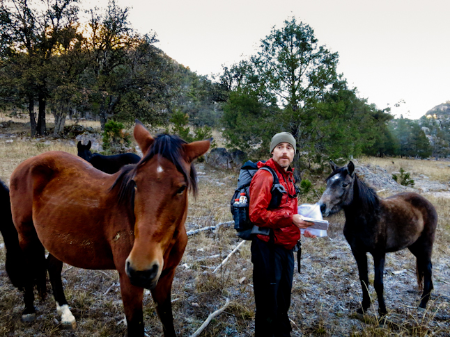
Doing some navigating on the frosty morning with some wild horses trying to show us the way. /凍り付いた朝、野生の馬に道を尋ねる
その朝はひんやりと寒く、僕たちは牧草地の凍った草の上を歩いた。夜の間に霜がおりるほど気温が下がっていたのだ。これから数日間の間、僕たちは最初の食料補給地であるクリールに向けて、より最短ルートで進もうとしていた。そのために尾根に登ったり、谷に降りたり、さらにはあのオテロス川を再度渡ってみたりさえした。僕たちはいくつかの小さな村々を通過しながら未舗装の道路やトレイル、道なき道も進んだ。バックパックは軽く、食料が不足し始めていることはわかっていた。僕たちの疑問は「いつクリールに到着できるか?」だった。当初は昼食までに到着できることを願っていたが、クリールの町へと向かうその進捗は気がめいるほど進んでいなかった。
僕らは地図に描かれていない道がショートカットになる事を期待していた。登って降りてを繰り返し、尾根と谷間をいくつも越えた。ついに地図上で目的地まで8キロの地点に辿り着いたが、太陽は低くなり、先を急ぐ必要があった。僕らは目的地によっぽど近い場合を除いては夜にハイキングはしたくなかった。とにかく急いでいたので地図で確認することもせずに歩いていると、分岐で間違った道を進んでしまい、8キロも余計に歩く羽目になってしまった。暗闇の中を2時間歩き、午後8時にやっと町にたどり着き、どうにか閉店間際のレストランに入ることができた。僕たちは64kmを歩いた後で疲労困憊していたが、満足した気持ちで、今後の道のりの事を考えていた。
The morning was cold and frosty as we walked through the frozen grass in the meadow. It had fallen well below freezing during the night. The next few days we tried to head more or less directly west towards Creel, our first resupply. We climbed ridges, and descended into valleys, and even recrossed the Oteros River. We passed small villages as we went off and on dirt roads, trails, and cross-country. Our packs were light and we knew we were starting to run low on food. The question on our mind was when were we going to get to Creel. We were hoping it would be before lunch but as we kept progressing towards the town, our progress was unnervingly slow.
We were hoping for a road that wasn’t depicted on the map that would make our route more direct. Nothing presented itself and we continued to climb and descend over and over as we crossed ridges and valleys. We were finally within five miles on the map and we knew we had to rush as the sun lowered in the sky. We didn’t want to be hiking at night unless we were really close. In our haste we did not pull out our map and made a wrong turn at a split on a dirt road. It led to an extra 5 miles or so. We walked in to town at about 8PM, having walked for a little over two hours in the dark. We made it into the restaurant right before it closed. We chowed down, satisfied and exhausted after a nearly 40-mile day, and thinking about the upcoming sections.
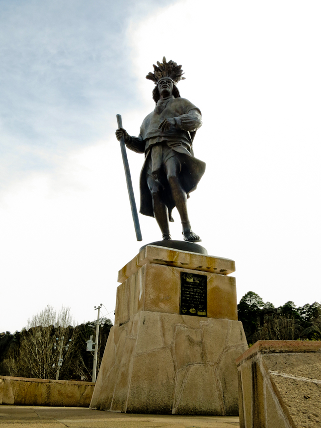
Statue outside of Creel of a native Tarahumara Indian in their traditional dress from the Copper Canyon./クリール郊外に建てられた伝統衣装を着たコッパーキャニオンの先住民タラウマラ族の像
■DAY 11 / 温泉でつかの間の休息
クリールの町で食料をダッフルバッグから補給し、メールを確認し、家族に電話をかけた。午後に僕らはクリールの町を出て、タレクルア峡谷の源流を目指して足を進めた。マウンテンバイク用のトレイルや、開発された温泉地に続く未舗装路のおかげで快適に歩くことが出来た。温泉の湯を確認してみると、Hot SpringというよりもWarm Spingだったけれど! 引き続き峡谷を下り、暗くなる前にもう数キロだけ歩き、より安全でひと気のない場所でキャンプをすることにした。
僕たちは深い小さな池の近くにある適当な砂地を見つけ、そこにキャンプを設営した。次の日はより充実した日にしようと決めていた。そうする事で、当初予定していた峡谷の殆どを制覇し、クリールの町に戻ってその日は休息日にできる。その機会がダッフルバックにある食料を補給し、残りの旅に向けて装備を取り替える最後のチャンスとなるだろう。
その朝、二つの温泉で素晴らしい時間を過ごせたので、時間の経過が早かった。僕らは足を止め、せっかくなので両方の温泉につかって体を癒した。その後、峡谷の底から15〜30m上に延びるけもの道を見つけて快調に進んだが、数時間後その道は不可解にも途切れてしまった。僕らは峡谷の底を進むしかなかったが、そこは岩がゴロゴロと転がる谷間で、歩くのに苦労した。案の定ペースは遅くなり、1時間に800mも進めなかった。
7時間もの苦痛に満ちた旅路の末、日は暮れてしまい、僕たちは唯一見つることのできた平らな場所でキャンプをするしかなかった。ウリク川の主流との合流点までまだ数kmを残していたが、目の前の支流の水位は高く、それはウリク川の主流が流れる峡谷を越えていけるのか、僕たちを大いに不安にさせた。
We resupplied from our duffels, caught up on our e-mails and phoned with family while in town. In the afternoon we walked out of town heading into the headwater of the Tarecurua Canyon. We made good time following a mountain bike trail and dirt roads down to the developed hot springs. We tested the waters and they were more like warm springs, so we continued down canyon determined to get another couple of miles in before dark and camp in a safer, more isolated location.
We found a nice, sandy beach besides a deep pool and made camp. We were determined to make good time the following day so that we could knock out most of the canyon since we planned to return to Creel after this short section and take a rest day. This would be our last chance to resupply out of our duffel and swap out gear for the rest of the trip.
The morning went by fast as we made great time past two sets of hot springs. We felt compelled to stop and soak in both of them. After the hot springs we found an animal trail that stayed about 50-100 feet above the canyon floor. It was smooth sailing for a few hours until the trail mysteriously ended. We had to pick our way down to the canyon bottom and struggle through the boulder-choked ravine. Our pace slowed to less than a half mile per hour.
After about seven hours of painfully slow travel we ran out of daylight and had to make camp at the only flat spot that we could find. We were still miles from the confluence with the main stem of the Urique River. Water levels were high in this tributary and it was worrying us about what we could face in the main canyon.
■DAY 12 / もっとも困難な徒渉
次の日も同様に痛々しいほど遅いペースだった。川底は狭く石で埋まっており、河岸のどの場所も草木が生い茂っていて、マチェーテ(中南米で広く使用される伐採用なた)を持っていたらよかったのにと思うほどだった。けれど、午後に僕たちのやる気は一気に復活した。次の角の先にやっと主流との合流地点があることがわかったのだ!
日が暮れるまであと一時間ほど。川を下って少しでも距離を稼ぐことは次の日を楽にさせてくれるし、町により早く到着させてくれることにも繋がった。 僕らは直に川の右岸の断崖を下ってウリク川の浅瀬を渡るしかなかったが、今回の旅でここまで高い水位の中を渡る事はなかった。川の流れは早く、水はとても冷たく、チャレジングだった。それはこれまでで、もっとも困難な徒渉だった。どうにか成功したが、2kmも進まないうちに、その浅瀬を再度渡らなければならかった…。
当初の旅のプランではウリク峡谷では次の補給まで48〜64kmで横断できると考えていたが、この川の水位ではその予定を再検討する必要があった。僕らは日が暮れるまでにさらに800mほど川を下り、適当な砂浜を見つけて寝袋を広げ、簡単に食事を準備し、泥のように眠った。
The next day was also painfully slow. The river bottom remained narrow and tight with boulder clogging the bottom. Anywhere outside of the water channel was so thick with vegetation that we wished we had a machete to get through. In the late afternoon we got a boost of enthusiasm as we realized the confluence was around the next bend. We reached the confluence with an hour of daylight remaining. Any miles that we could get down river would make the next day easier and get us to town earlier.
We quickly got cliffed out on the right side of the river and had to ford the Urique. There was only one place we could cross with the high water levels. It was swift, cold, and challenging. By far the hardest ford yet. We made it across and had to ford back to the right side after less than a mile.
Our plan was to travel in the Urique Canyon for thirty or forty miles following our resupply. We knew we had to reevaluate our plan with these high water levels. We made it less than a mile down the Urique River before we ran out of daylight. We found a sandy beach and rolled out our sleeping bags, cooked dinner and crashed for the night.
■DAY 13 / クリールへの帰還
翌朝、僕たちは興奮して目を覚ました。いま僕たちはタレクルア渓谷のすぐ外にいて、町までは残り半日で着くだろうと思われたからだ。しかし、そう簡単にはいかなかった。ふたたび川を渉ることを避けるため、けもの道を登り、崖を渡ろうとした。しかし、うまく行かず崖をおり、峡谷の底へ降りる道を見つけざるを得なかったため、結局川を二度渡る羽目になった…。
徒渉の一つはとてもチャレンジングで、結局泳いで向こう岸まで渉ることになった。完全に濡れてしまった僕はバックパックの中身に水が浸みていないことを願った。どうにか川を渡り、かすかにトレイルが上に延びているように見える場所に着いた。そして、その道に行き先を託してみることにした。
この道を行く事で、もう一つの崖を迂回でき、川を渡る必要がない事を期待したが、その道でキャニオンの側へと続く約450mの地点まで登ったが、行き止まりだった。僕らは戻って主流に行こうとしたが、その行き先には迂回不可能な、バックパックと共に泳ぐ必要のある徒渉がふたつ待受けていた。
We awoke with excitement. We were out of the Tarecurua Canyon jumble and thought we would only have a half-day of hiking to make it to town. Everything went afoul from the start. We climbed on a game trail to try to by-pass a cliff instead of crossing the river twice.
It didn’t work. We still got cliffed out and had to find a way back down to the canyon bottom. We then forded the river twice. One of the fords was very challenging and I took a swim as I was scouting out crossing spot. I was completely wet and hoped the contents of my backpack were not soaked. We managed to cross the river and get back to the right side where we saw another faint trail leading up. We decided to follow it in hopes that it would bypass another cliff area where we would have to cross the river.
The trail climbed up 500 feet only to drop back down in to a side canyon and dead end. We decided to make our way down the side canyon to go back to the main river. As we made out way down there were two areas that we could not bypass and involved swimming with our packs.
僕らは主流に辿り着く為に必要と腹を決めた。水はとても冷たく、呼吸をするのも困難だったが、この浅瀬を渡って、そして再度渡ってどうにか切り抜け、到着すべき地点へと着いた。ここから続くトレイルを登ると峡谷の縁にある村へと続いているはずだった。しかし、そこにトレイルはなかった。この時点で既に半日を使っていて、到着地点まで残り5kmを残していた。僕らは、その先でトレイルが現れる事を期待して、低木の密生地帯を通り抜けることにした。
約300mを登ると密生した低木が砂漠植物に代わり、進むのが楽になっていった。その後、更に約300mを登るとたくさんの家畜用の道が見えてきた。僕らはその道を進み、岩の中にある小さなタラウラマ族の家々を通り過ぎて、登り続けた。2〜3時間進み、約1,500m以上の高さにあるポンデロ—ザ松の木がある尾根まで来て、約30分後に目的の道まで到着した。既に時計の針は午後6時を指していて、太陽は沈みかけていた。
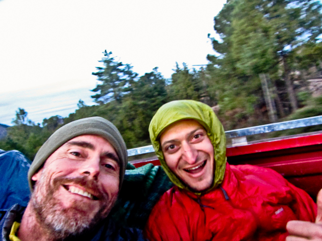
僕たちは日が暮れてしまうまでの15分程でヒッチハイクをしなければならなかった。車が捕まらなければ、町へ行くのは明日までお預けなのだ。歩きながらヒッチハイクをしていると、一台のピックアップトラックが荷積みを終え、出発するところだった。僕たちは乗せてもらえるか尋ねて、トラックの荷台へ乗り込んだ。一時間後、僕たちはクリールの町へ戻って夕食をとり、待ちわびた明日の休日に思いを馳せていたのだった。
The water was very cold and it was hard to breathe. We made it through those areas only to get the main stem at another mandatory crossing. We crossed and recrossed and finally reached the location where a trail was supposed to ascend out of the canyon and up to the village on the rim. There was no trail and we had already burned half of the day trying to make it down less than three miles of canyon. We bushwhacked up through thick brush in a side canyon hoping the trail would appear.
After 1000 vertical feet the thick brush gave way to desert plants and the going got a bit easier. After another 1000 vertical feet there were a slew of little used cattle trails that emerged. We followed these past a cluster of small Tarahumara houses in the rocks and continued ascending. A few hours later and over 5,000vertical feet higher we reached the Ponderosa Pine trees on the rim and a half hour later we reached the road. It was 6PM and the sun was about to set.
We had fifteen minutes of hitchhiking before the light faded and we would have to wait until tomorrow to reach town. As we walked up a pick up truck was loading up and starting to pull away. We asked them for a ride and crawled in to the back of the truck. An hour later we were back in Creel eating dinner and looking forward to a well-deserved day off.
TAGS:

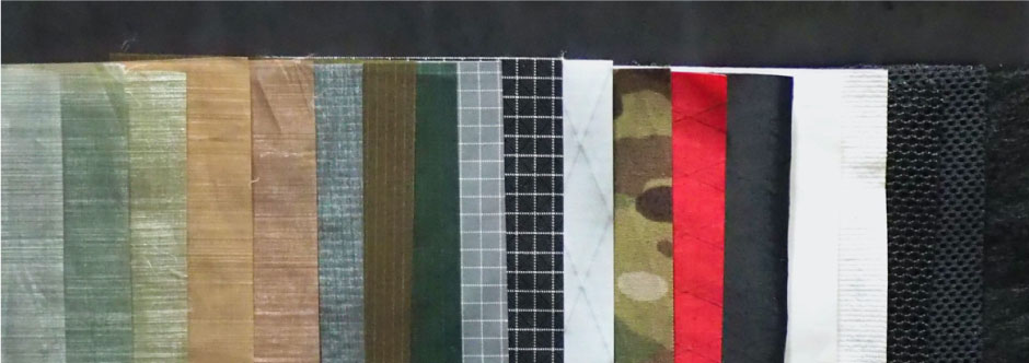
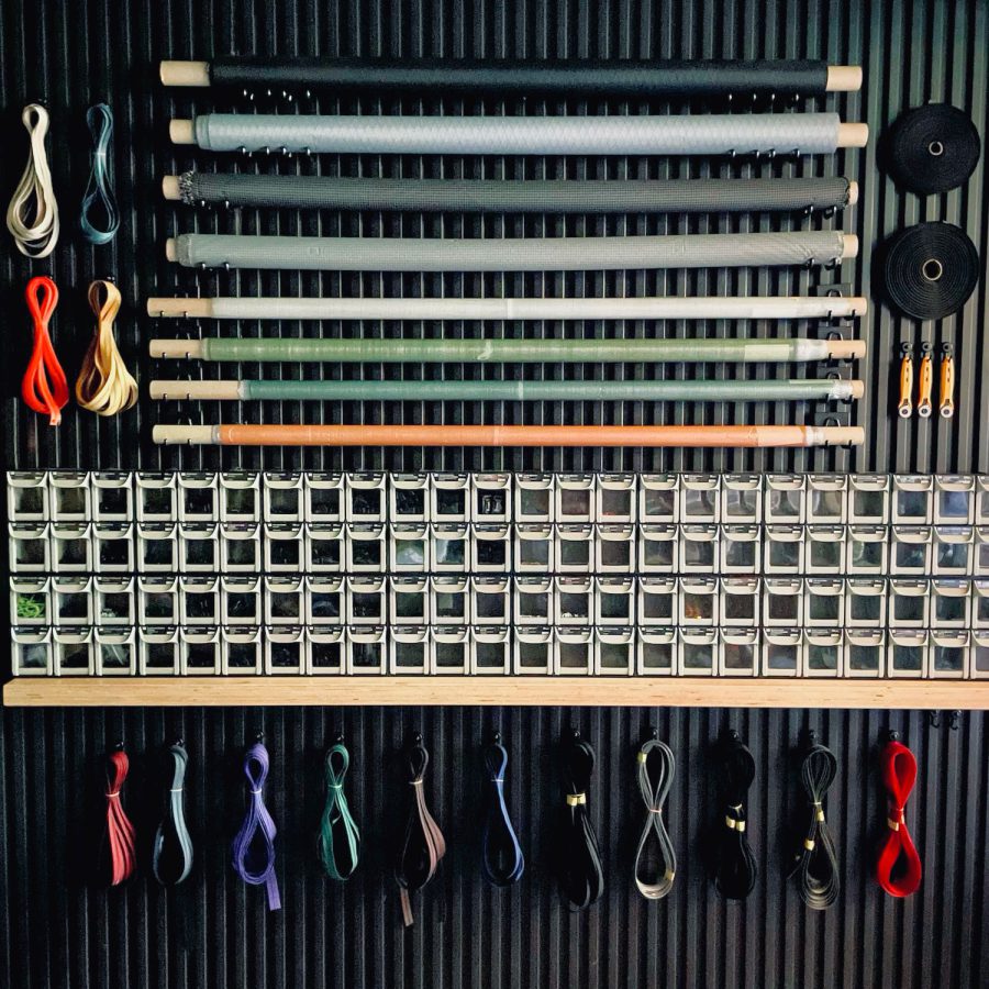 ULギアを自作するための生地、プラパーツ、ジッパー…
  ZimmerBuilt | TailWater P…
  ZimmerBuilt | PocketWater…
  ZimmerBuilt | DeadDrift P…
  ZimmerBuilt | Arrowood Ch…
  ZimmerBuilt | SplitShot C…
  ZimmerBuilt | Darter Pack…
  ZimmerBuilt | QuickDraw (…
  ZimmerBuilt | Strap Pack …