リズ・トーマスのハイキング・アズ・ア・ウーマン#05 / ワンダーランドの世界
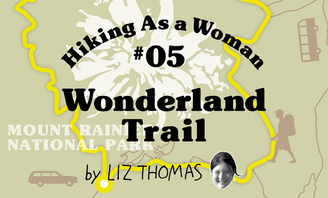
World of Wonderland
Among Japanese hikers, the John Muir Trail (JMT) may be the most famous long distance trail in America. At 344 km long, it takes the hiker from Yosemite Valley to the top of Mt. Whitney (4,421 km) across some of the most wild and scenic terrain in the country. I used to live very close to the JMT and have hiked it several times. Every time I’m on that trail, I meet Japanese travelers and talk with them. A question that always comes up is, “What other trails should I hike in America?” Often, my first suggestion is the Wonderland Trail. Not only is the Wonderland Trail –in my opinion—mile-for-mile the most beautiful trail among the many long trails that I have hiked in the States, it is also relatively easy to plan. In this article, I will discuss what to expect on the Wonderland Trail and how a Japanese hiker can hike it.
The Wonderland Trail is 150 km long and goes around Mt. Rainier (4,392 meters), one of the tallest and most massive mountains in the contiguous United States. The trail takes you right up to the tip of some of the biggest glaciers outside of Alaska. You will feel like Indiana Jones as you cross swinging bridges over white, glacier-melt filled rivers. Every turn of the trail gives you another view. In the summer, there are wildflowers everywhere. At lower elevations, old growth giant trees line the trail. The trail is a loop around the mountain, so there is no “right or “wrong” starting point—just get on the trail and, if you walk the whole thing, you will be back to where you started from when you are done. If you have a problem or need medical attention, there are many bail out points on the Wonderland Trail. The last advantage of the Wonderland Trail is that there are numerous outhouses along the way!
I hiked the Wonderland Trail at the end of September and the beginning of October. It was very late in the hiking season, but as a result, I saw very few other travelers. I had to finish up some work, so my hiking friends Cam “Swami” Honan, Greg ”Malto” Gressel, and Joshua “Bobcat” Stacey started the trail at the Longmire Trailhead one day ahead of me. Because the trail is a loop that crosses several roads, I was easily able to find my friends and join them about 45 km ahead of where they started at the White River Campground.
For travelers without a car, you can take a bus from Downtown Seattle to Mt. Rainier National Park about 2.5 hours away. You can walk the Wonderland Trail either clockwise or counterclockwise. Once you are inside the Park, hitchhiking from one trailhead to another is easy. You can also choose to rent a car and park it wherever along the trail you intend to start. Since you will follow the trail around the loop and back to your car, getting to and from the starting point and ending point on the Wonderland Trail is much easier than on the John Muir Trail.
Just a few hours into my hike, we realized that the weather was starting to look very bad. One of the members of our group was able to get cell reception and it appeared as if temperatures were going to reach a low of -10 degrees Celsius! That evening, we hiked up a very steep hill to our first camp at Sunrise Campsite. Despite the cold, we stayed up late joking and chatting with each other. When we went to bed at 10 pm, the sky was still clear and we had an incredible view of the stars. However, when we woke in the morning, there was snow everywhere!
Although our fingers were cold from the snow, we quickly packed up, used one of the outhouses, and started hiking up trail. The terrain on the Wonderland Trail can sometimes be steep, but it was good for warming up our bodies. We traveled above treeline, which normally would offer incredible views of Mt. Rainier. In the white-out snow, I felt like we were on top of the world.
We were happy to drop below treeline to Granite Creek, where temperatures were a bit warmer. After collecting some water, we had a chance to warm up in the sun. As the clouds left and our views opened up, I was shocked to find that we were right next to the Winthrop Glacier! A roaring river was coming off the glacier and the river had clearly flooded recently, taking out trees and moving boulders. It is amazing the power and force of destruction that the glaciers and the water coming off Mt. Rainier can make. As we crossed the White River, I was humbled by the size of the mountain and the power of nature. Right before lunch, the trail took us on an incredible walk along the Carbon Glacier. Outside of Alaska, it is the longest, thickest, and widest glacier in the United States. It is only 1,100 m above sea level, also making it the lowest lying glacier in the United States. Where I live in the States in Denver, Colorado, the elevation is 1600 m above sea level. On a hot summer day in Denver, it is hard to imagine that there could be a glacier surviving anywhere at such a low elevation!
After reaching the Carbon Glacier, our team had to make a decision. Do we take the lower elevation “official” route of the Wonderland Trail as it follows the Carbon River away from its source, the Carbon Glacier? Or do we take the Spray Park alternate route? I knew very little about Spray Park other than that it sounded like it was a high route that would be colder and wetter and would require more climbing. Swami had hiked the Spray Park alternate before and encouraged the rest of us to choose that route. Although I was feeling cold and tired, Swami convinced me, so off we went towards Spray Park. Man, was Spray Park the right choice!
The climb up to the park was beautiful, even though we did not get much of a view. Above us, we could see the Russell Glacier. The waterfall at Spray Park may have been the highlight of the whole trip. It was possible to walk right by the waterfall and I felt like we had stumbled upon a hidden gem that few hikers get to see.
After nightfall, we stumbled by headlamp into the South Mowich River shelter. We were wet and cold, but and the three-sided shelter provided a respite from the elements. Our tarps were still wet from the night before because there had not been enough sunlight to properly dry them out. We hung them up along the side of the shelter and enjoyed a fun-filled night sharing a three-sided hut together.
The next morning, I was a little scared about the next section of trail. The Wonderland Trail crosses many rivers that come off of Mt. Rainer. These rivers are formed by melting glaciers and snow and can be quite powerful. Every year, flash floods cause the bridges on these rivers to get washed away. The National Park Service is good about replacing bridges—especially in July and August. But when I hiked the Wonderland Trail, they had not replaced a bridge on the South Mowich River. We would have to ford.
We sent Malto, our tallest member, on the ford of the river first. The water was cold and fast moving and white in color—you couldn’t really see how deep the river was. Our hiking poles were useful, but in the end, the river ford looked scarier than it actually was.
The weather throughout the day was better and we had more opportunities to take photos and enjoy the unique landscape of the Wonderland Trail. We relished crossing a swinging bridge over the Pullayup River, which flowed rapidly 30 m below us. The trail was lined with ferns and colorful mushrooms. We crossed small waterfalls and even a few flowers remained.
Towards the late afternoon, we wondered whether we would be able to make it that night to Longmire, the trailhead where Malto’s rental car was parked. Although I was tired, Malto gave me one of his caffeine pills. Talk of food plus the caffeine pill doubled my pace. We returned to the car right before dark. Once inside, we turned on the heat, and were able to drive to a little restaurant on the side of the road that served burgers that weighed 450 grams! We each ate one before going to sleep in a warm and dry cabin. We were all content.
Malto, Bobcat, and Swami had started at the Longmire trailhead, so they had completed their trip by making a full loop around Mt. Rainier in 3 days! However, I had started my trip at the Sunrise Campground, so I still had about 40 km left to go. The three of them drove me back to Longmire trailhead before returning to Seattle, and I started my trip back to the Sunrise Campground solo.
The weather was sunny and I was mesmerized to pass Reflection Lakes—which had a perfect mirror-like reflection of Mt. Rainier in it. The trail travels along Stevens Creek before reaching the famous Box Canyon area on the Muddy Fork of the Cowlitz River. This area is popular with tourists and there were many other trails around. I got temporarily lost on one the side trails, but after asking some other hikers, was able to find my way back to the Wonderland Trail. The climb to the Indian Bar Campground was very steep, but when I reached the campground, I was stunned by its beauty. After two days of rain and grey skies, I had an open view of Mt. Rainier. The sunset was pink and the valley below looked so inviting. It was a wonderful place to camp and I felt like I had it all to myself.
That morning, I walked from Sunset Park through Ohanapecosh Park, which was one of the highest and most beautiful parts of the whole trip. Except for Spray Park, I did not have to walk on any permanent snow fields on the Wonderland Trail—mostly because I was hiking in October at the end of the season. Most Wonderland Trail hikers who start in June find that more than 70% of the trail is covered in snow. Early season hikers must navigate the path when the trail isn’t visible because of snow. Even though I hiked in October, I was surprised to find there were a few places at Ohanapecosh Park where I had to walk on last year’s snow.
The hike from Summerland Campground down the Frying Pan Creek was an easy downhill. I was sad that the trip was already over. The weather was great and it was a Friday, so there were many more hikers on the trail. As I walked the last bit to my car, I was sad to see another trail move by so quickly and already wishing to return to the Wonderland Trail once more.
Important Information:
Gear: My rain jacket and Montbell umbrella were the most important pieces of gear on this trip. It rains frequently on the Wonderland Trail and I was very happy to have lots of rain protection. I carried a sleeping quilt rated to -9 degrees Celcius and inflatable sleeping pad to stay warm at night and slept in the Mountain Laurel Designs Solomid tent, which repelled the snow and water well. If I were to hike the trail again, I would bring a synthetic Montbell Thermawrap jacket instead of a down jacket.
Permits: Before you go on the Wonderland Trail, it is important to get a permit. To get a permit, choose how many days you plan to hike the trail in and which campsites you think you will stay at each night depending on your daily mileage. This website is a very useful tool to choosing campsites based on your mileage. Download and fill out the permit form, which will require that you pay a small fee via credit card to make a reservation. You can submit your permit request as early as March 15, but no earlier. Unfortunately, you can only mail or fax your permit—there is no email option yet. All permits submitted between March 15 and April 1 will be processed in random order, and you will receive a confirmation letter up to 6 weeks later. When you arrive at Mt. Rainier National Park a day before your hike, take your letter to a ranger station to get your permit. All Wonderland Trail hikers must have a permit and are not allowed to camp anywhere other than established campsites.
There are also a certain number of permits available for visitors who walk up to a ranger station and ask for a permit. These are called first-come, first-served permits or walk-in permits. You can request a permit to start the following day or to start your trip that very day. On the spot, the ranger will give you a permit that will outline where you will stay for however long you will be hiking the Wonderland Trail—up to 14 days. If you plan to ask for first-come, first-served permit, your schedule will have to be very flexible.
You may be asked to hike 20 miles one day and 4 miles the next day. If you are not attached to the idea of staying at a specific campsite, but are OK with staying at whatever camp has availability, you are much more likely to be successful with a first-come, first-served permit. Your chances of getting a first-come, first-served permit are much higher if you hike early in the season (May or early June) or late in the season (October), or if you try to get a permit for a weekday. It is much easier for a one or two hikers to get a same-day permit than for a large group to get a same day permit.
I hope that you found this guide and the story of my hike to be inspiring, and that you will come to America and visit the Wonderland Trail. When you do, let me know! I hope that your adventure is as fulfilling as mine.
- « 前へ
- 2 / 2
- 次へ »
TAGS:


 ULギアを自作するための生地、プラパーツ、ジッパー…
  Tenkara USA | RHODO (ロード)
  Tenkara USA | YAMA (ヤマ)
  Tenkara USA | Rod Cases (…
  Tenkara USA | tenkara kit…
  Tenkara USA | Forceps & …
  Tenkara USA | The Keeper …
  Tenkara USA | 12 Tenkara …
  Tenkara USA | Tenkara Lev…