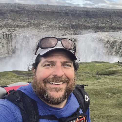
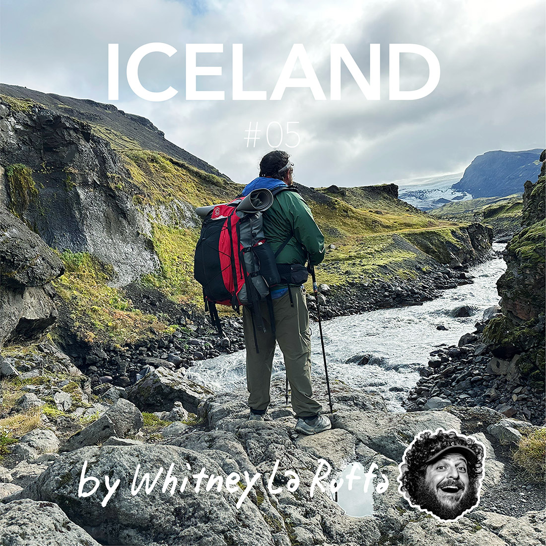
アイスランド縦断ハイキング 575km / 18 days by ホイットニー・ラ・ルッファ #06
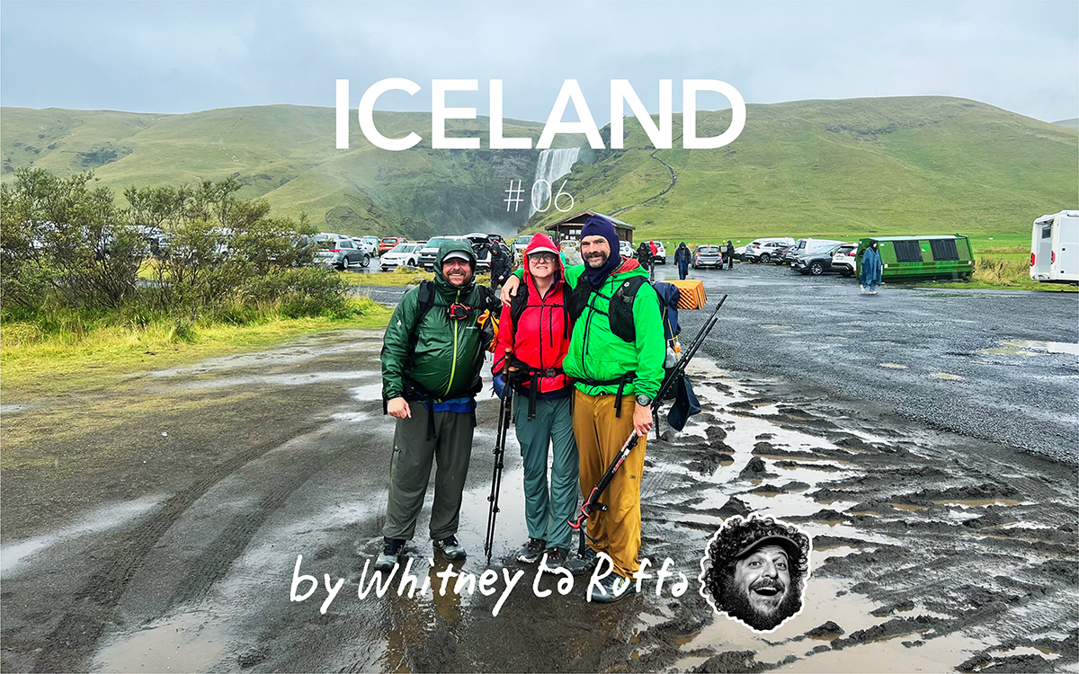
Icelandic Traverse Part 6
Start Basar Campground
End Skogafoss
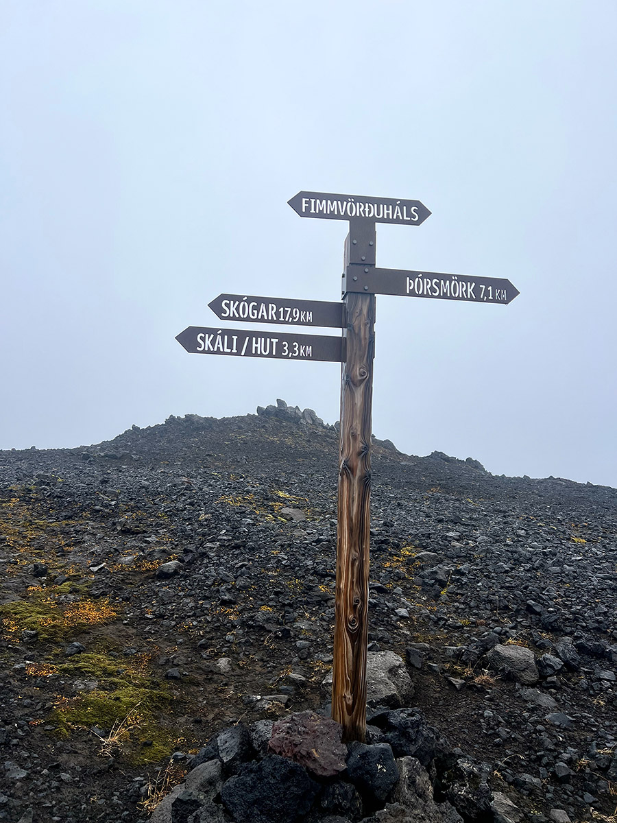
Fimmvorouhals Trail, 24km
The Laveaguer Trail may be the most famous hiking trail in Iceland, but the Fimmvorouhals Trail is the crown jewel of the Iceland Traverse. In 24 km, this hike will give you various challenges and amazing sights. From a long climb along a narrow knife edge, then find your way through lava fields and an ice cap at the high pass, and finally, the hiker is treated to 33 of the most stunning waterfalls you will ever see in life.
The three of us woke up at 4:30 a.m. to get an extremely early start to the day. We had agreed to get out early to catch the 3:30 p.m. bus from Skogafoss to Ryekajvik that afternoon. This final push to finish this day would allow us a few free days to explore Iceland as tourists after our hike.
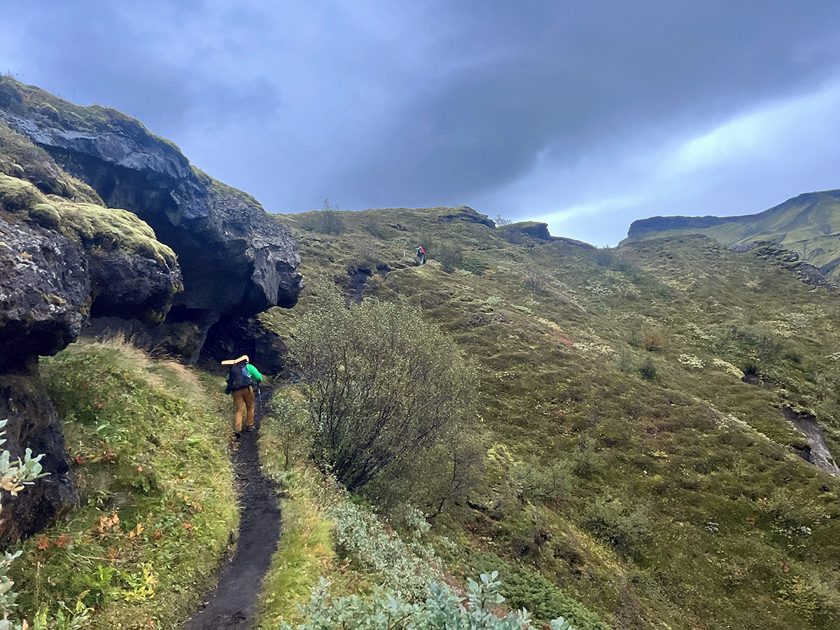
The weather was cool, and the sky was overcast. We broke camp and layered up within 30 minutes; we were heading out on the trail. The hike began with a long climb of 1000m over approximately 8 km. The trail walked through the valley where we camped and then, in short order, started to climb. We climbed along a well-established trail on the side of the mountain; one side was a spectacular display of basalt columns, and the other was a steep drop down to the valley. We reached the top of this initial climb and faced a narrow knife edge.
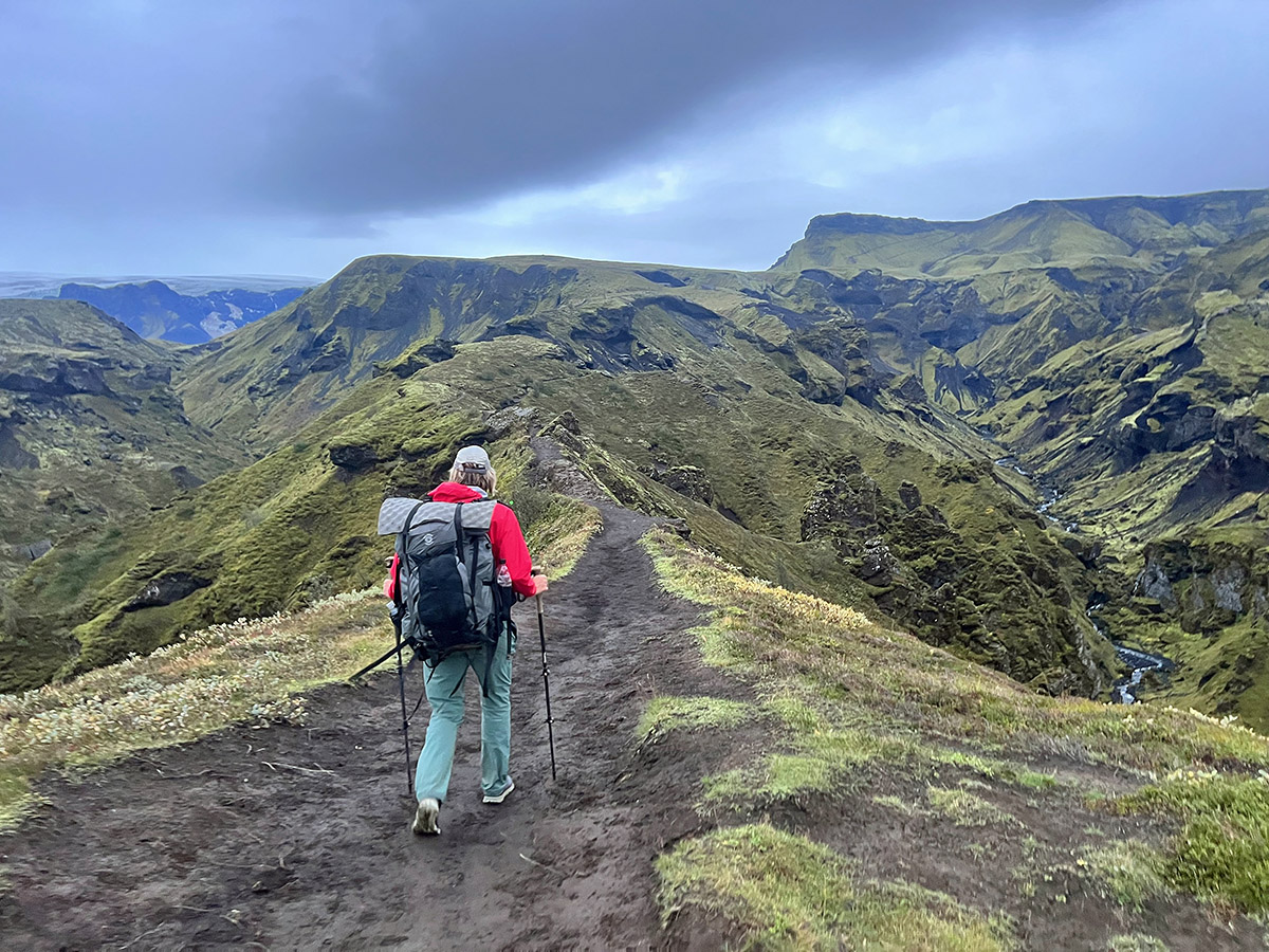
We worked our way across the ridge. It was just wide enough for one hiker and had steep drops on either side, testing one’s nerves. I have always been comfortable on such terrain and easily navigated my way across. I then waited and helped Naomi and Mike across with some positive encouragement. Neither was very comfortable in this type of terrain, but after a few minutes, we stood together, facing the next challenging section.
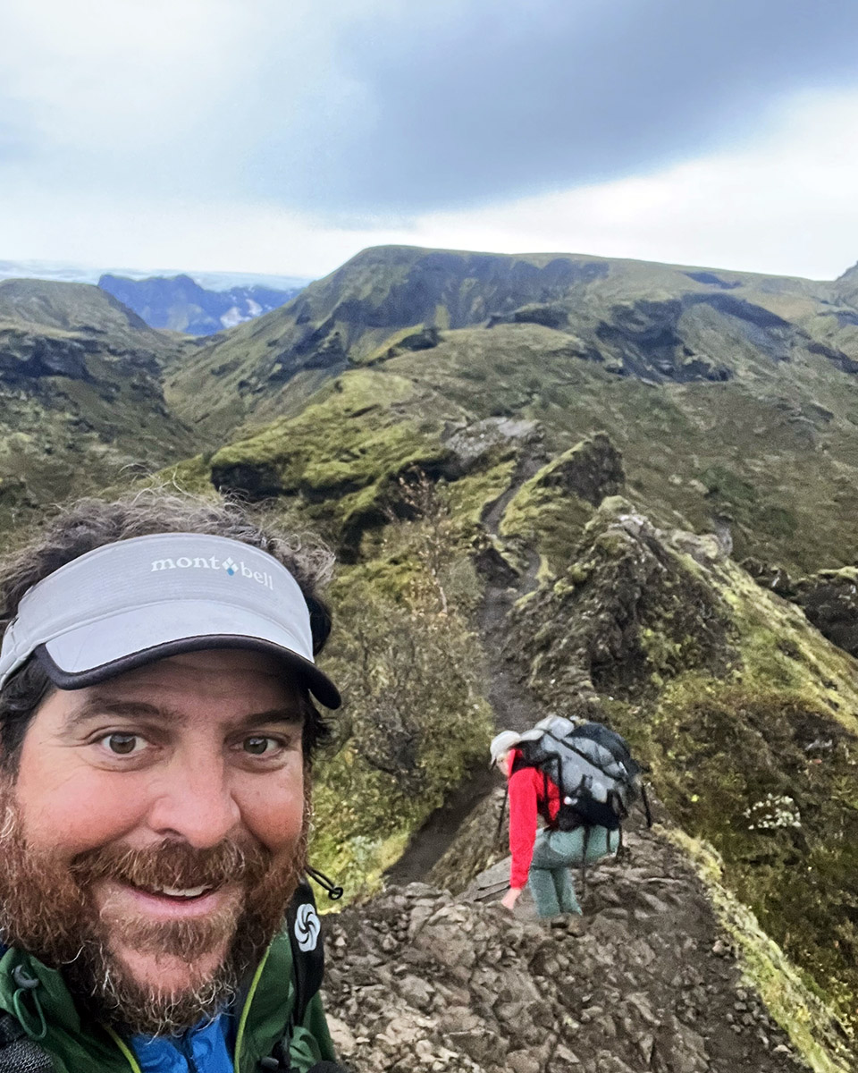
There were cables and chains to hold onto to get past a very sketchy section of the trail. I was the first through, and they told me to keep going at my own pace as they would be taking their time through this section. I soon found myself climbing up a narrow, long trail toward the clouds above, obscuring my destination. Below, the green valley and the glacial river provided a wonderful backdrop to this fantastic climb. I was moving fast and feeling strong. Before I knew it, I was at the trail junction.
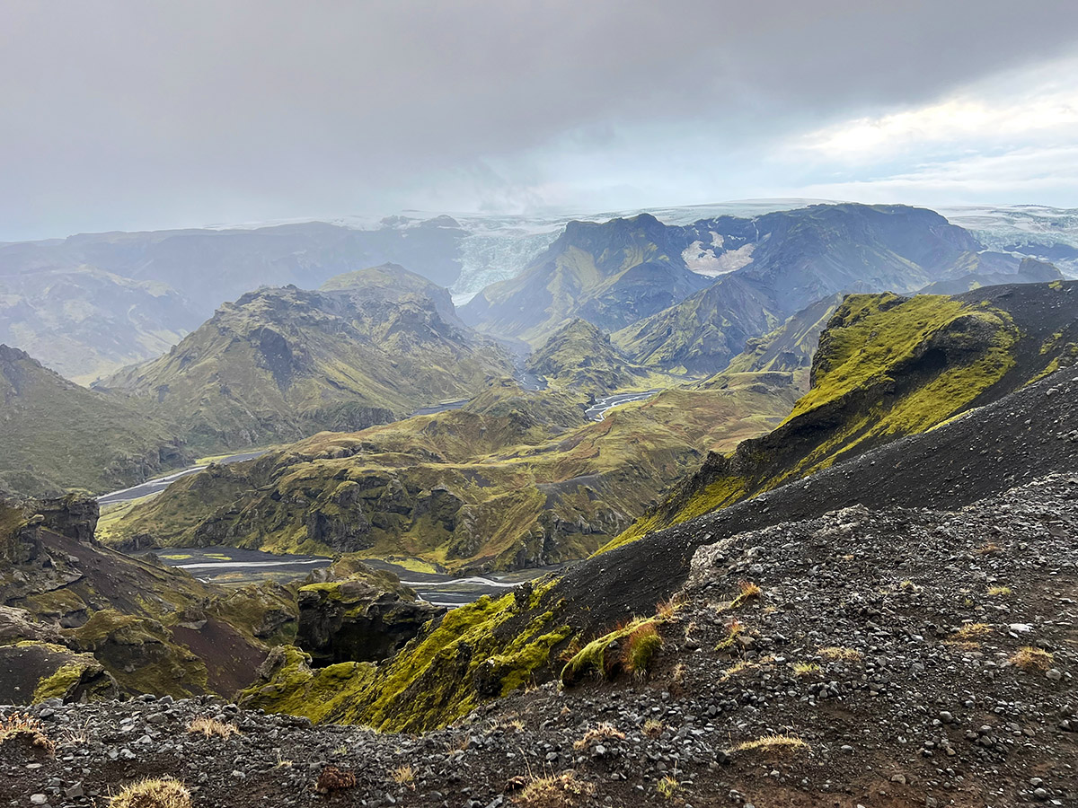
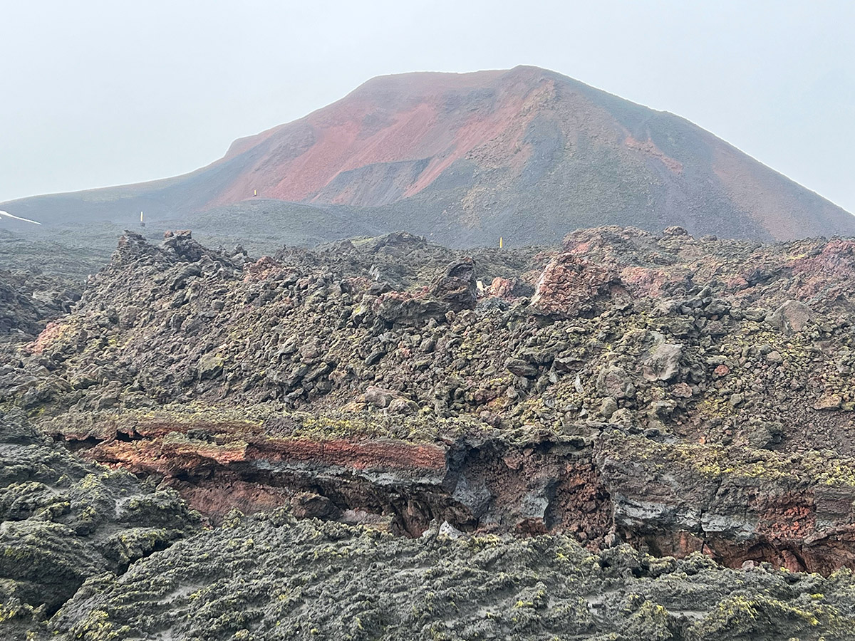
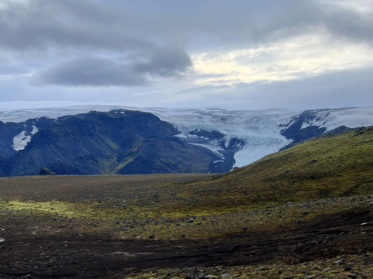
We regrouped at the junction. The air up here was cold, and we each put back on some layers we had shed during the climb. Bundled up against the cold, we set out on a confusing set of paths at the begging stretch of the Fimmvörðuháls pass, which goes between the Eyjafjallajökull and Mýrdalsjökull ice caps. The Eyjafjallajokull Volcano has been famous for its recent history. In 2010, this volcano erupted, forcing air travel between the US and Europe to be canceled for a short time. The newly formed laval field from this eruption was hard to navigate as we were not sure where the trail went. We worked together to pick our way across the sharp rocks and then came upon the ice caps.
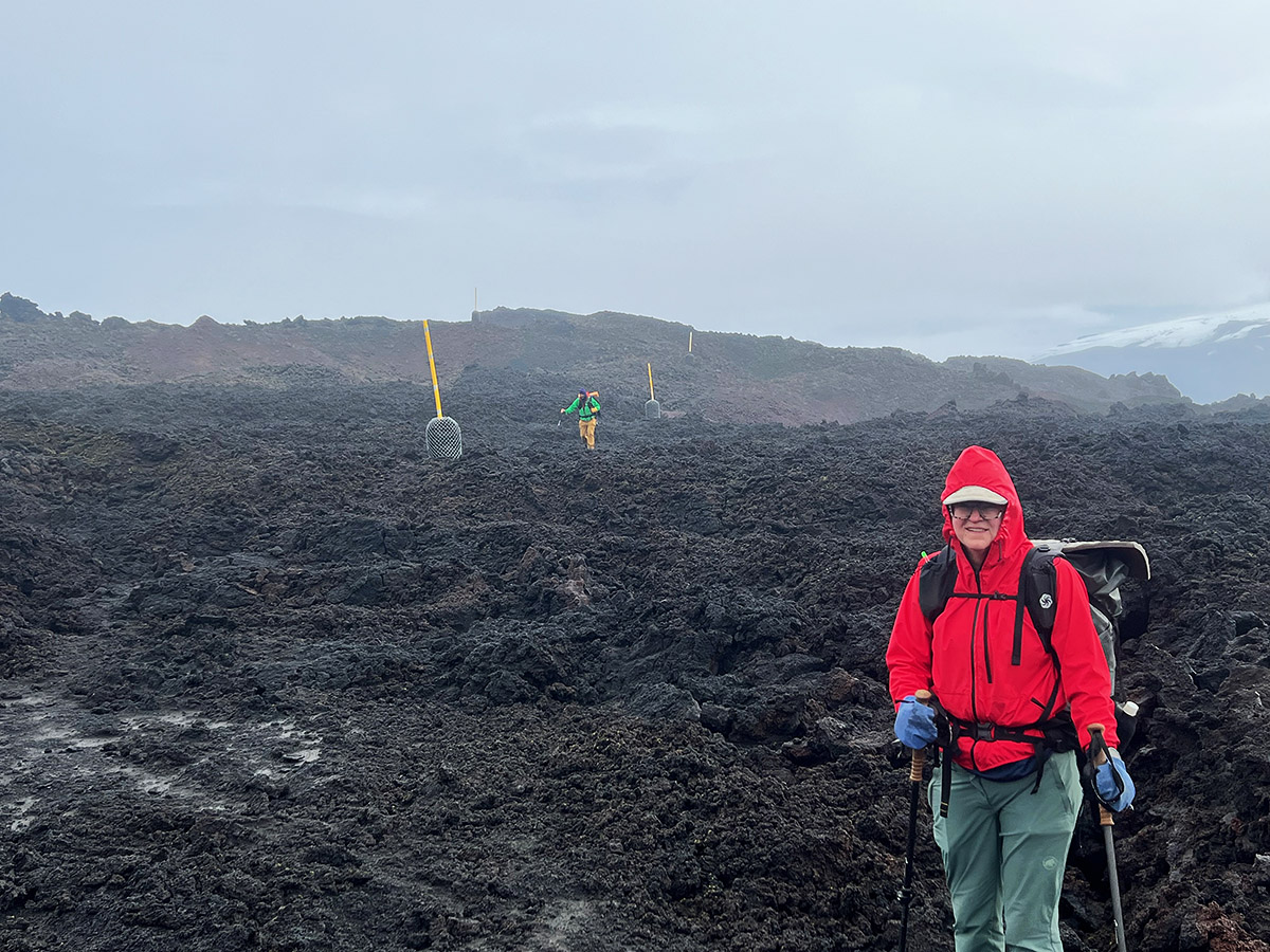
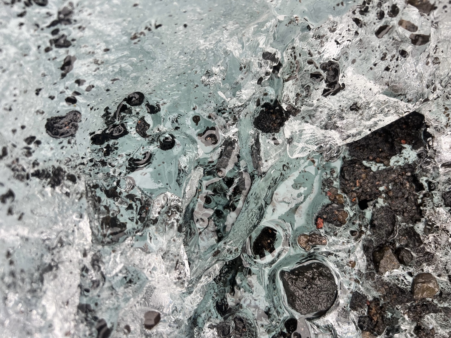
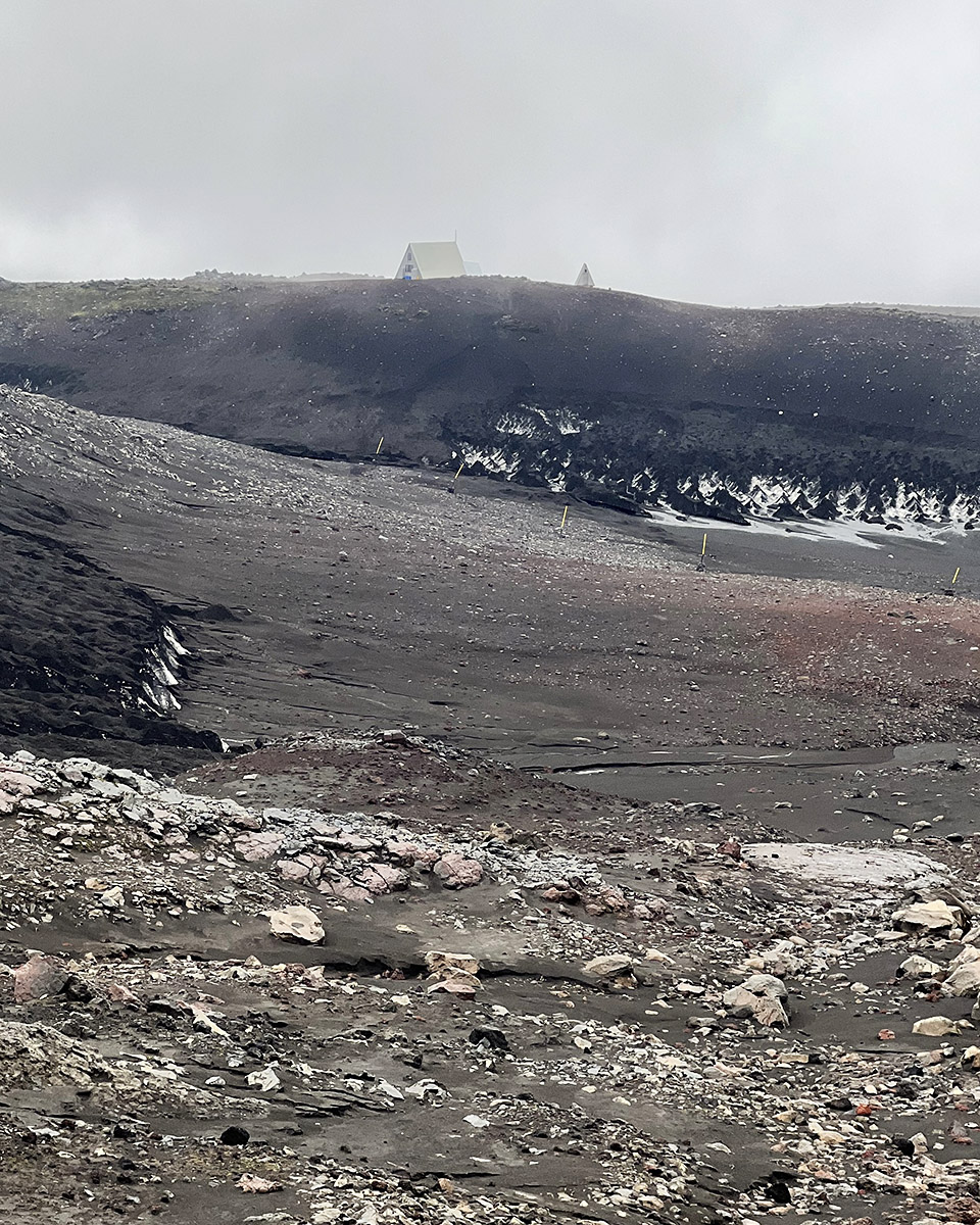
We first had to descend a steep frozen cliff of rhyolite mud and ice and carefully walk across solid glacial ice. None of us had traction devices like microspikes; thankfully, we had our trekking poles, which we relied on to balance across the highly slick surface. The clouds kept coming in and out, and with one clearing, we spotted the hut, which marked the high point of the trail and the descent to Skogafoss. As we approached the hut, rain started to pelt us. We had been hiking straight for hours without a break, so we decided to pop into the hut to warm up and eat a snack.
The hut warden was a wonderful woman named Katrin, who had been there for about 15 years. She welcomed us in and offered to make us some coffee. We were concerned about a long break and having enough time to catch the bus, but Katrin said, “Based on how quickly you three reached me here, you should have no problem making the bus today on time.”
For the next 45 minutes, we enjoyed sharing hot coffee and cookies in our bag and swapping stories about our hike and her time living high up on a volcano every summer. She was such a wonderful human being. By the time we were ready to leave, we had parted as old friends and promised to let her know we had made it down safely.
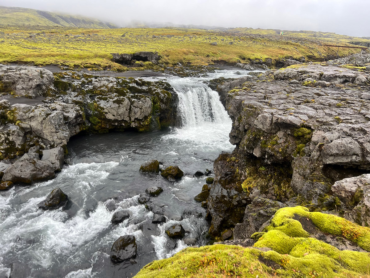
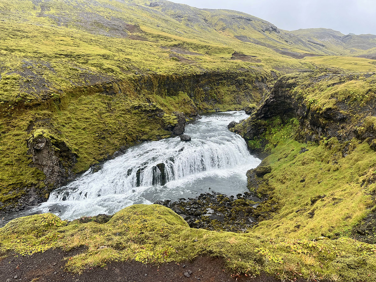
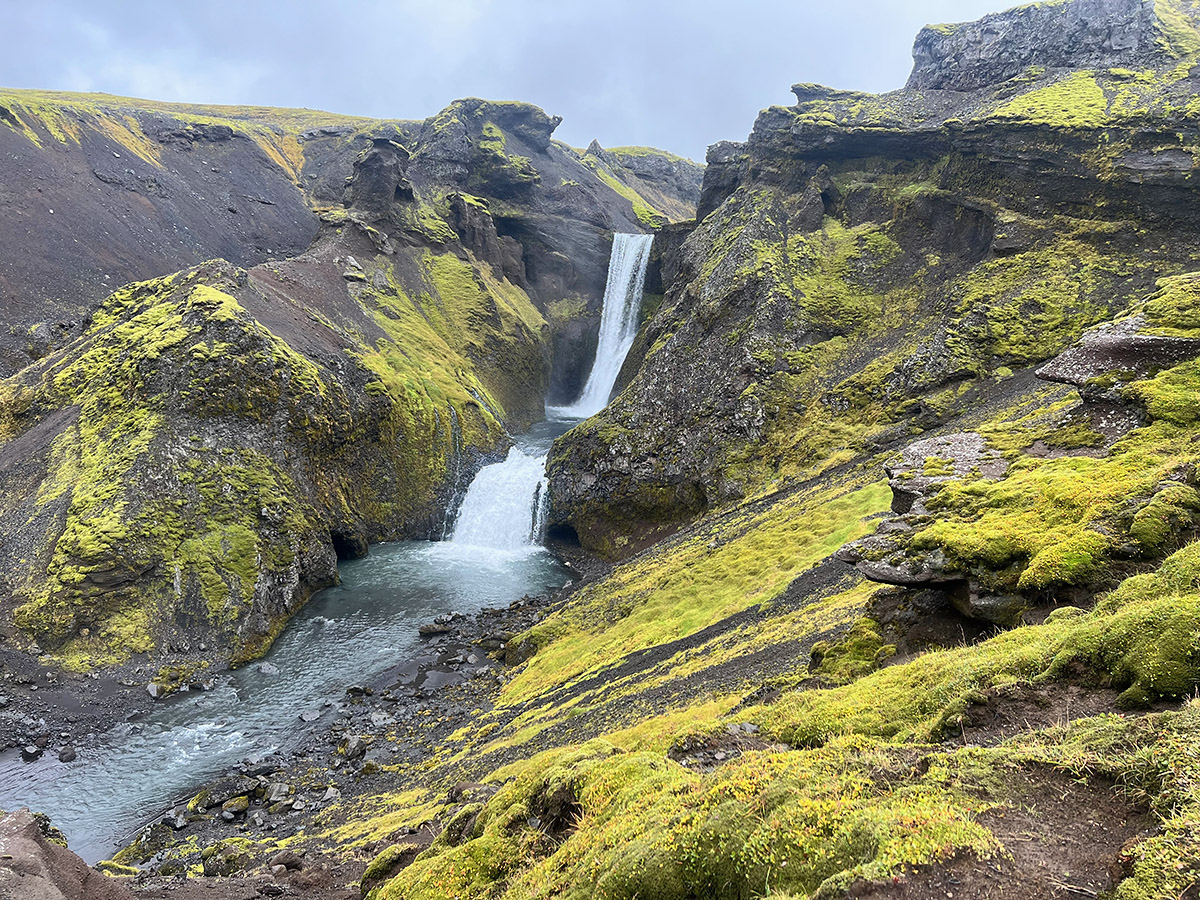
The trail leaving the hut was an unremarkable large gravel road used by 4×4 to resupply the hut during the season. We descended it for about 45 minutes. A cold, steady rain now fell on us and would last for the rest of our hike. Zipped up our gore-tex jackets, we trudged along and then turned onto the trail. We crossed a small footbridge over the canyon and were soon greeted by the first of 33 waterfalls along the descent.
These waterfalls were large, powerful, and stunning. We spent the next few hours hiking as fast as possible just to stop and marvel at the waterfalls and grab some photos. As we got lower on the trail, we began encountering groups of day hikers coming up from Skogafoss. A popular day hike is to start there and hike up and down the waterfall section of the trail.
The groups were spread out, and the trail still provided plenty of time to reflect on where we had been and all we had experienced. The pull of a warm bed in Reykjavik and dry clothes kept us moving quickly. As we approached the last few kilometers, we realized we would be very tight on time to catch the bus. We each dug deep for that extra fast gear a hiker has when heading for town, and we quickly worked the remaining terrain.
Right towards the end, we saw the large parking lot for Skogafaoss below. We were shocked at the number of cars and buses. Hordes of tourists now started coming up the short trail from below. Like salmon swimming back upstream, we pushed our way through the crowds. In a few minutes, the three of us stood in the mud of a large parking lot, with Skogafoss thundering behind us. Our journey had come to an end.
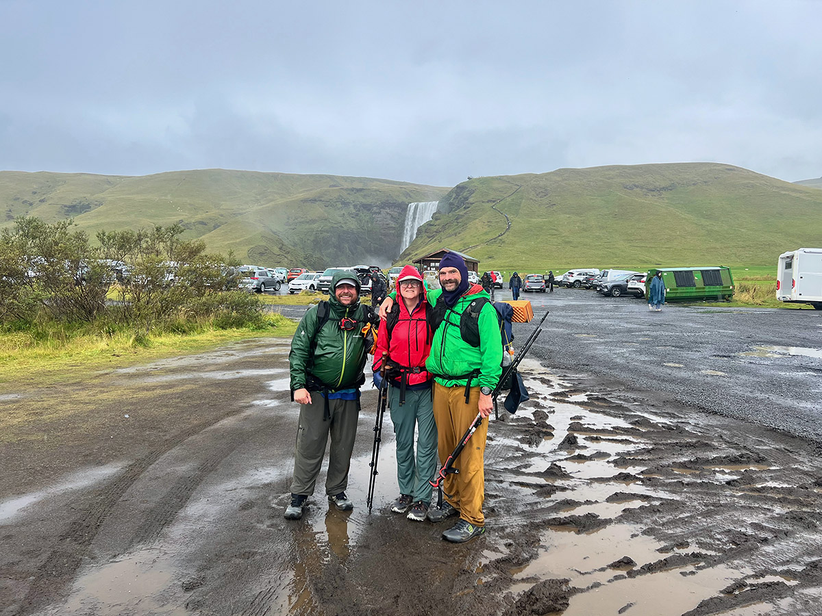
With less than 15 minutes to spare, we boarded a large public bus and started our three-hour ride back to Reykjavik. I sat alone, lost in thoughts about the traverse we had just completed. I was proud that I had pushed through some very low morale at times and was able to complete the hike and enjoy it. Like all my hikes, I also started to dream of my next long hike and where it would take me.
Post Hike
The three of us had a few days before leaving Iceland, so we spent 2 nights in Reykjavik enjoying some food, museums, and the local public pool to soak our sore muscles. We rented a car and took off to the Snaefells Peninsula.
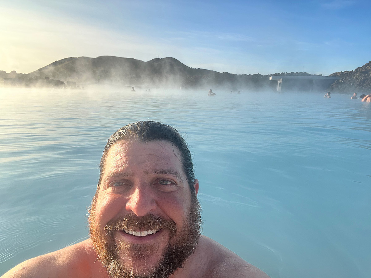
We explored small fishing villages, went through Snaefellsjokull National Park, and enjoyed an extended visit and soak at Hvammsvik Nature Resort. On our final morning, Mike and Naomi departed at 5 am. My flight was at 4 pm, so I took the morning for one last lagoon visit and went to the famous Blue Lagoon for a final soak before leaving the land of fire and ice.
- « 前へ
- 2 / 2
- 次へ »
TAGS:


 ULギアを自作するための生地、プラパーツ、ジッパー…
  Tenkara USA | RHODO (ロード)
  Tenkara USA | YAMA (ヤマ)
  Tenkara USA | Rod Cases (…
  Tenkara USA | tenkara kit…
  Tenkara USA | Forceps & …
  Tenkara USA | The Keeper …
  Tenkara USA | 12 Tenkara …
  Tenkara USA | Tenkara Lev…