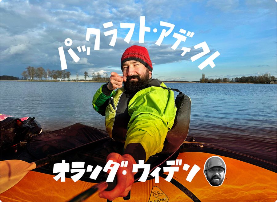
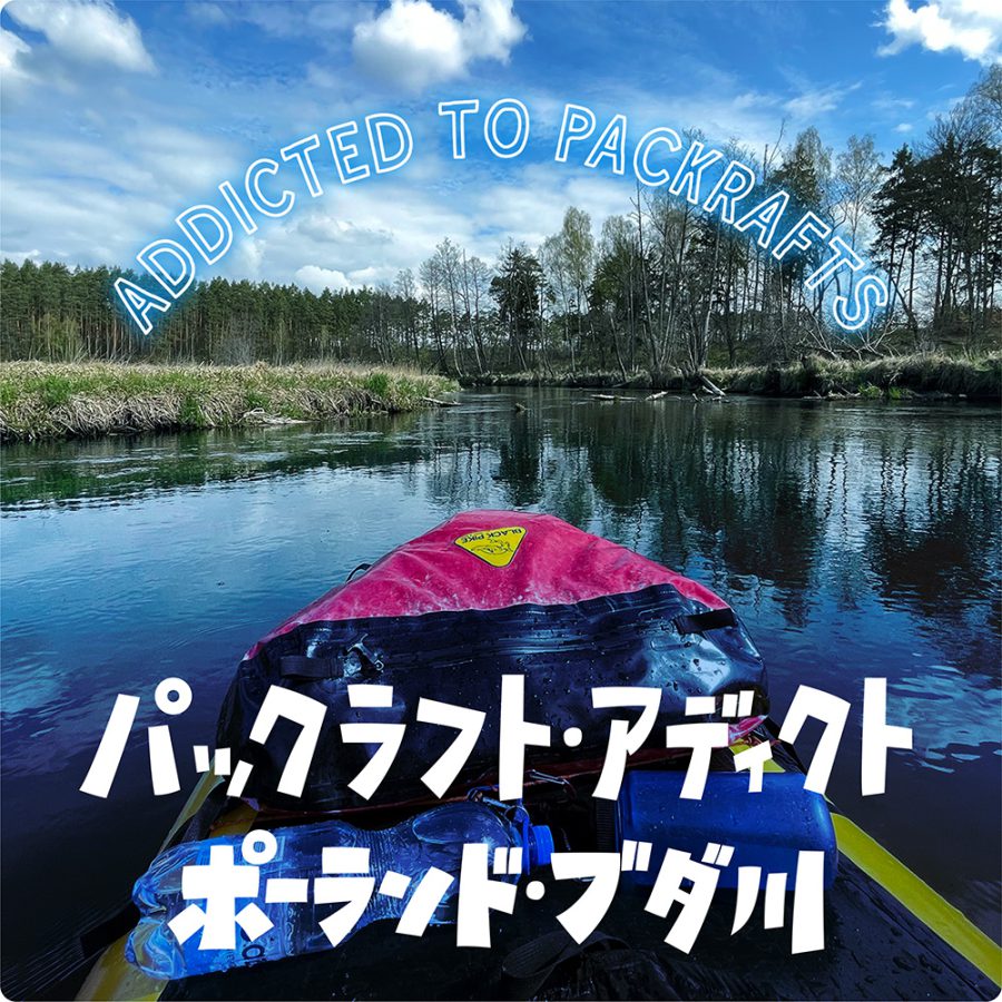
オランダ・ウィデン 国立公園の湖と運河をつなぐパックラフティング&キャンプ | パックラフト・アディクト #67
Visiting Giethoorn and the Weerribben-Wieden National Park by Packraft
In Dutch, the words “gracht,” “sloot,” and “vaart” refer to narrow, winding channels that are often used for transportation and irrigation, while “wijde,” “kolk,” and “belt” describe open bodies of water such as lakes and larger ponds. These words are closely linked to the region’s history and are often used in toponyms. This was also the case with the names of the waterways I paddled on during my two-day trip in the Weerribben-Wieden National Park on March 11th and 12th, 2023.
The Weerribben-Wieden National Park is a vast wetlands area in the province of Overijssel, located in the northeastern part of the Netherlands. It covers over 10,000 hectares of lakes, ponds, canals, and reed beds, making it one of the largest and most diverse wetland areas in Europe. The park is home to a rich variety of plant and animal life, including rare and endangered species such as otters and black terns.
The park’s unique landscape is the result of a long history of human activity in the region, particularly peat mining that began in the Middle Ages and continued until the 20th century. The extraction of peat left behind a series of lakes, marshes, and canals that have become a crucial part of the park’s ecology.
The park consists of two parts, with the northern part – Weerribben – managed by Staatsbosbeheer (the Dutch Forestry Commission) and the southern part – Wieden – managed by Natuurmonumenten, a non-profit organization. Despite their different management structures, both organizations share the goal of preserving the natural environment while promoting sustainable land use practices that benefit both wildlife and humans, including recreational activities.
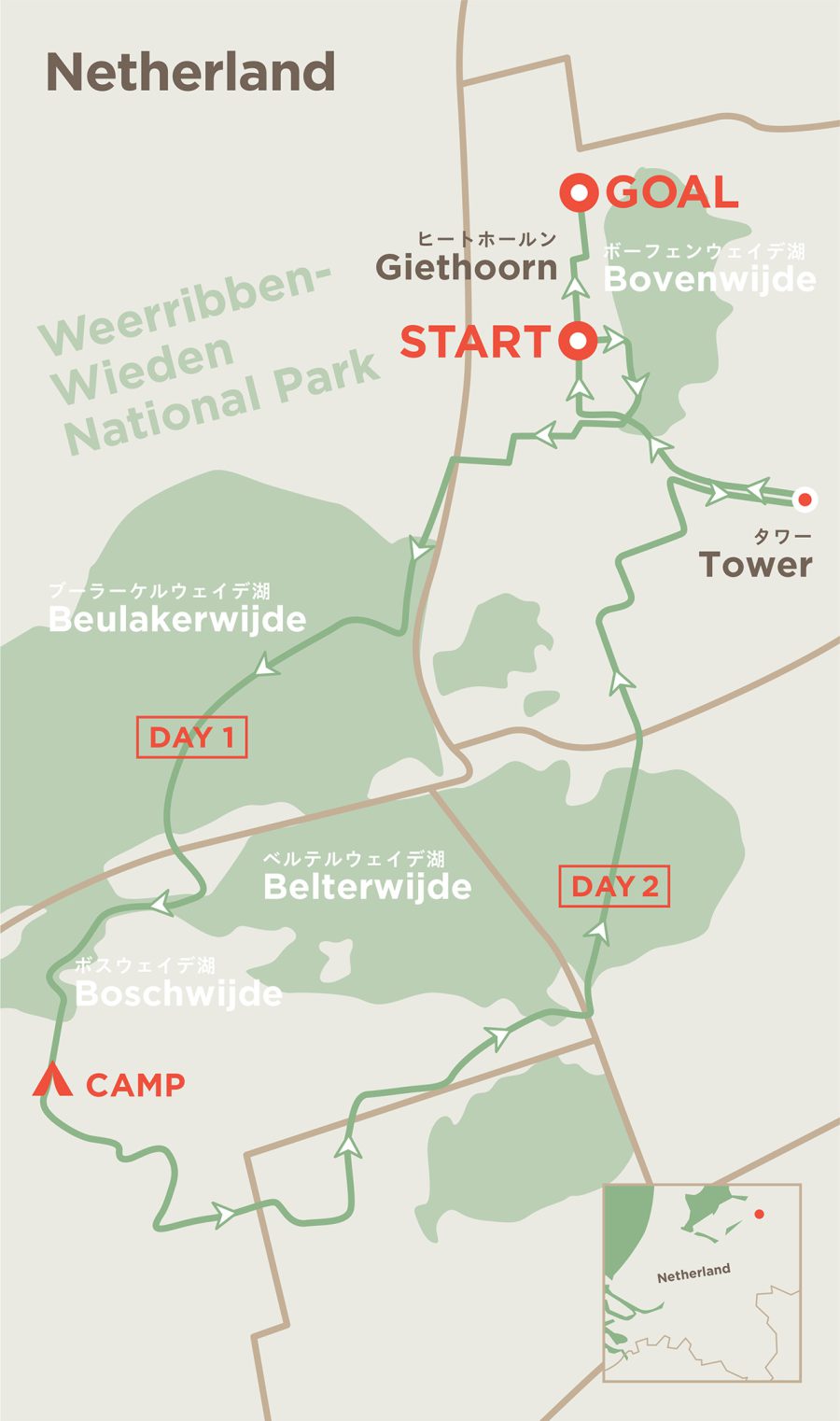
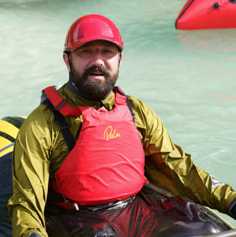
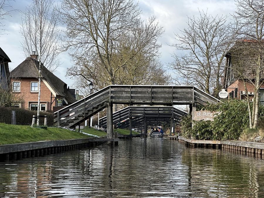
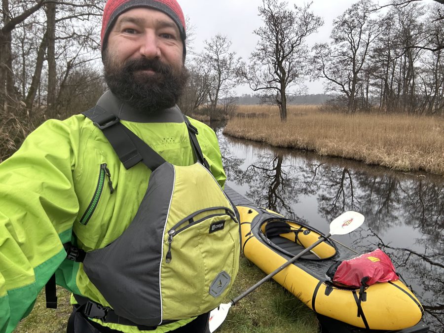
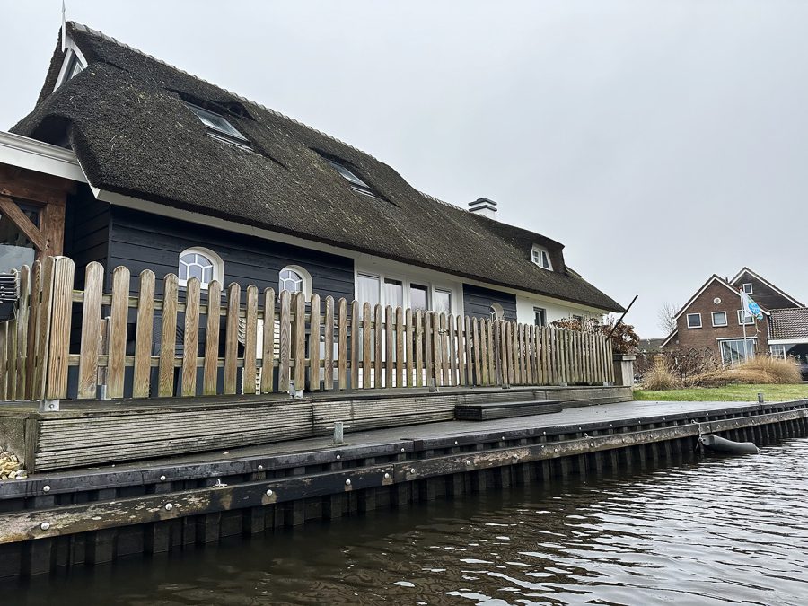
During my visit, I explored the Wieden part of the park, starting and finishing my trip in the village of Giethoorn. Giethoorn is a popular tourist destination and one of the most famous villages in the Netherlands, known for its picturesque canals, wooden bridges (over 180 of them!), and traditional thatched-roof houses. The village is sometimes referred to as the “Venice of the North” due to its many waterways, and that a lot of houses there can only be accessed by boat or on foot. The villagers use boats for all sort of transportation, even for moving to a new house, as I witnessed during my trip.
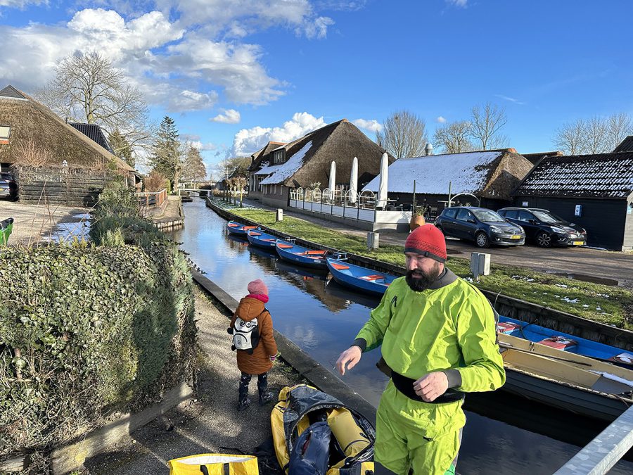
The first day, I paddled just over 10 km. As Giethoorn is only around 40 minutes by car from where I live, my wife Marta and my daughter Helena were kind enough to drop me off there. The starting point I chose turned out to be special as well – it was a small side canal next to the restaurant called “De Fanfare.”
What is interesting about it is that it is named after the famous Dutch film “Fanfare,” which was filmed in Giethoorn in 1958 and brought the village to national attention, inspiring many people to visit the area.
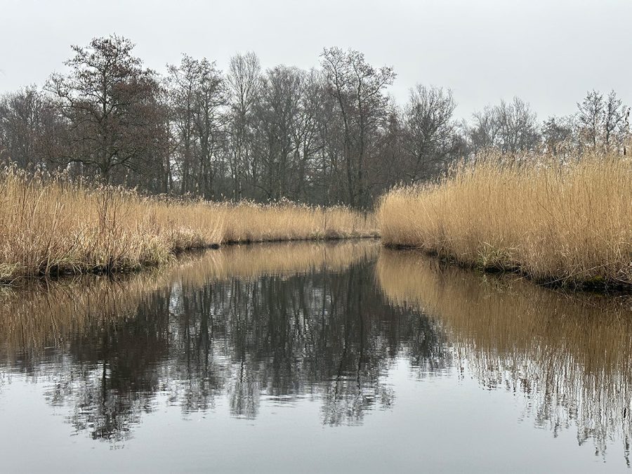
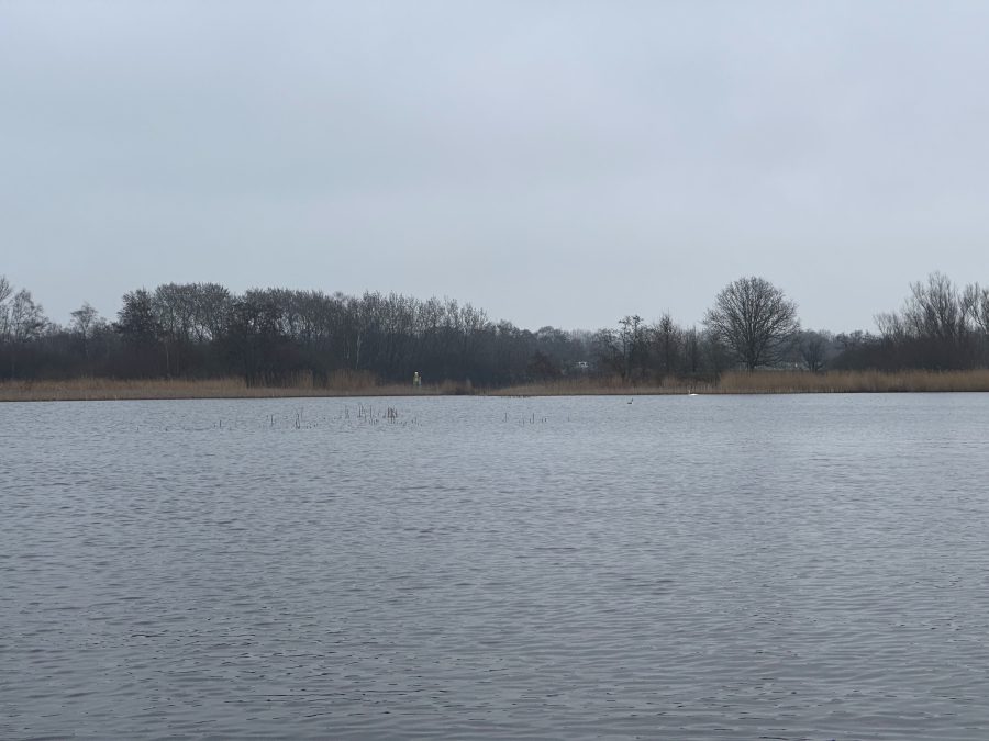
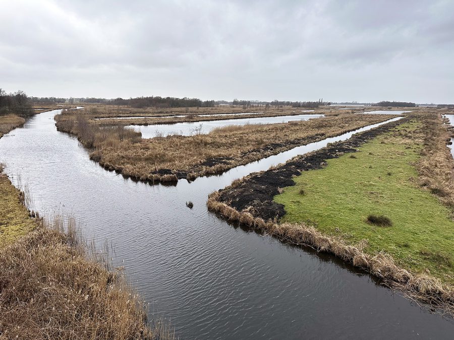
After posing for a couple of pictures, I waved goodbye to my family and started the trip in earnest. As the central waterway, aptly named the Dorpsgracht (which means Village canal), is rather narrow in the center, they have established one-way traffic there. This meant that to get to where I needed to be, I had to take a side canal to the Bovenwijde lake, paddle south in the open, and then re-enter the village a bit further where it was allowed to paddle in both directions. From there, I took Jan Hozengracht to the Beukers-Steenwijk Canal, from which I reached the Beulakerwijde lake.
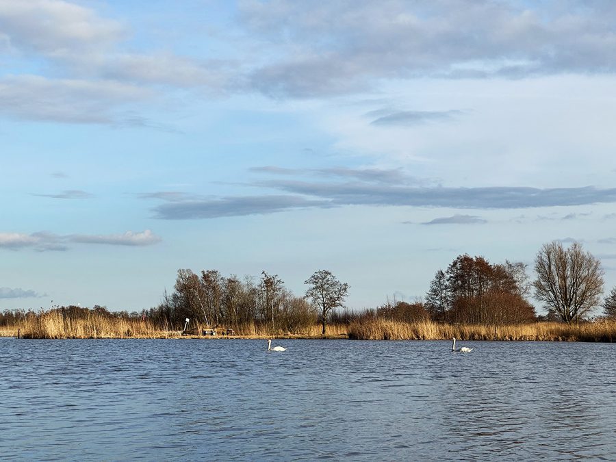
As I had a late start (around 4 p.m.), by the time I arrived, it started to get dark. The sun disappeared, and the temperature started to drop as well. In the twilight in the distance, I could just barely make out hundreds of birds flying just above the water to the other side of the lake. Luckily, the wind quieted down as well, which made it much easier to cross first the Beulakerwijde, then a part of Belterwijde, and finally the Boschwijde before entering the narrow Dirk Klaversvaart.
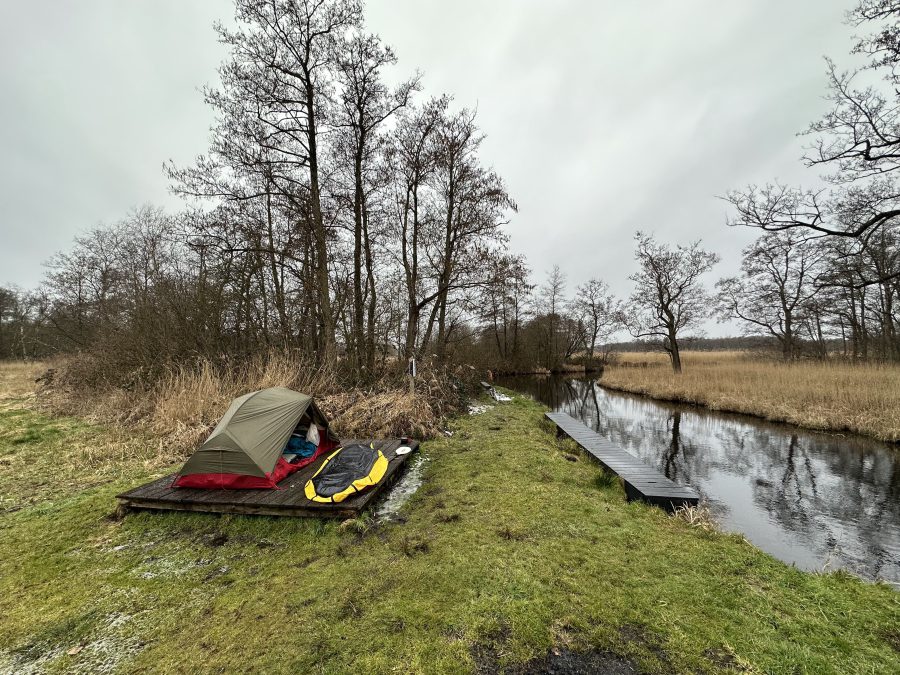
By this time, it was almost completely dark (and freezing). The good thing was that I knew exactly where I was going – the Kluitenberg canoe camping site, which is one of the three official ‘wild’ camping spots in the National park. These are basic campsites that are free to use by paddlers (you cannot reach them in any other way) and have nothing more than a wooden platform and a bench. I had camped at this particular one a couple of times in the past, the previous time being in 2015 when I had a two-day bikerafting and sailing trip.
As a matter of fact, this time really reminded me of that trip as I also paddled on a windless night, with stars reflecting in the quiet dark waters. The main difference, however, was that that time it was a warm summer night and not a freezing March one. By the time I got there, I could see small icicles forming on my packraft. It also took me ages to put up the tent with my freezing hands. That night, the temperature dropped to minus 3 degrees Celsius.
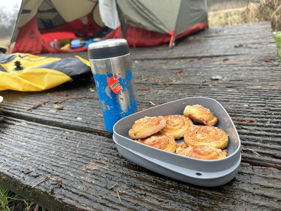
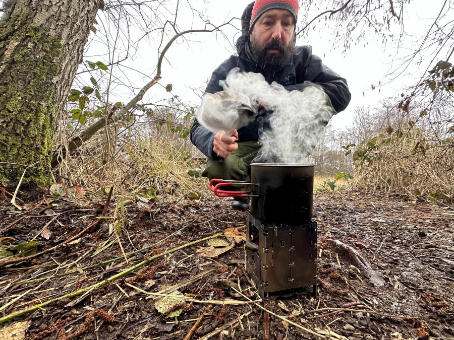
The next morning began with icy rain and sleet, which made me reluctant to leave my warm sleeping bag and venture outside, despite waking up early. Opting for a relaxed start was not a bad decision, as most of the ice melted later on, and although there was still some drizzle, it was much more pleasant to prepare my breakfast and pack up the camp.
After checking the weather forecast, which predicted no sunshine but mostly dry conditions with increased wind, I decided to paddle back to Giethoorn. Fortunately, the wind mostly blew in the direction I was heading. Although I had previously done the same route eight years ago, this time I decided to take a more scenic route as I had more time. I also came across a mention of an observation tower, and even though there were no pictures, I wanted to see if I could find it.
On this day, I paddled over 14 km. Following my packing up, I started my journey by taking the Dirk Klaversvaart to Vossebelt lake, then went through Zandgracht (meaning “sandy canal,” which accurately described its sandy bottom) to Dirkswijde. From there, I took Schenkelvaart to Mastenbroekerkolk.
Although I was alone during the journey (except for numerous water birds and a couple of roe deer I spotted on the way), there were many traces reed cutting, the season for which usually starts in November and lasting through March. After cutting, the reeds are left to dry for a few weeks before being sorted and graded according to quality. The best quality reeds are used for thatching roofs, while lower quality reeds are used for other purposes such as making baskets and mats.
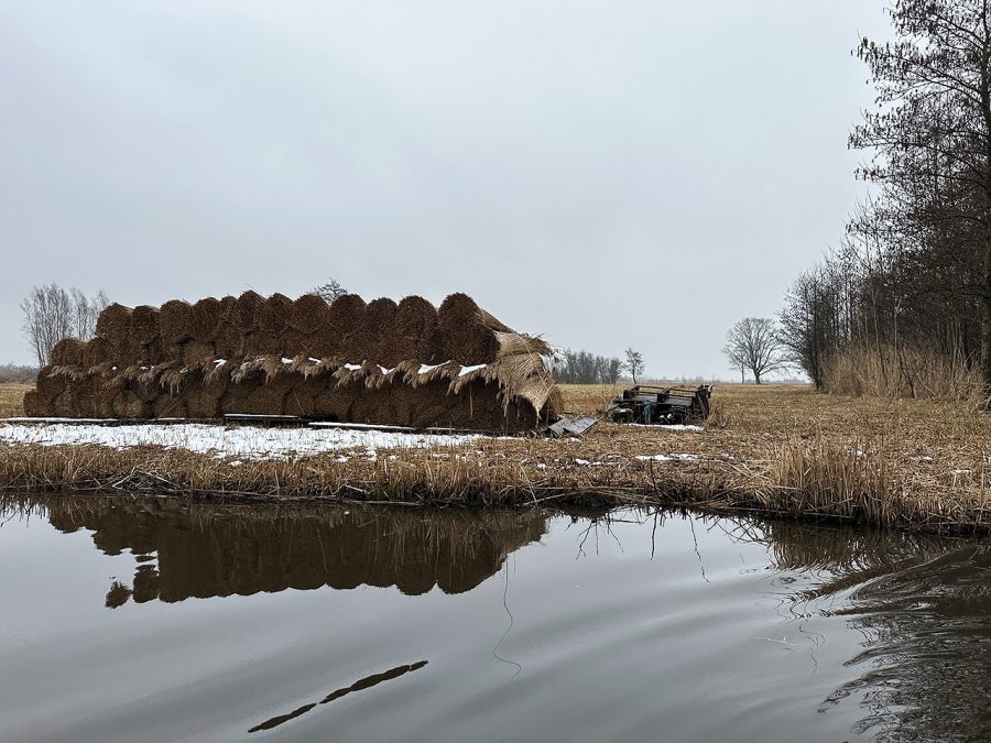
Reed cutting is an essential part of the cultural heritage of the Wieden, and many landowners in the area still practice this traditional craft, although nowadays they mostly use machinery. In addition to being an important source of income for many families in the area, reed cutting also plays a vital role in maintaining the ecological balance of the wetland ecosystem by preventing the reeds from becoming overgrown and choking out other plant species.
From Mastenbroekerkolk, I took an unnamed canal (I could not find its name on any maps) across Arembergergracht to Toppenkolkje lake. I then traveled on another unnamed canal to Schutsloot in the village of Belt-Schutsloot.
Like Giethoorn, Belt-Schutsloot is known for its picturesque canals and traditional thatched-roof houses, making it a popular destination for tourists seeking a peaceful and scenic side of the Netherlands. One of the unique features of this village is the “belt,” in this context a strip of land that separates the two main canals. The belt has a historic significance as it was once used to transport goods and materials between the different parts of the village.
After paddling through the village, I took the Schutsloot canal to the Belterwijde, which is divided by a national road. Passing under a large bridge, I saw a flock of European coots resting on the lake, the same type of birds I saw the day before. I crossed the lake easily as the wind was blowing from the back, and soon arrived at the village of Westeinde on the other side. From there, I took Dwarssloot back inland and continued with the Bovenboersevaart until it joined Hoosjesgracht.
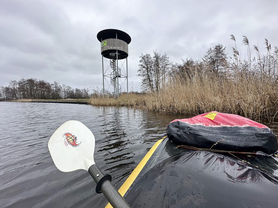
At this point, I had to decide whether to turn left and go straight to Giethoorn or turn right and visit the observation tower as well. The second option also meant that on the way back I had to paddle over a kilometer against the wind, which had picked up by then. I decided to take a challenge. To make it more interesting I also decided to count the number of paddle strokes it would take me to get to the tower and back. It took me around 760 strokes to get there.
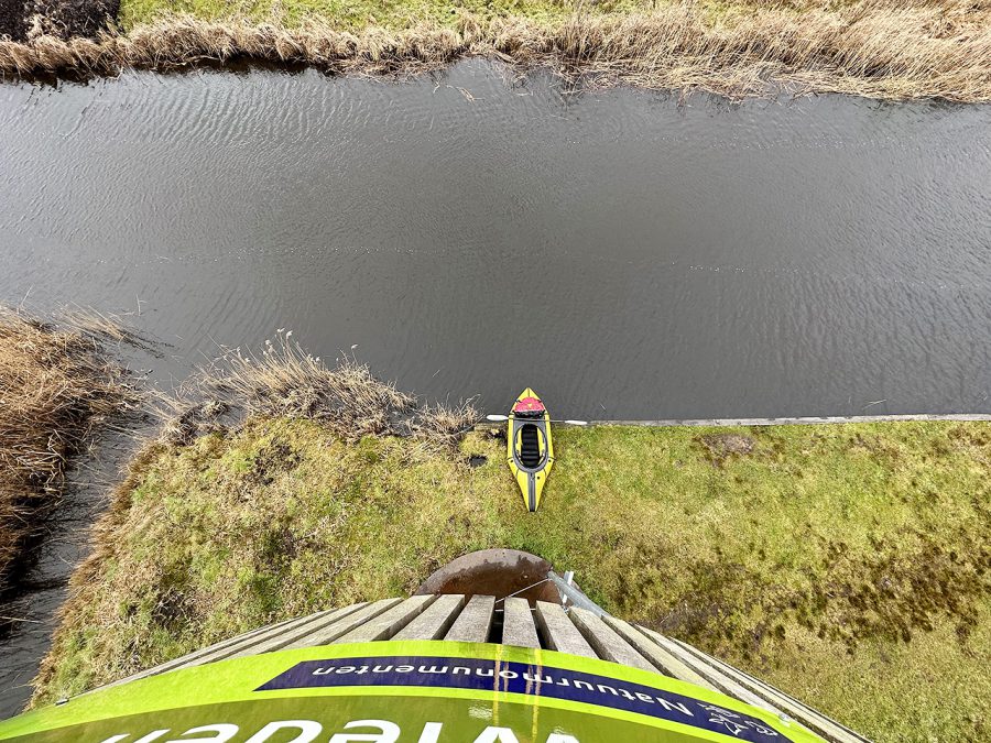
The tower was rather high and looked like it was constructed recently, although there was no information about it. It had a logo and the name of Natuurmonumenten on it, and the view from the top was spectacular. It was nice to see the patchwork of water and land I had been paddling through. On the way back, it took me over 850 strokes to return to the starting point.
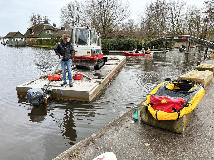
After that, I quickly returned to the Bovenwijde lake I had paddled the day before, from where I entered Giethoorn and paddled through the center along the main “Village canal” to the pick-up point on the other side of the village, next to the stump of a traditional windmill from the late 18th century that has been converted into an apartment. While packing my stuff, I watched as a local arrived on a flatbed metal boat with a small excavator on it, masterfully parking next to the side of the canal and easily disembarking the vehicle. It made me think about how people can live in harmony with water in this country. And what a great place Giethoorn and the National Park Weerribben-Wieden are. I am certain it was not my last time there.
- « 前へ
- 2 / 2
- 次へ »
TAGS:


 ULギアを自作するための生地、プラパーツ、ジッパー…
  Tenkara USA | RHODO (ロード)
  Tenkara USA | YAMA (ヤマ)
  Tenkara USA | Rod Cases (…
  Tenkara USA | tenkara kit…
  Tenkara USA | Forceps & …
  Tenkara USA | The Keeper …
  Tenkara USA | 12 Tenkara …
  Tenkara USA | Tenkara Lev…