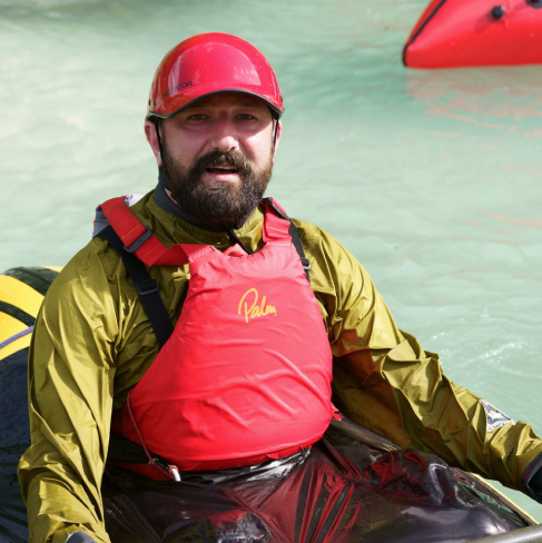
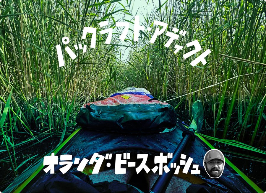
オランダ・ビースボッシュ 長年憧れていた国立公園でのパックラフティング・トリップ2Days | パックラフト・アディクト #68
Packrafting in the Biesbosch National Park, the Netherlands

I finally did it – I went to packraft to the Biesbosch National Park in the Southwest of the Netherlands. This had been on my bucket list for almost a decade (since I started packrafting), but it had always evaded me. Located on the other side of the country, in the vicinity of Dordrecht and Rotterdam, somehow it was always just ‘too far’, which was more of a mental image than a reality, I have to admit. At first, not having a car did not help either. Later, when I got one, it was more a question of time or priorities. And so, for years paddling there remained a ‘distant dream’.
This time, however, all stars aligned perfectly – it was a weekend and I had to drive my wife and my daughter to Schiphol Airport, which is already more than halfway there. I had also not had much chance to packraft the previous couple of months (just some hours here and there) and I was eager to get onto the water for a longer trip again. And so I did it – I went for an overnight paddling trip to one of the largest national parks of the Netherlands and one of the last extensive areas of freshwater tidal wetlands in Northwestern Europe.

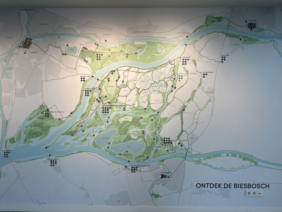
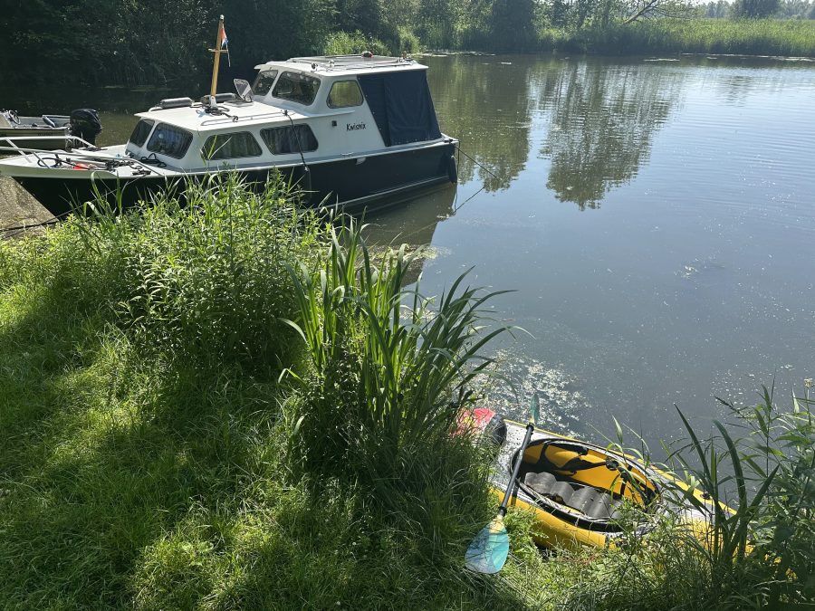
A green maze of rivers, islands and a vast network of narrow and wide creeks, this area is as close to being “the Dutch mangroves” as it gets. At least this is what my friends, who have been there many times, called it. I talked to one of them, Harold, before the trip and he shared some coordinates on where it would be possible to camp. I added them to the map. “Do you know a safe place to park a car?” I asked him. He told me that in the past he used to do that at the yacht harbor in the southeast of the park, which used to be something like an official gateway to the Biesbosch.
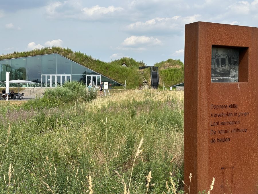
“But this is the official visitor centre nowadays” he told me and shared a link to the so-called Museum Island. “It’s in the Noorwaard, which has been transferred into nature over the last years. I’ve never been there in a kayak or packraft, but I’m very curious about how it has developed.” I checked its location online and, as it was more central, I thought that it would be a good place to start the trip.
And so, after having dropped off my family at the airport, it took me another our to get to the Museum Island. Even though it was 2 PM already, I was not really in a hurry to get onto the water yet. This June has been the warmest on record. I was eager to avoid the relentless sun beating down upon me with intense heat and the museum offered a much-welcomed haven. It also provided a great opportunity to learn more about the National Park and its history.
Even though the park was created in 1994, its history dates back to the Middle Ages when the region was mainly covered by peat bogs and marshlands. Over time, the area underwent extensive human intervention with the construction of dikes, drainage channels, and the extraction of peat for fuel, which gradually transformed the landscape into an agricultural area. However, in 1421, a massive flood known as the St. Elizabeth’s flood devastated the region, breaching the dikes and resulting in the formation of numerous creeks and islands.
The area became a dynamic estuary, influenced by both freshwater and tidal saltwater from the North Sea. In the following centuries, the Biesbosch was used for various purposes, including fishing and hunting and for harvesting rush, reed and willow branches. As a matter of fact, the name of the area itself, ‘Bies-bosch’ came from the former abundance of rushes and literally means ‘Rush-woods’.
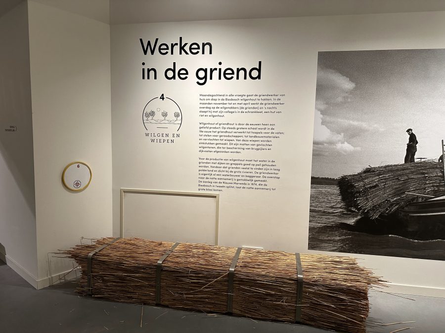
However, after the completion of the Delta Works, the tidal movement was reduced significantly. As a result, the rushes mostly disappeared and gave way to other plant life. While in the 20th century, the Biesbosch faced significant threats due to land reclamation and industrial development plans, in recent times, efforts to restore and maintain the natural habitats have been made. Thus, in 1988 beavers were reintroduced and now there are over 300 of them living in some 100 borrows. At the beginning of June this year, they started a pilot during which a small number of sturgeons were reintroduced in the area. If successful, this will be repeated on a much larger scale. There was a small temporary exhibition dedicated to this. Recently, they also started to flood some of the polders, which is what Harold must have meant as well when talking about this area.

Besides learning all this background information that provided much appreciated context, I managed to get a brochure, in which some kayaking routes were described. I was really happy to get my hands on it as before the trip I did check on the internet for some suggestions, but I could not find much.
What I did find was a Packraft Trail, a two-day self-guided trip organized by a travel company. I had come across this once before, but I had completely forgotten about it. The information on their website was also more about the experience and not so much a description of a route. The map was more of an artistic impression as well and not easy to read at all, therefore I could not really use it either.
However, the free brochure that I found had a lot of good routes. The one that I was interested in was called ‘the Labyrinth’ and it promised an exciting trip along a maze of narrow waterways. And that’s what I was looking for – the Dutch mangroves.
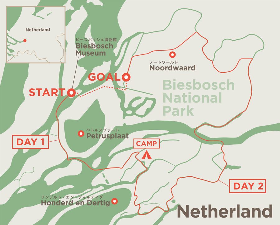
By the time I finished with the museum and got onto the water, it was already 6 pm. As it was just after the midsummer day, it meant that I still had a good 4-4.5 hours of light. At the same time, I was not certain where I would camp for the night. All I had were approximate coordinates of the camping places what Harold sent to me. I chose the one that was the closest and started to paddle there, trying to plot my route so that I would take smaller streams as much as possible and avoid broader rivers. This way I could also evade unwanted head-wind.
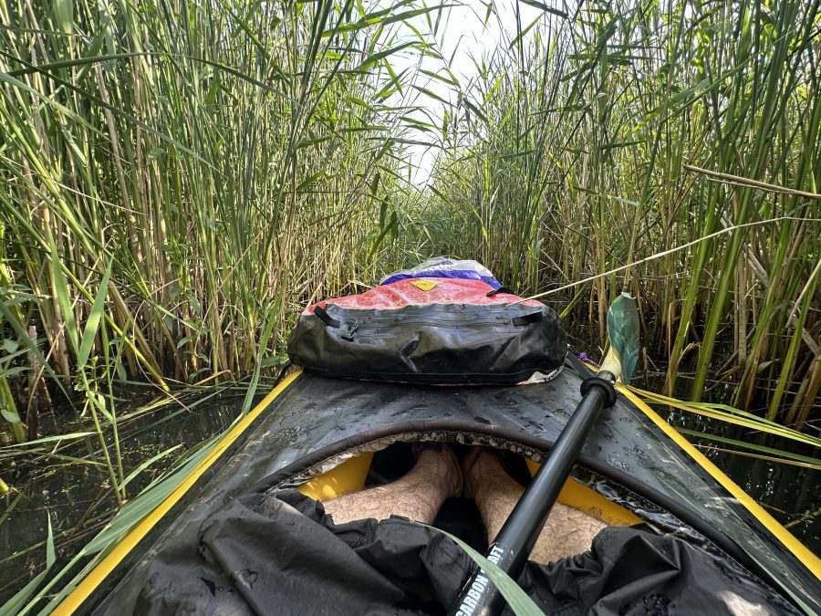
As it turned out, it was a mistake. Immediately, the first narrow stream that I took (it looked passable on the map) was partially overgrown by reeds. This made the progress very slow and it required way too much energy from me to get through. ‘Crawling’ through the reeds, I had a flashback to the trip in Poland that I had three years ago (please see my previous article). However, unlike that time, I could not just take out and walk around the overgrown parts – here, the banks were overgrown too. So, I had to slowly continue forward.
My persistence paid off and I managed to get to a bigger stream, where I joined the company of multiple motor boats. As it was a sunny weekend evening, it made sense that there will be other people on the water. Still I was taken aback by the number of these loud ‘party’ boats cruising through the waterways of national park. A bit further, I could see a good score of boats of all sizes anchored next to the shore, loud music blaring from one of them. The feeling of being on an expedition that I originally had gave way to irritation.
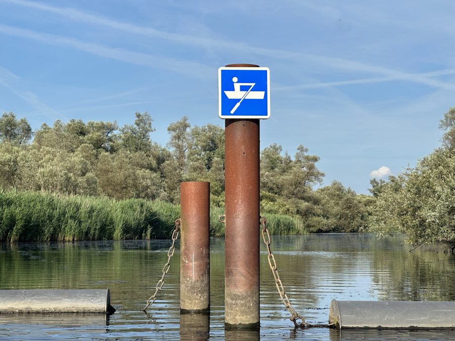
Lucky for me, my planned route took me through an area where the motor boats were not allowed. Nor could they enter it as the way was blocked by a chain of connected floating buoys across the whole width of the stream. The only opening between the two metal poles, was big enough only to go through in a kayak. Or, in my case, in a packraft.
This ‘paddlers only’ area was indeed more enjoyable. You could also see much more wildlife. At one point, I spotted a big rat that ran along a branch over the water. A bit further, I observed a beaver swimming for a while, before it disappeared after a loud clap – when feeling in danger, the animal slap the water with the tail to warn the others and scare an potential predator.
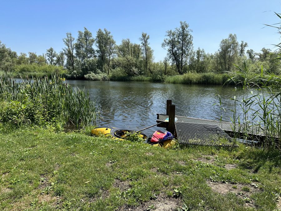
The heat of the day, the bushwacking, and head wind that I got eventually got on the more open water meant that I felt rather tired. Still, it was a long way to go to the nearest camping place Harold suggested. He also said that he was not certain if that place would be free as it was accessible to the boaters. And I really did not want to camp next to them. That is why, when I saw an open place suitable for pitching a tent (mostly the banks were overgrown), I decided to stop. As it was still in the ‘paddlers only’ zone, it meant that I would not have noisy neighbors.
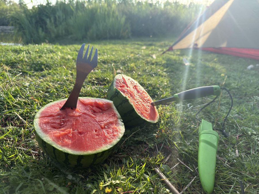
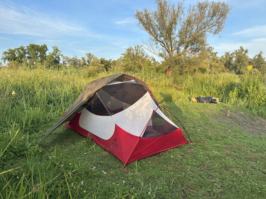
I pitched my MRS Hubba Hubba NX in a semi-open configuration (I call it a star trooper one as it somehow resembles a start trooper helmet), had a small watermelon, I picked up in the supermarket on the way, for dinner, and went inside the tent. Exhaustion washed over me, and I began to slip into a drowsy state. As I drifted off, faint splashing sounds reached my ears, and I caught a glimpse of a couple gliding past in a kayak. I managed to muster a wave before succumbing to sleep.
The next morning I took my time to eat and dry my gear. I also had to rethink the original plan – the experience of the previous day showed me that I might have been a bit too optimistic with the distances (I did only 5 km in around 2 hours). Therefore, completing the “Labyrinth” route from the book (over 25km) was out of the question. I examined the map and found what I though was a shortcut, which I decided to use. Indeed, by taking this I could shorten the route significantly.
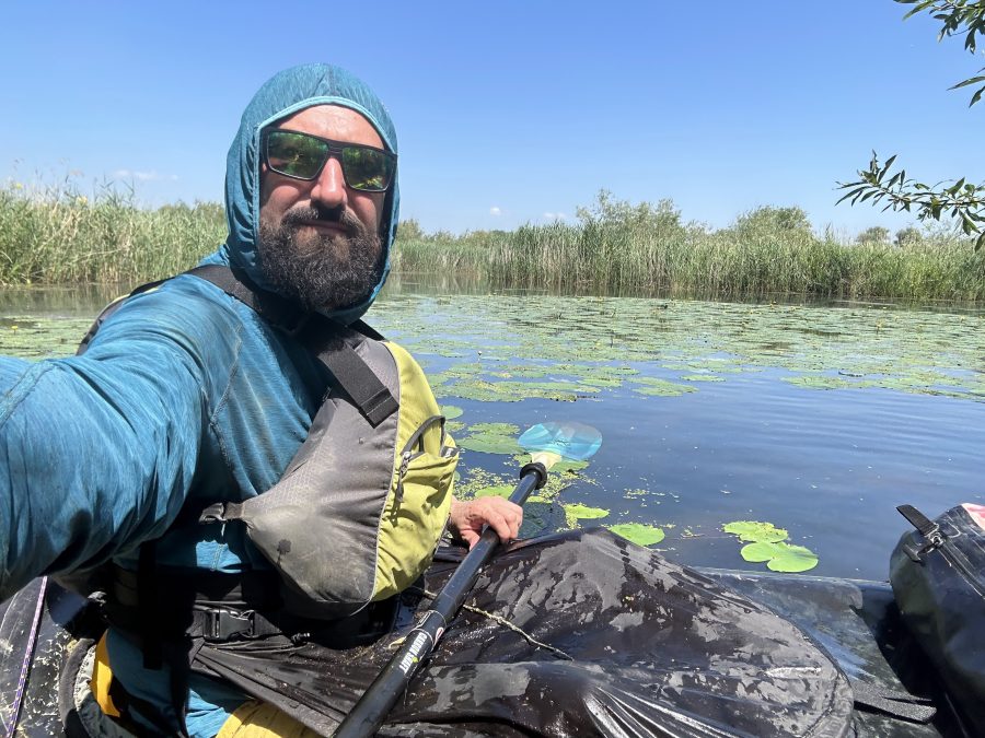
With the clock nearing 11, I set out on the second day of the paddling trip. Out of the ‘paddlers only’ zone, I joined the traffic of motor boats. Some of them would be considerate and slow down when approaching me, while others would pay me no attention. I did not mind that at all though as I really enjoyed some waves coming from the boat. With the sun shining intensely, I was grateful to keep my neck and arms protected from its rays.
As I were to pass close by the place I originally was planning to camp, I decided to check it out. Sure enough, there were a couple of boats with camping table and chairs and a crate of empty beer bottles on the bank – I felt really grateful that I could spend a quiet night on my own.
When I reached the turn to the shortcut, there was a sign that it was for paddling boats only. Later, there was another one with a boat propeller crossed out. Encouraged by this I carried on, only to arrive at a chain of buoys blocking the way. As there were no “no entry signed” and the distance between the individual buoys was wide enough to pass, I thought that it was ok to continue.

As I ventured deeper, the stream gradually narrowed, presenting a more challenging path. Fallen trees obstructed my way, requiring careful maneuvering to navigate around and underneath them. The lack of human presence became evident; it seemed this area was seldom explored. Soon, I reached a shallow pond with water plants and crystal-clear water. Taking a moment to rest and soak in the picturesque surroundings, I suddenly noticed a movement beneath the surface. To my surprise, a sizable eel gracefully glided alongside my packraft, providing a captivating sight. Later I caught a glance of a large carp as well.
Just before I reached the end of the shortcut, I saw another choice of buoys. This time, however, there was a ‘no-entry’ sign. No entry to the areas I just came through that is. And why it was not my intention, it seems that I have entered a closed area. Going back was no option, so I quickly crossed the buoys and entered the main river.
The day was young and I decided that it was still too early to paddle back to the car. Instead I wanted to explore the area more and paddle in the Noordwaard polder. I looked at the map again and decided to go and check another camping place that Harold indicated. And I found it. This was an official ‘wild’ camping place a bit further than I thought. This March I stayed at a similar campsite in the Weerribben-Wieden NP (please see my previous article). The rules of camping were described on a small sign. According to the time-stamp on the back, they were just updated this April, the old sign lying in the grass next to it.
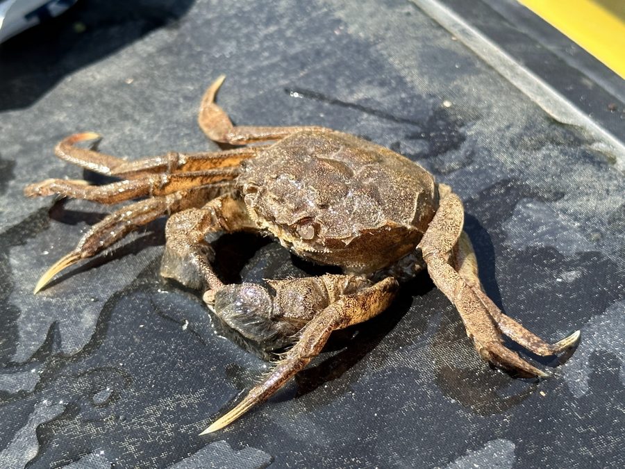
The further in the Noordwaardpolder I went, the more rural it became. The willow trees edged the water gave way to grassland and fields. It really felt that this was still very new somehow. And boring. What made it interesting though was a chance discovery – in the shallow water I spotted some crabs! I never even know that we had fresh water crabs in the Netherlands. (Later I read that these were invasive Chinese hairy crabs. Who would have guessed..)
The final stretch to the car park next to the museum I had to walk as the waters around it were ‘no-entry zone’ again – I did not want to break any more rules. So, I took out the packraft and covered the last 2 km on foot. While walking, I spotted a young couple with PFDs and four-piece paddles on their backpacks. I picked up my pace and caught up with them. “Are these packrafts?” I asked. Yes. It turned out that they finishing day 1 of the Packraft Trail I read about on the Internet. And they were not the only ones doing it – according to them there were around 30 people who started that morning.
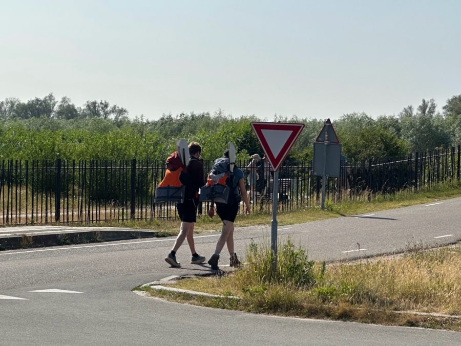
We walked together for a while talking about packrafts and their first impressions (it was their first time trying them) until we reached the Museum Island and the car park where we had to say goodbye. A bit further more people with PFDs and four-piece paddles could be seen.
And that was the end of my two-day paddling trip. It had some ups and downs. I saw and learned new things. And I have paddled another interesting area I have never paddled before. What more can you ask for?
- « 前へ
- 2 / 2
- 次へ »
TAGS:


 ULギアを自作するための生地、プラパーツ、ジッパー…
  Tenkara USA | RHODO (ロード)
  Tenkara USA | YAMA (ヤマ)
  Tenkara USA | Rod Cases (…
  Tenkara USA | tenkara kit…
  Tenkara USA | Forceps & …
  Tenkara USA | The Keeper …
  Tenkara USA | 12 Tenkara …
  Tenkara USA | Tenkara Lev…