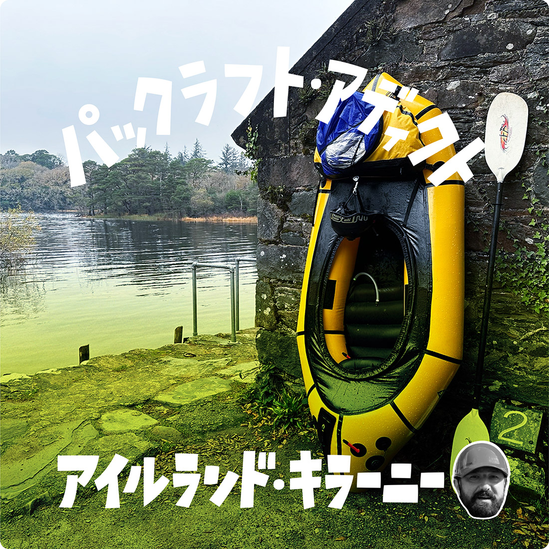
パックラフト・アディクト | #35 オランダのラウテン・アー川でバイクラフティング
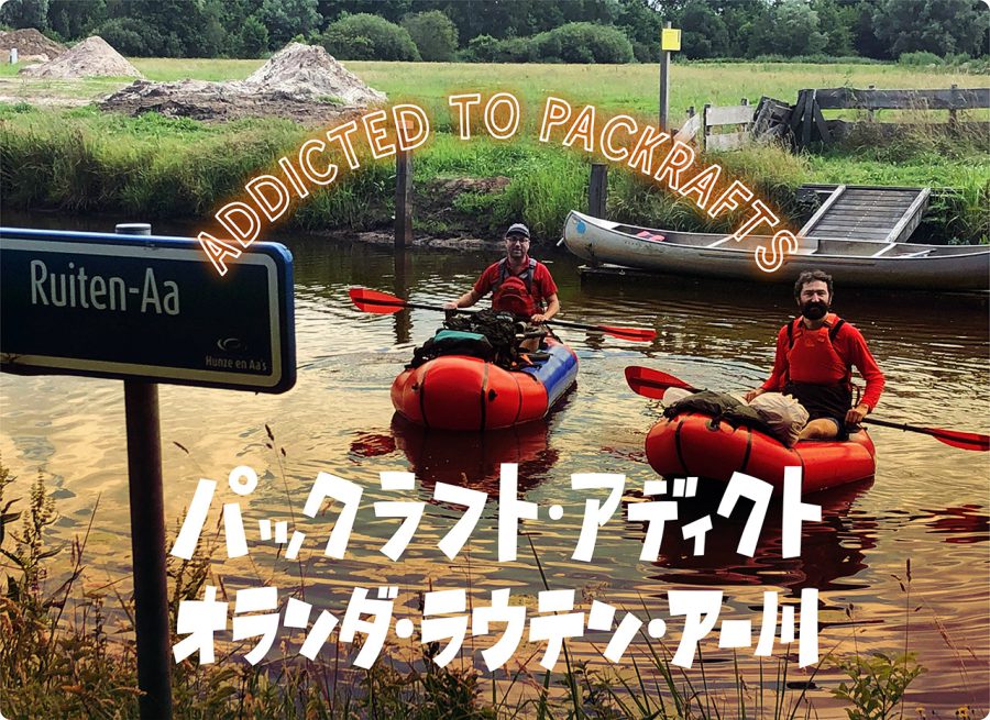
By Pedal And Paddle Along The Ruiten-Aa
My wife and I recently got a new house and it took us over three months to fix it and move from the old place. On top of that, due to the corona outbreak, all my spring and summer travel plans had to be canceled, changed or postponed. That is why, when I finally got a chance to take a short break a couple of weeks ago, I decided to go on a mini-paddling trip somewhere close by where I live. I also invited my new neighbour, Tjeerd, to join me – he was really happy to run away from home for a short time as well. While an avid sailor and hiker, he had never used packrafts before and, thus, he was really curious about them.
The river we chose for his maiden voyage was the Ruiten-Aa that flows in the east of the province of Groningen (North-East of the Netherlands), not far from the German border. This river was suggested to me by Harold, a Dutch packrafting friend of mine (please see my previous articles).
He had paddled this river with his girlfriend twice this spring and was positively impressed by it (“Few rapids even!”). And while both of his trips were day trips that involved paddling down the river and then hiking up back to their car, he was certain that it would be possible to make an overnight trip out of it. Harold even suggested a couple of camping spots that he thought would be ok for wild camping on the river.
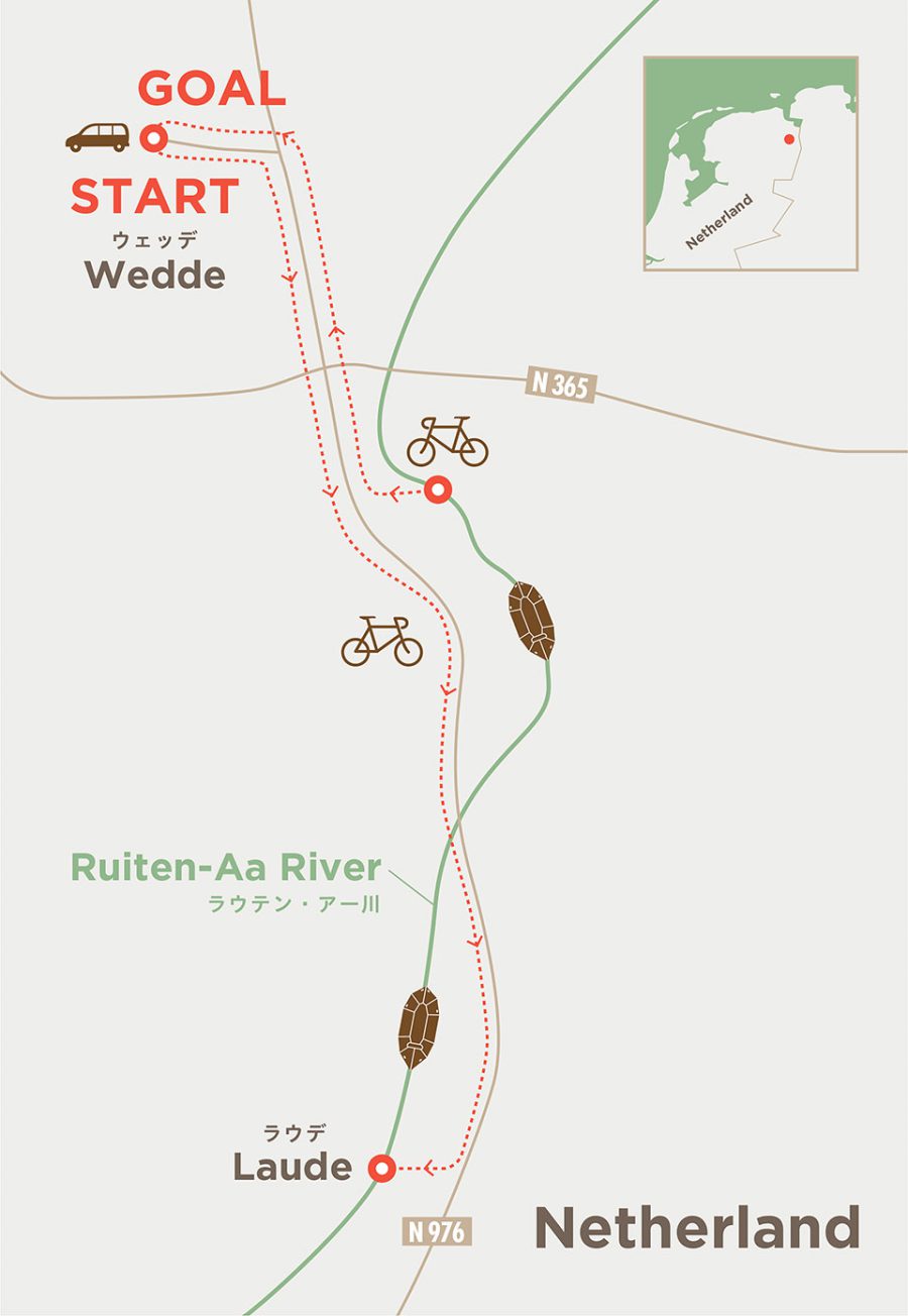
He also shared two possible put-in and take-out points that were easily accessible by road. “From the most upstream put-in to the most downstream take-out, I would guess about 6 hours,” he told me, when asked about the duration. “Beautiful trip though.”
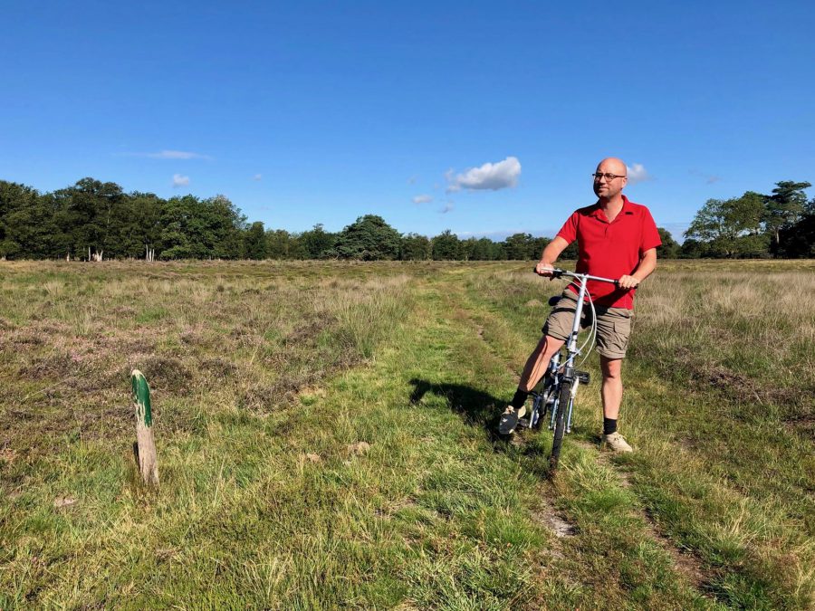
As we wanted to do the ‘longer route’ but could take only one car and didn’t want to use public transport (due to health concerns), Tjeerd and I decided to take our folding bicycles and use them instead. This way it became a mini-bikerafting trip.
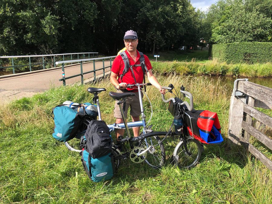
Having left after dinner time from Leeuwarden, it took us just over an hour to get Wedde, the furthest suggested take-out point. We parked the car at the parking of a small castle (the castle itself was closed unfortunately), loaded our paddling and camping gear onto our bikes, and started our one-hour cycling trip to the put-in point.
Though a short distance from where we live, cycling through this unfamiliar area gave us a true feeling of being on a holiday. The grain and potato fields, wooded areas and small hills looked very different from the treeless, flat grass fields intercepted by multitude of ditches and canals that we are used to in the north of Friesland.
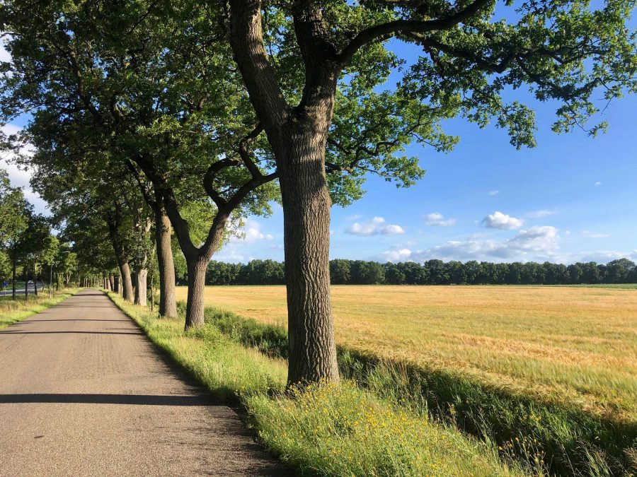
Along the way we often saw signs, indicating that it was the Valley of The Ruiten-Aa cycling route. And indeed, it took us along the brook, which we could sometimes see meandering nearby. What surprised me a bit was that, at some places, its banks looked very new and clean, with hardly any grass growing on them. Later we learned that there was a really good reason for this.
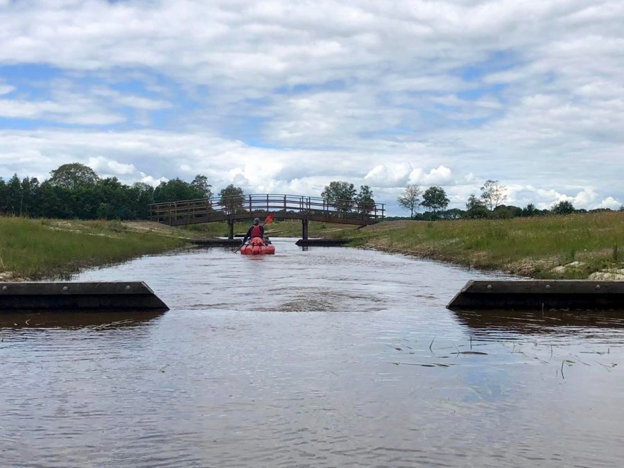
With a couple of short stops on the way, it took us a bit more than an hour to get to the put-in point near Ter Walslage. Even though the Ruiten-Aa originated some kilometers further south, this place very much felt like the start of the river for me – there the river reemerged from underground, having passed through pipes under the road that blocked it completely. It was also a perfect place to get onto the water as there was a proper wooden kayak put-in platform there.
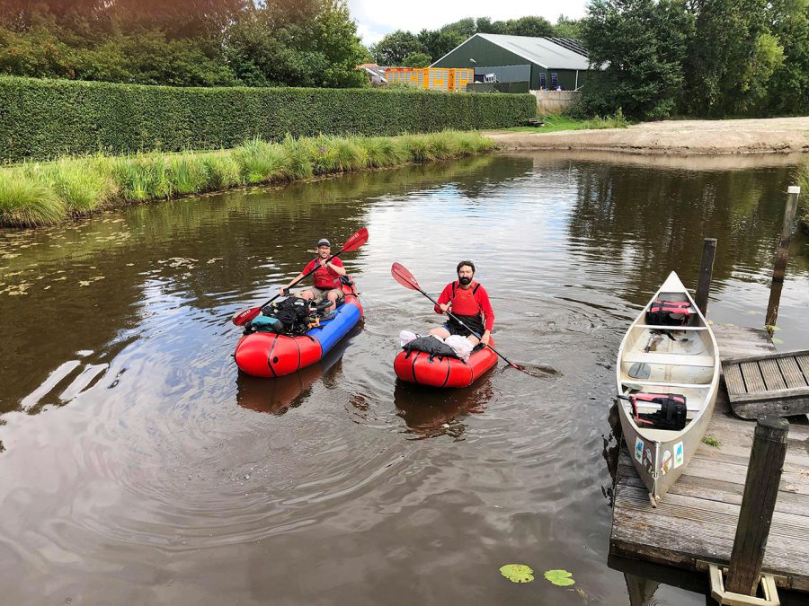
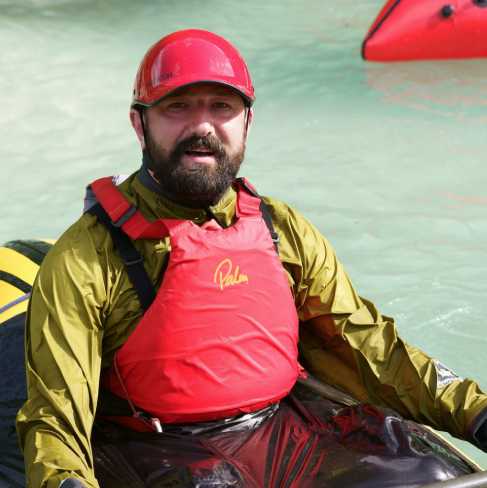
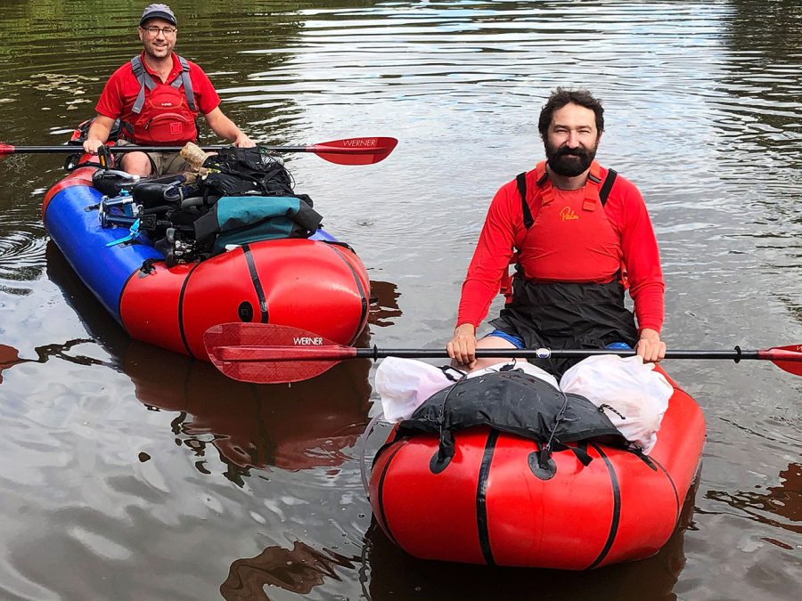
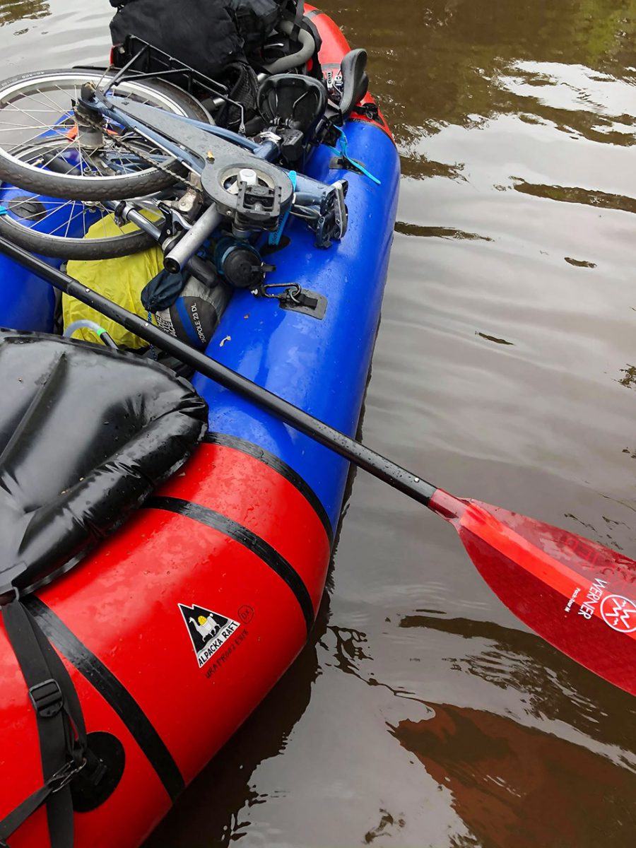
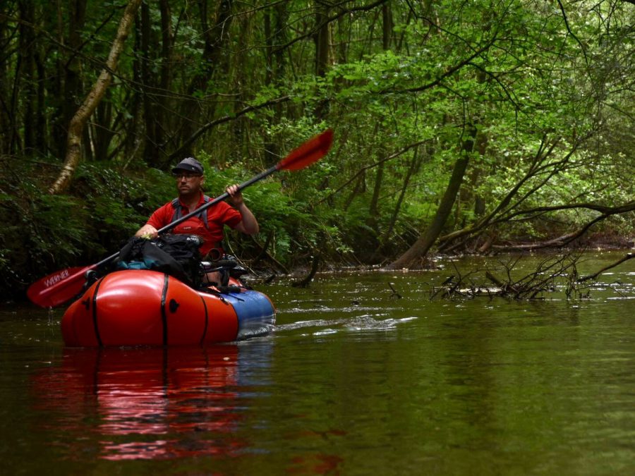
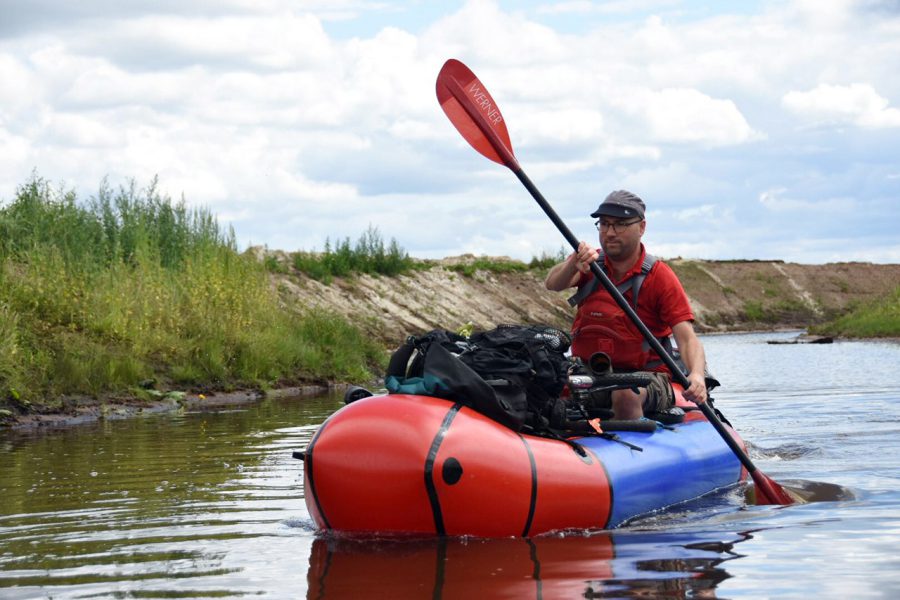
It took us another 40 minutes to get our packrafts ready. This time, as we had two bikes and some luggage with us, I took my two-person Alpacka Raft Oryx and, for Tjeerd, my wife’s Yukon Yak. As neither of them had a cargo-fly, we put all our gear and the bikes in the front of my Oryx, and let Tjeerd experience his packraft to the fullest.
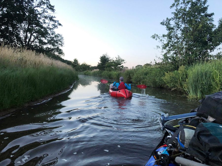
What I saw at once was that for the first time in a packraft, Tjeerd seemed extremely comfortable. From the way he paddled, it was obvious that he was experienced on the water. He paddled with ease through the meandering stream, which for the first kilometer was overgrown with water plants (interestingly, it is said that the name Ruiten-Aa possibly comes from a Germanic dialect, in which the first part refers to “reeds” and the second means “water”).
After that the nature of the river changed slightly and it became wider, free from water plants and often surrounded by ‘high’ sandy banks. We also passed through several ‘artificial rapids’ – wooden micro-weirs that would be just 10-15 cm above the water with a passage for a kayak in the middle. They mostly came in small groups, which made it feel like we were going down the stairs. (We would see a lot of them next day as well; I wonder whether these were the rapids that Harold talked about.)
Not long after the start of the trip, the sun began to set. “How far are we from the first camping spot,” asked Tjeerd. “I am afraid still a few kilometers away,” I replied. That is why we decided to start looking for a nice place where we could spend the night.
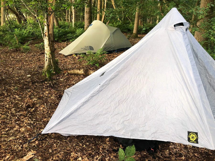
And soon we found one – in a small wood on a sandy back above the river a good distance away from any houses and roads. By the time put up our tents, it was almost completely dark. A huge starry sky was visible through the canopy. Partially because we were tired, and partially because we did not want to draw any unwanted attention to our camp, Tjeerd and I ate our dinner of instant mashed potatoes with sausages and tomatoes in almost complete silence in the dark. It was almost midnight when we went to our tents, which is why we agreed to sleep a bit in the next day. And that’s what we did.
In the morning, before packing the camp, we decided to use our bikes to explore the area around. As it turned out, the wood was much bigger than we originally thought. Next to it there was even a small area of heathland and a number of marked paths went through both of them. As a matter of fact, our camp was just a short distance from one of such paths, that’s why before we even had our breakfast, we broke it down and destroyed any trace of its existence.
Very soon after we got back on the water, we met a couple of family groups with children in rented Canadian style canoes. The river was rather slow and they could easily paddle upstream. “I wonder how they go over those wooden steps,” asked Tjeerd.
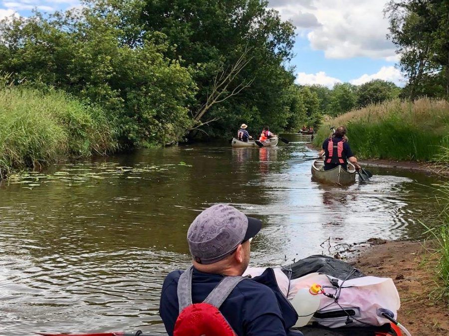
Just like the day before, the riverscape was continuously changing. From open fields to wooded areas and small villages, from high sandy banks to flat swampy areas and even one tiny rocky rapid – the Ruiten-Aa kept on surprising us.
One big surprise came when we reached the first spot that Harold suggested for camping – it was not as secluded as he promised. Just next to it there was some heavy construction machinery, and some people were building a pedestrian bridge. The river bed looked rather new as well and a small dam he mentioned to me was nowhere to be found.
But the biggest surprise came just a short distance further. To keep track of our location, I used Google maps on my mobile. However, next to the village of Jipsinhuizen, I got completely lost as the river that was going as a straight canal through the village was not there. Instead, a new meandering river bed was created around the village, which on Google maps made it look as if we were paddling in the middle of fields.
Later, I read that the Ruiten-Aa was originally canalized after the end of the Second World War, which was partially done to facilitate the drainage. But due to this, the area started to dry up too much, which had a negative effect on the natural environment there. That is why, at the end of the 20th century plans were made to return the river to a more natural state and give it back its meanders.
This is supposed to help to retain water better. To make the river living again, they also planned to replace various small dams along its course with micro-weirs, which allow fish to go up the river to spawn freely. By redeveloping the area and creating better hiking and cycling paths, they also hope to attract more tourists.
While the reconstruction project started in the early 2000s, its last stage was supposed to be finished this spring. However, it seems that it is taking longer than planned and some parts were added after Harold had paddled it earlier this year. Indeed, parts of this river are so new that I cannot find them on any of the maps yet.
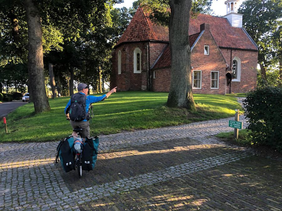
Due to a late start and an unexpected detour, Tjeerd and I never reached Wedde by water. As we were starting to run out of time, we stepped out next to the bridge in the village of Renneborg, packed our stuff and cycled back to the car. This time the gate to the castle park was open, and before we finished the trip, we had an opportunity to have a closer look at this place, which played an important role in the history of this area. Just like the Ruiten-Aa did.
After the trip, I asked Tjeerd what was his first impression of packrafting. Here is what he said:
“Great feeling to have everything you need with you and then relaxed sailing downstream. I already liked the feeling of carrying everything with you as a hiker and sailor, but to have it all packed on such a light little boat was extra special.
Also nice to be constantly in motion while paddling, although I guess the raft is more suited to have a bit more flow in the water. All in all I thought it a great way to have an active outdoor adventure while discovering new territory that’s hard to venture through by other means!”
Related Articles
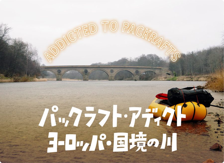
パックラフト・アディクト | #33 ヨーロッパにある国境の川を旅する
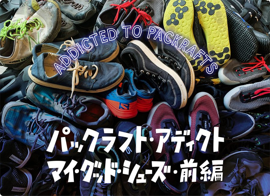
パックラフト・アディクト | #34 パックラフター11人が選ぶ マイ・グッド・シューズ (前編)
- « 前へ
- 2 / 2
- 次へ »
TAGS:


 ULギアを自作するための生地、プラパーツ、ジッパー…
  Tenkara USA | RHODO (ロード)
  Tenkara USA | YAMA (ヤマ)
  Tenkara USA | Rod Cases (…
  Tenkara USA | tenkara kit…
  Tenkara USA | Forceps & …
  Tenkara USA | The Keeper …
  Tenkara USA | 12 Tenkara …
  Tenkara USA | Tenkara Lev…