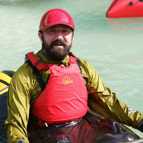
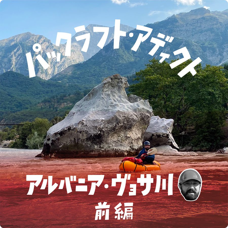
アルバニア・ヴョサ川 ヨーロッパ最後の原生河川、パタゴニアの映画『Blue Heart』の川を旅する(後編) | パックラフト・アディクト #64
The Vjosa Packrafting Trip: From Bridge to Bridge in 7 Days(Part3)
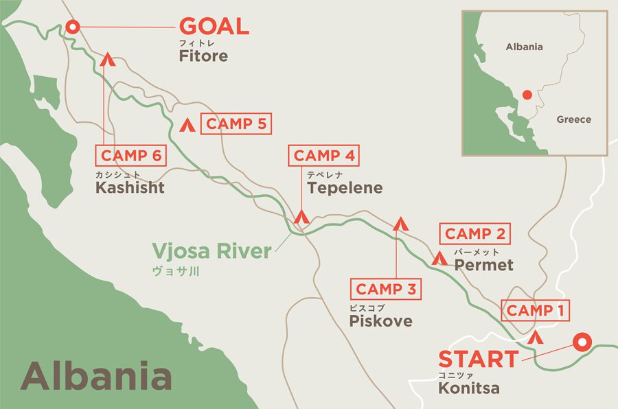
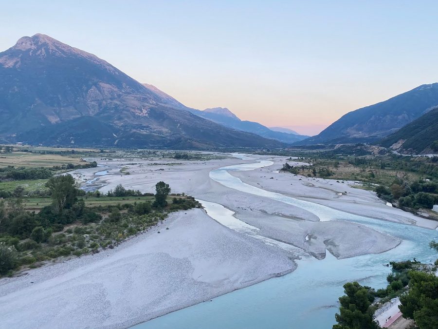
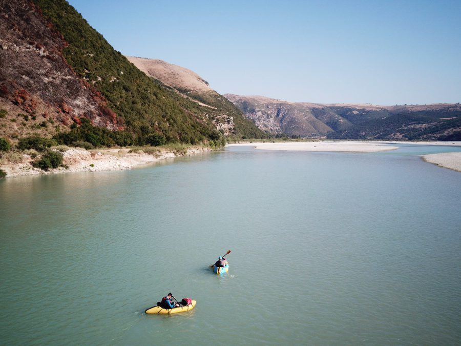
After the gorge, the river changed its character and opened up significantly. The Vjosa also split up into multiple channels that ran through a wide floodplain covered in gravel. And that was what the river valley looked like near Tepelene – the second big town we encountered on our way.
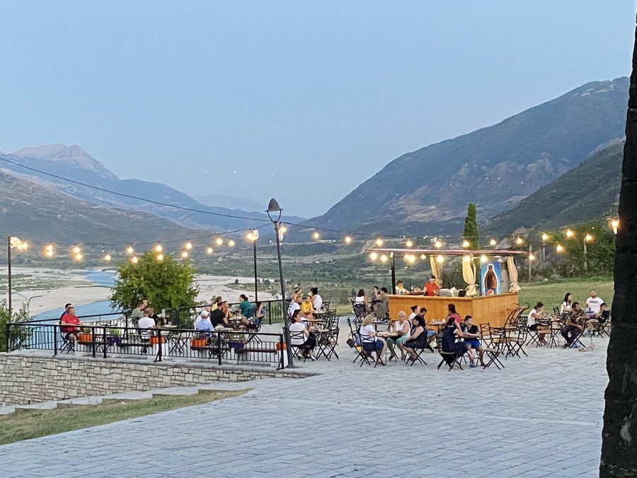
The town is dominated by its old Ottoman fortress, that, according to a notice, was visited by Lord Byron. Inside it however, there was not much to see – just residential houses surrounded by the wall. The shops were still open and we managed to find some yogurt and another dairy drink. It was also time for the evening xhiro.
By the time we got back to the packrafts, it was about to get dark. That is why, instead of paddling a few kilometers further as we originally intended, we just went down a few hundred meters away from the pedestrian bridge across the river. There, just opposite the old fortress we set up a cowboy camp in the compete darkness. That night I read a local legend, which said that if Tepelene exceeded 100 buildings it would be destroyed. Possibly by the river, I thought.
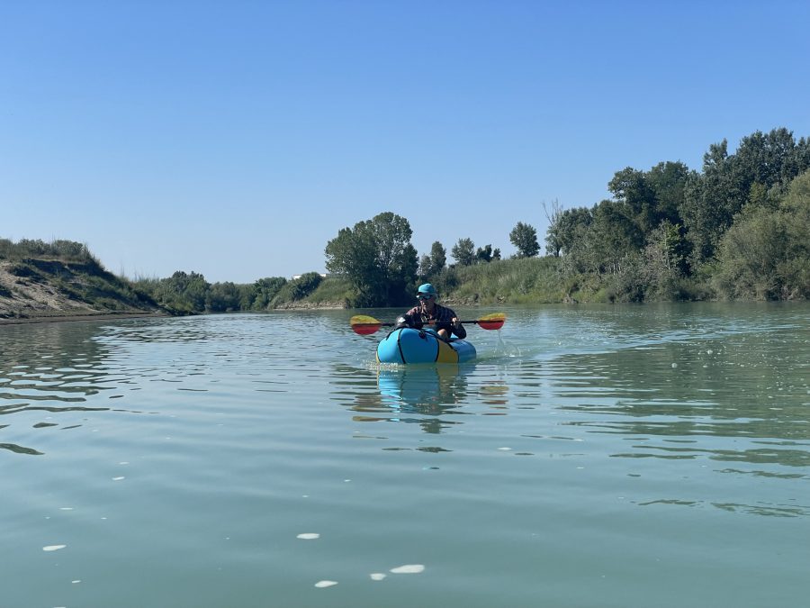
Day 5 of our trip became the longest day that we had as we packrafted around over 37 km. Even though we still had to play pinball from time to time, the river became very much open and timider.
Just to prove this point were 30 plus seayaks that we spotted on the shore in the village of Memaliaj. They belonged to a Hungarian travel company and were being prepared for a trip with customers later that day. I talked to one of the guides who said that they are planning to take 4 days to paddle around 70 km.
When we left, I was almost certain that the group would catch up with us easily. However, Didier said that most likely the customers would not have much experience and they would take it easy the first day. Especially with such a big group. And indeed, he was right – we never saw them again.
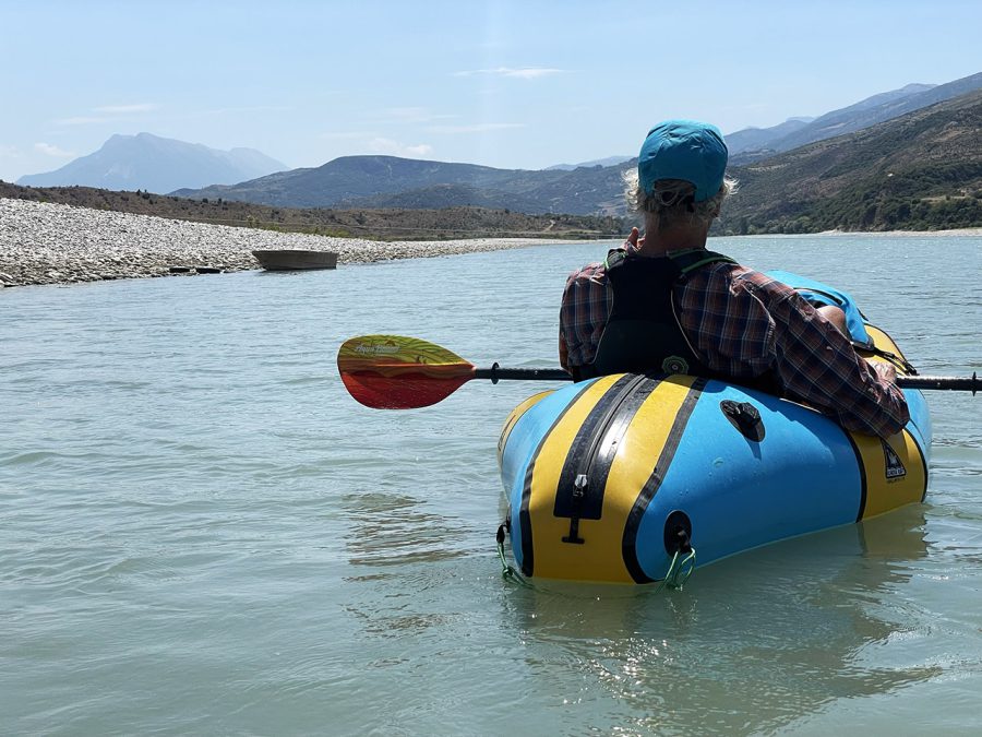
The mountains mostly gave way to hills. The floodplain became even wider and there was more than one river arm that we could take. It was always a guessing game – which one has more water. Even though we were far from the see, a strong headwind wind was for most of the day (starting from 11 am until 6pm). If it were not for the current, it would have been hard to paddle.
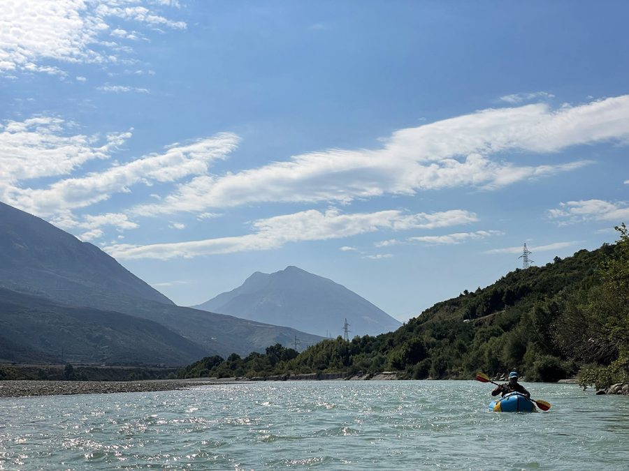
Having stopped for a lunch in Iliras, we paddle further, until the river cut through the mountain range.
Here it narrowed down again. On left, higher side the traces of forest fire were visible.
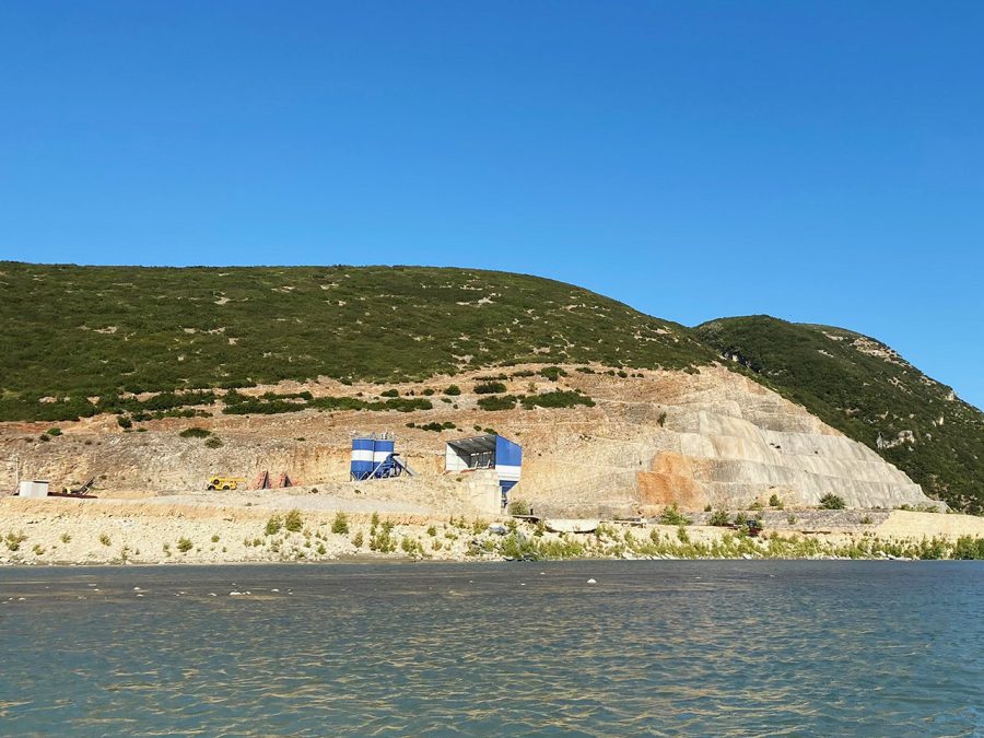
Just before the valley opened up again, we saw that the mountains on both sides were turned into giant staircases. Next to the one on the left, we could see some offices cut into the mountain side and some temporary structures on the riverbank. Someone who looked like a guard walked out of one of them.
“I think this must be the place where they were building a dam,” I told Didier. “I think you are right,” he said in reply.
That definitely looked like a place that they were planning to build a hydroelectric plant. Should it be built, the place where we had the lunch that day and many more communities around there would be under water. Luckily, however, if the Vjosa be turned into a wild river national park, the construction of this and any other hydroelectric plant on the river will be impossible and the fight of the local people and international community of scientists, artists and activists will be a success.
Just a short distance further we saw a large excavator that was half submerged in the much and water – it seems that the Vjosa is fighting as well.
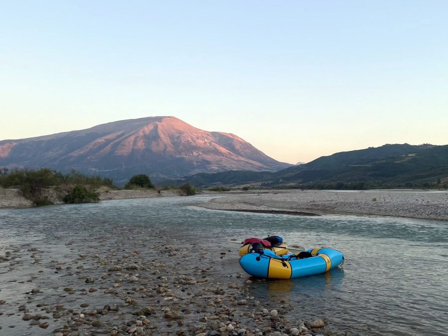
We paddled for some 10 km more. It started to get dark, but it took us sometime to find a suitable place for a camp on the massive floodplain, which was mostly covered in stones. It was a nice spot with flat sand – just perfect for cowboy camping.
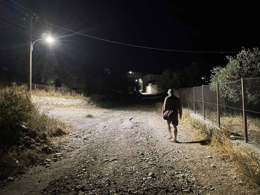
In the Google Maps app, I saw that there was a bar/restaurant in the village not far from us and so we decided to go and check it out. It took us good 50 minutes to this remote mountain village.
What Google said was a restaurant was actually closed.
However, there were two more places open next to it. We entered one of them – it looked like a shop more than anything else. With the help of Google translate, we asked where a restaurant was. The shop owner waved his hand and said that it was in 7 km. But if you want to eat, you can go to the place in the village. And so we did.
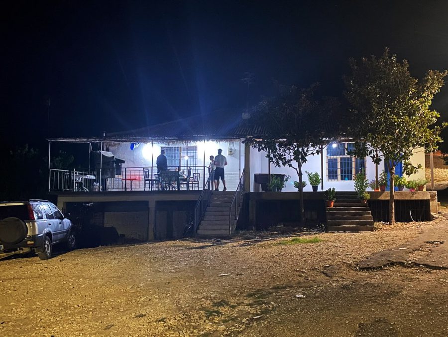
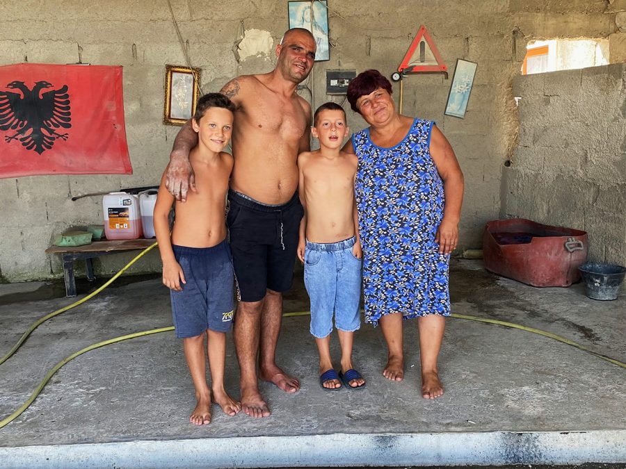
There were several people sitting in front of it drinking. Didier asked if anyone spoke English. Nope. No one. I am not sure why, by I asked if anyone spoke German. It turned out that one of the guys did. We explained that we would like to eat. He sent us inside where an older man was in his very simplistic kitchen listening to a festival of folk singing on TV. The guy who spoke German helped us to translate. “What do you want?” he asked. “Would meat be good?”
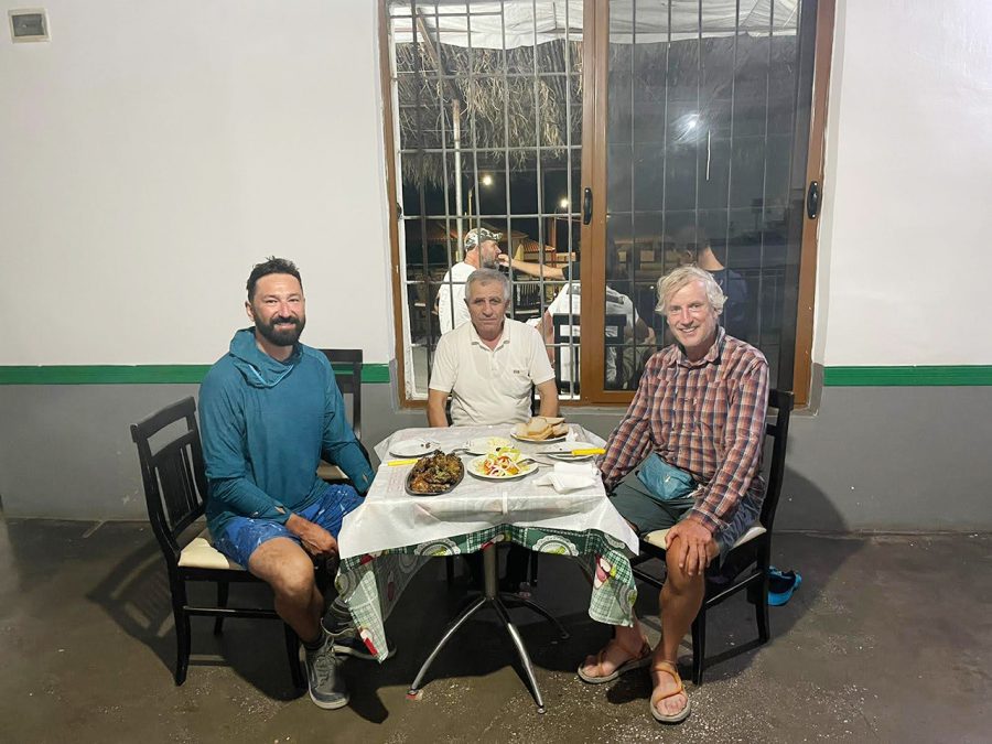
Definitely. The older man in the kitchen opened a freezer, took a huge piece of meat out of it and cut several slices with an axe on a butcher’s block that he had in the kitchen. Then he put the meat on the scales. It was 800 gramme. “Is it enough?” he asked us. More than enough. Then he fired up a gas burner and made the tastiest meat dish with aromatic fresh herbs that we had on the trip. It felt good walking back to the camp in the warm air of the summer night, endless Milky Way above us.
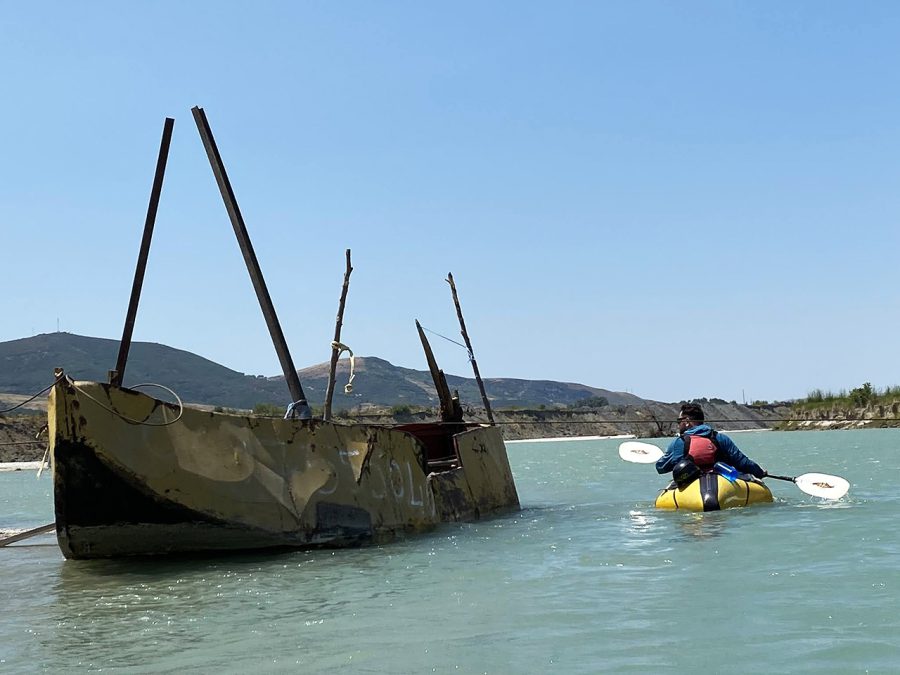
The next day we paddled around 33 km. The river opened up even more. The river also stared to slow down. At one point we passed by a place with beach chairs and umbrellas that felt more like it should have been on a tropical beach and not here. Now we started to see more boats that people used to cross the river. Sometime these were crudely made metal vessels.
For the lunch we had a choice between a 24hour auto grill on the river right or finding a place to eat in a small town of Selenice on the river left. Encouraged by the grate experience the night before, Didier and I decided to go for a more “authentic experience” and visit the town. And a more “authentic experience” was exactly what we got. Next to the river, there was a group of teenages swimming and jumping into the water. Some of them swam towards us and tried to climb onto the packrafts. They asked what our names were.
Not wanting to leave packrafts next to them (“Never trouble trouble” they day), we paddled a bit further and then had to find our way through a maze of overgrown roads to Selenice, which turned out to be mining town where they have been excavating natural bitumen.
To be honest, I did not know much about Albania before I came there. And I feel a lot of people in Western Europe are the same. The country might be number one if you put all European countries in an alphabetical order, but it is still a mystery for a lot of us. For example, I did not know that Albania had something like gas and oil. Or that its self-name is Shquiperia, which means “Land of the Eagles” and the inhabitants are Shquiptare “children of the Eagles.” That is why the eagle is on their flag.
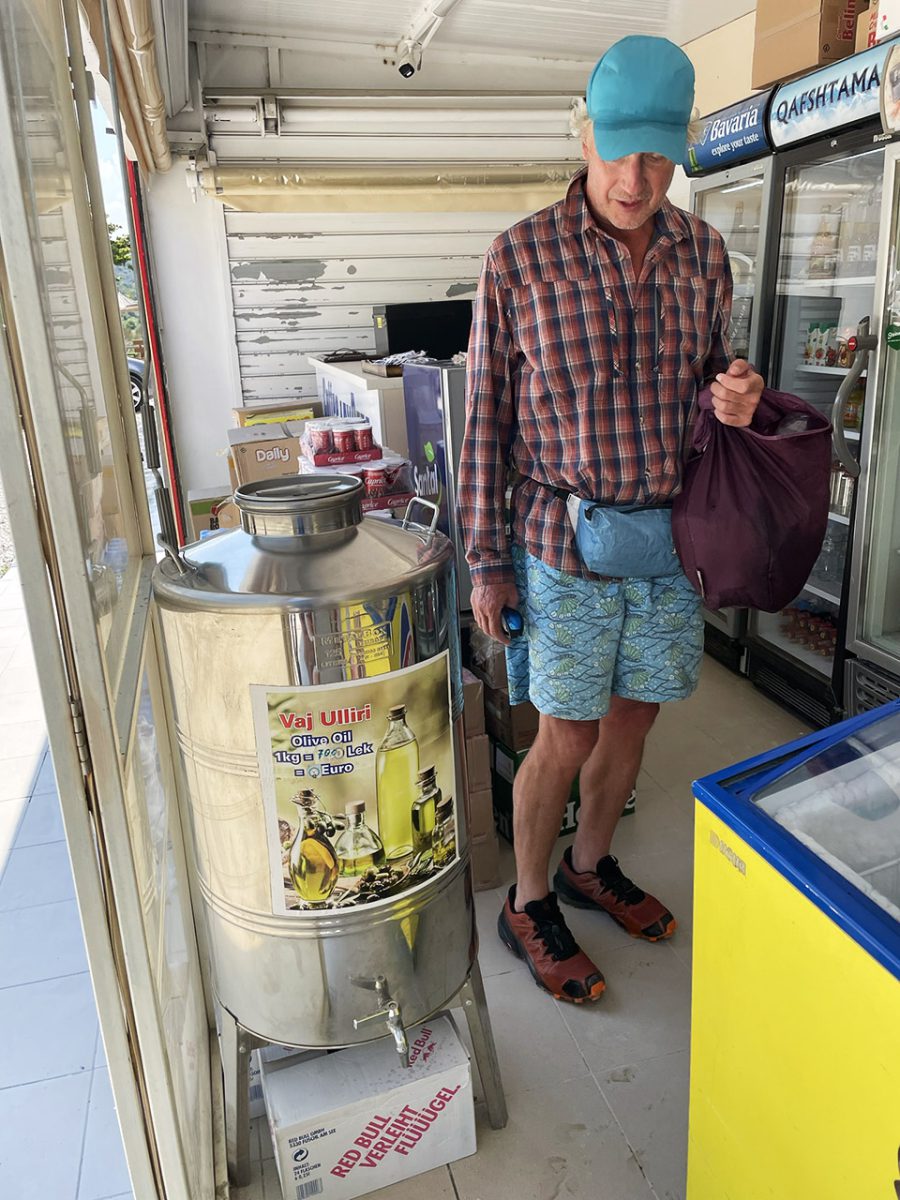
We got to Selenice during the siesta, which meant that a few of the restaurants they had did not serve food. It was possible to order a dink, but we wanted to eat something. That is why we found a show where we picked up some ‘drinking’ yogurt, a watermelon, and some other small stuff.
When asked how much it was, the shop owner said 7000. As it is 116 Albanian lek for a Euro, 7000 seemed excessive. Seeing our confusion, he showed 700 lek. Later I found out that in 2019 the national bank introduced ‘new’ lek which has one zero less. Still a lot of people say the prices in “old” lek, which can be confusing.
When we were going back, we got invited by a local guy to their family home, where he lived with his mother and two of his children. He had a car wash which was full of Albanian flags. They insisted that we have some tea and coffee with them. We decided to share the watermelon. The owner’s young nephew, who could speak good English translated for us. It was another great “authentic moment.”
We spent the night next to the village of Kashisht. As we did not have a proper lunch, we were very eager to get something to eat. But as luck might have it, the village did not have a restaurant. There was a shop though where we could buy some tomatoes and cheese and the owner was kind enough and made a simple, but tasty salad for us.
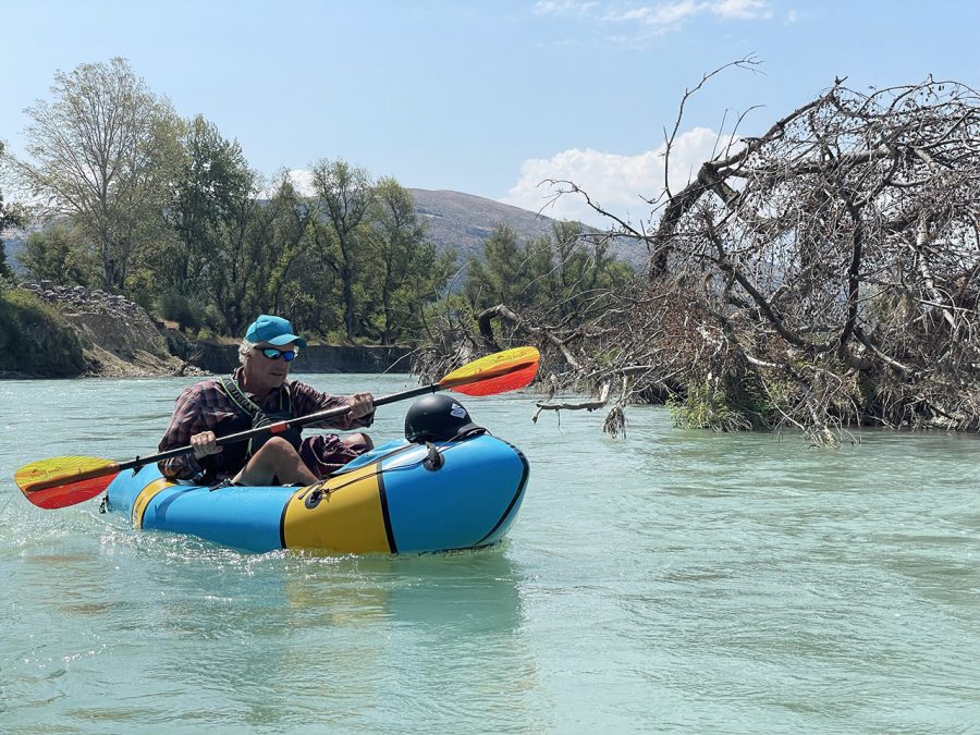
The next day was supposed to be our last day. As the elevation almost reached zero, it meant that we were almost at the sea level. We also checked the times for high tide and according to it, we needed to leave at 8 am. We left one hour later. The water was not moving much though. And by the time it was 11 am, a strong headwind picked up and we were hardly able to make any proper progress. What is more, Didier’s self-bailer is great for white water, but on flat water like that all the holes and extra water in the packraft create an extra drag.
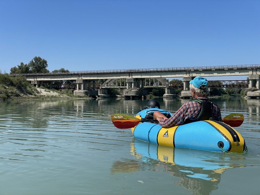
The water became visibly less clear here as well. We passed over a contraption that pulled a huge net the width of the river up. There was definitely fish here. After paddling for around 12 km, we reached the bridges at Fitore, where we decided to stop for a lunch and think what we should do next.
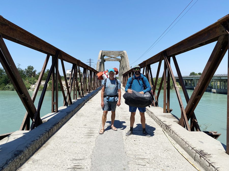
The outlook was somber. Either we would need to spend another day trying to cover the last 18 km or, as we had still almost a week before my flight, go and do something else. We knew that there was not much water in some other Albanian rivers that we originally were planning to paddle. “What about the Tara in Montenegro then?” I asked Didier. We checked the water levels online, I called two campings on the Tara I know, and all seemed to be ok. “Let’s do it,” said Didier. And just like that it was the end of our Vjosa trip. From a bridge to a bridge in 7 days.
The End
- « 前へ
- 2 / 2
- 次へ »
TAGS:


 ULギアを自作するための生地、プラパーツ、ジッパー…
  Tenkara USA | RHODO (ロード)
  Tenkara USA | YAMA (ヤマ)
  Tenkara USA | Rod Cases (…
  Tenkara USA | tenkara kit…
  Tenkara USA | Forceps & …
  Tenkara USA | The Keeper …
  Tenkara USA | 12 Tenkara …
  Tenkara USA | Tenkara Lev…