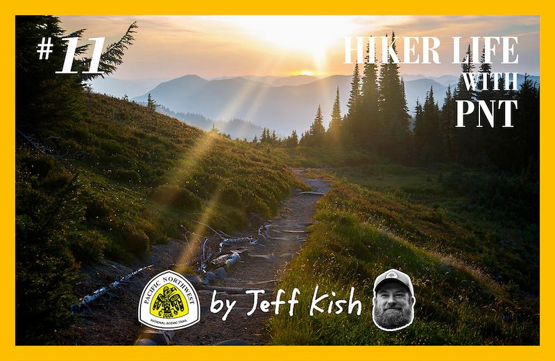
ジェフ・キッシュのHIKER LIFE with PNT | #11 パシフィック・ノースウエスト・トレイルのスルーハイキング (その7)
Thru-Hiking the Pacific Northwest Trail (part7)
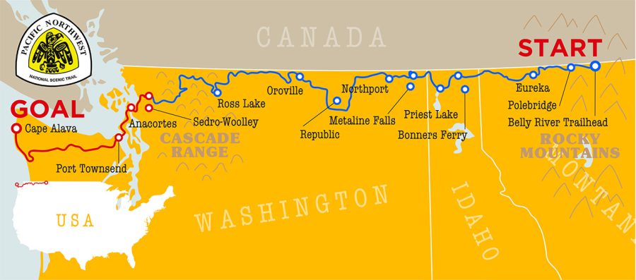
Leaving the Cascades behind in the east, I began my final push on the PNT in the Skagit Valley. The valley is named for the Skagit River, which begins in Canada, fills (and spills) from Ross Lake near the border, and then makes its way out to the sea here. The river gets its name from the indigenous people of this area, the Upper Skagit Tribe, who are still headquartered not too far away.
Along the northern Washington coast, US Interstate 5 —which connects places like Bellingham with major cities like Seattle, Portland, Los Angeles and San Diego— runs north to south, with the PNT crossing below it. The Interstate 5 corridor is the most developed and densely populated area along the PNT, as well as the flattest, and the character of the trail briefly changes from a rugged mountainous experience to a more rural and suburban one as it crosses from the Cascades to the Olympic Mountains ahead.
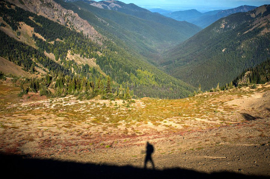
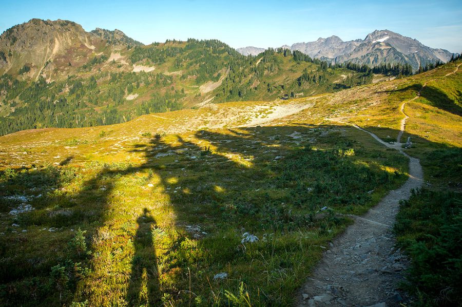
My shadow while walking a ridgeline in the northern Olympics.
After the long section without resupply as I hiked across the Pasayten Wilderness, North Cascades National Park, and the Mount Baker Wilderness, there were some perks to hiking this lowland coastal portion. I never had to carry more than a day’s worth of food, and meals in restaurants were available daily. The flat land made for easy miles, and I was never far from amenities. Still, the PNT makes good use of undeveloped public land here, crossing the Anacortes Community Forest Lands and several Washington State Parks that dot the islands.
Bridges carry hikers from the mainland to Fidalgo Island, and then onto Whidbey Island. The Deception Pass Bridge, which connects the two Islands, is the most-visited section of the entire Pacific Northwest Trail, carrying 20,000 cars and hundreds of sight-seeing pedestrians across each day. The high arch bridge offers outstanding views of the Salish Sea and the Olympic Peninsula to the west, as well as a look back to Mount Baker and the Skagit Valley in the east. Bald eagles and ospreys fish from the surrounding bluffs, and marine mammals such as dolphins, whales, sea lions and otters are commonly seen swimming below.
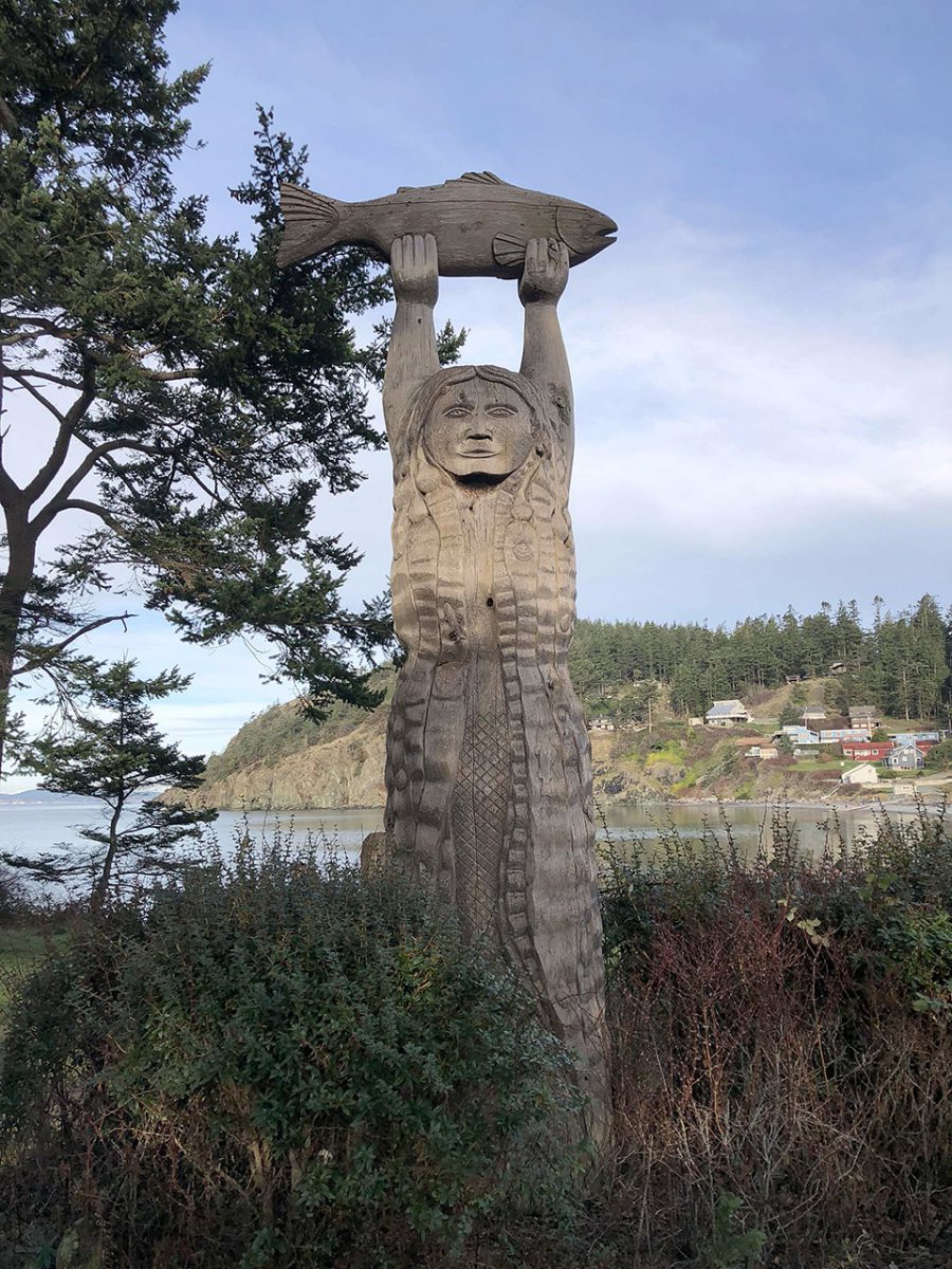
An indigenous carving in Deception Pass State Park.
There is no bridge from Whidbey Island to the Olympic Peninsula. Instead, most hikers make use of the Washington State Ferry System, which carries travelers back and forth across the 9 kilometer Admiralty Inlet regularly throughout the day. The ferry has enclosed decks with a snackbar for food and drink, but if the weather is nice, the views from the open decks are not to be missed, including the Olympics, Mount Baker and Mount Rainier. At the far end of the ride, the ferry docks in Port Townsend, which is the last community hikers will see before traversing the heart of Olympic National Park.
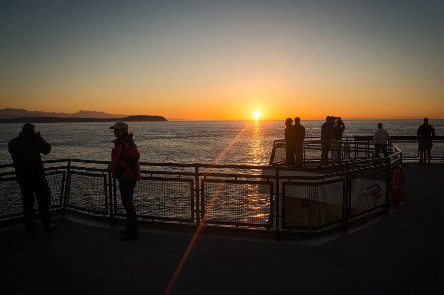
The ferry ride between Whidbey Island and the Olympic Peninsula.
Port Townsend is also the last place a PNT hiker can call from to arrange permits for crossing the park. I found a local beer bar with a view of the Strait of Juan de Fuca, laid out my maps across a quiet table in the corner, and called the park Wilderness Information Center (WIC) to discuss my trip. They were able to help me find sites along the route and issued my permit over the phone.
You don’t have to hike all the way into the park to begin enjoying world-class views. From Marmot Pass in particular, the scenery is spectacular. Here, the PNT is surrounded by craggy
alpine peaks with names like Mount Mystery, Mount Deception, and Warrior Peak. Hikers can camp anywhere they chose prior to the park boundary, as long as they follow Leave No Trace principles. Once inside the park however, travelers must stick to the itinerary on their permit and camp in designated sites.
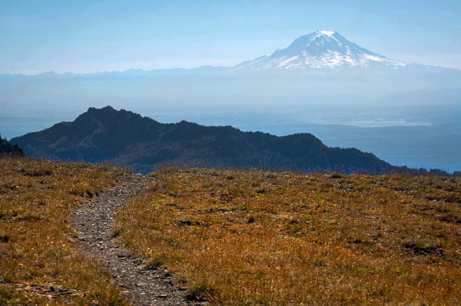
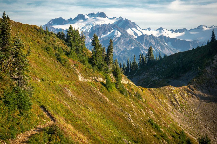
As I hiked up into the high country of the eastern Olympic Mountains, the large volcanoes of Washington’s Cascades came into view. Here is Mount Rainier from the PNT.
The scenery continues into the park. The views from Constance Pass rival those of the Buckhorn Wilderness, and the landscape only gets wilder as the PNT travels ever deeper into park. After ascending Constance Pass and walking the ridgeline toward Twin Benchmark Peak, the trail drops to the Dosewallips River and follows it northwest, into the park further still.
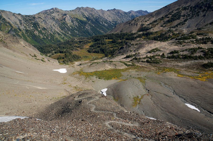
Looking north from Cameron Pass.
At Dose Meadows, hikers are presented with a choice; and win no matter what they choose. The official PNT continues west to climb Hayden Pass, before descending to the Elwha River and following it north. An alternate route heads north over Lost Pass, Cameron Pass and Grand Pass before dropping and climbing once more to reach Obstruction Point. I chose the alternate route, which has significantly more climbing, but was rewarded for each climb with some of the finest hiking and unique views found anywhere along the trail.
Alpine meadows near the northern edge of Olympic National Park.
The other advantage of taking the alternate is a visit to the Hurricane Ridge Visitor Center, which offers excellent views as well as a small restaurant and snacks to-go. For hikers who wish to break up the olympics with a resupply, Hurricane Ridge offers excellent opportunities to hitch a ride into the nearby town of Port Angeles. I decided to stay immersed, and continued on.
The year that I hiked, construction crews were busy removing dams that once existed along the Elwha River. Due to the construction, the area was closed, but after speaking with several Park Rangers, I was encouraged to move through the area in the evening, after the construction work had been completed for the day. In the time since my hike, the dam removal has proven to be a great success. With the ecosystem restored, salmon and other native river inhabitants have returned to the area.
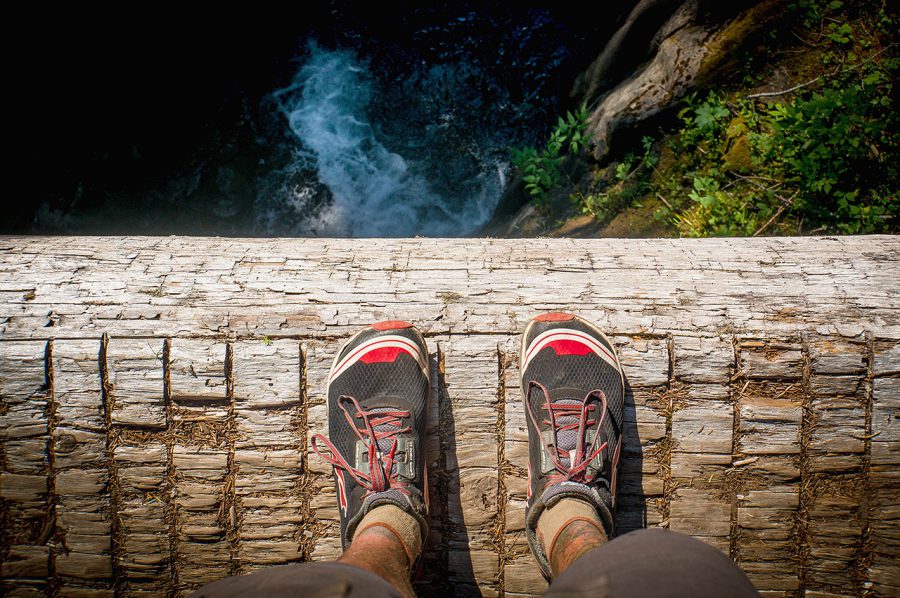
A simple log bridge over one of the Olympics’ many rivers.
When I reached the Olympic Hot Springs, I had them to myself. Here, there are dozens of stacked stone pools to choose from, and they’re situated among some truly impressive old growth trees. If you get too hot from your soak, you can follow the spring water downslope to nearby Boulder Creek to cool off.
The PNT continues on from the hot springs over Appleton Pass and up to the popular High Divide and Seven Lakes Basin area. Camping in this alpine zone requires a bear canister. Since this area can easily be traversed in a single day, most thru-hikers opt to camp on one side, cross the area during the day, and camp on the other side in order to avoid having to carry a bear can across the entire peninsula. That’s what I did. The High Divide is gorgeous, with incredible views of Mount Olympus to the south, and the Seven Lakes Basin to the north. Olympic black bears are commonly seen here. This unique subspecies of American black bear is larger than adjoining populations, and feeds well on berries which are abundant within the park.
Mount Olympus is the highest point in Olympic National Park, and the PNT hiker gets great views of it from the High Divide and Bogachiel Peak portions of the trail.
After the High Divide, the PNT begins to make its final descent toward the Pacific Ocean. As I left the high mountains behind, I could begin to hear the eerie bugling of a herd of large Roosevelt elk in the valleys below. These are the largest elk in North America, and are named for US President Theodore Roosevelt, who first protected the land that became Olympic National Park in 1909.
Descending further still, the PNT enters temperate rainforests where trees sometimes reach 95 meters in height and up to seven meters in diameter! The western Olympic rainforest is among the wettest places in the United States, so it’s no surprise these ancient giants grow so large here. This area is known for its “champion trees” —the largest and tallest examples of each species found anywhere in the world.
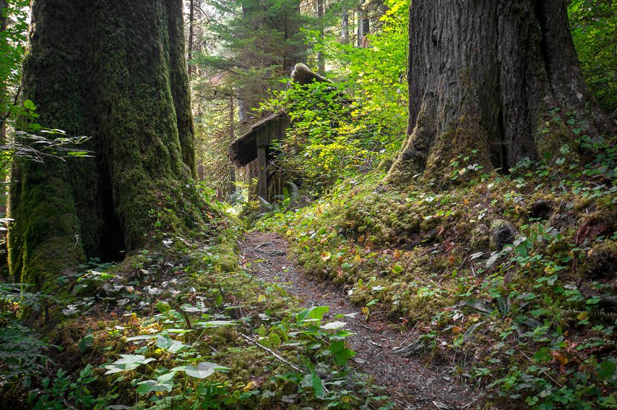
An old wooden shelter gives perspective to the size of the old growth trees along the PNT in the western Olympics.
I emerged from the park 265 kilometers after leaving Port Townsend. Hungry and exhausted I was eager to reach my final resupply of the PNT in the small town of Forks, a few miles north of where the PNT crosses highway 101. I intended to walk to town, but was picked up by police, who had been in the area responding to a car accident involving an elk. They thought it was too dangerous for me to be walking the highway at night, and offered me a ride into town.
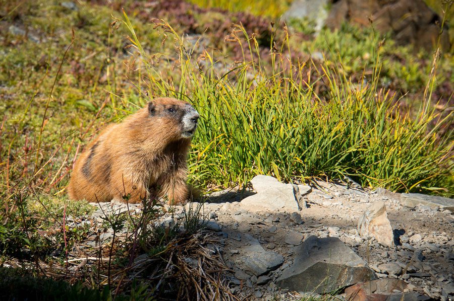
Although marmots can be found along the length of the PNT, the olympic marmot is a species that is found nowhere else on earth.
I picked up a bear can in Forks, which is mandatory for the last section of PNT, and packed it with a small bottle of scotch whiskey and a package of chocolate chip cookies to celebrate with when I reached the end. Then I made my way to the coast and began the final few days of hiking the trail to its completion. The beach hiking along the PNT is very unique. For most of the way, there is no trail: just footsteps in the sand. Hikers must carry tide charts and maps that show passable tide levels in order to safely navigate the headlands. Occasionally, ropes or ladders lead to short sections of trail that bypass areas where rocky bluffs meet the ocean and make beach hiking impossible.
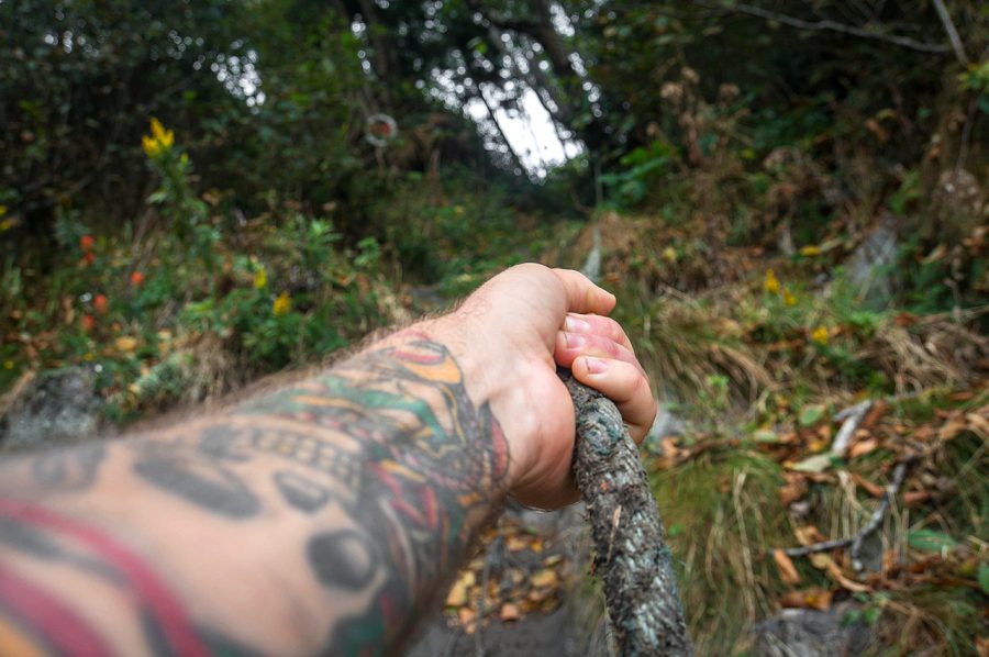
The Wilderness Coast portion of PNT walks mostly along the beach, but occasionally, hikers climb over headlands using ropes or ladders.
The wildlife along the coast is unique as well. Here, where the rainforest meets the sea, bears and deer wander the beach, starfish and anemones crowd rocky tide pools, and sea otters play in the surf. Further asea, hikers may spot gray whales off the coast.
Hiking is slow here, due to the sand and the tides, but at the end of this summer-long trek, I was ready to be slow. Over the last two months, I had experienced one of the most intense and rewarding experiences of my life, and I wasn’t in a rush for it to be over. All good things must come to an end, however, and finishing the PNT was now inevitable. On September 19th, I reached the westernmost tip of the contiguous 48 United States, and the end of the Pacific Northwest Trail.
It was the journey of a lifetime, and would shape my life for years to come.
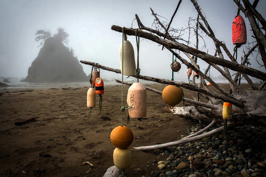
The PNT finished on the Olympic National Park Wilderness Coast.
- « 前へ
- 2 / 2
- 次へ »
TAGS:


 ULギアを自作するための生地、プラパーツ、ジッパー…
  Tenkara USA | RHODO (ロード)
  Tenkara USA | YAMA (ヤマ)
  Tenkara USA | Rod Cases (…
  Tenkara USA | tenkara kit…
  Tenkara USA | Forceps & …
  Tenkara USA | The Keeper …
  Tenkara USA | 12 Tenkara …
  Tenkara USA | Tenkara Lev…